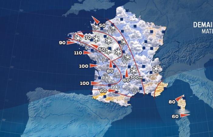
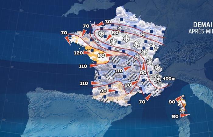
The “Caetano” depression which will cross the country during the day on Thursday will generate a significant conflict of air masses.
North of the depression, precipitation will occur in the form of snowfall up to the plain.
From Normandy to the center-east, the snow will stick to the ground and make driving conditions difficult.
In the heart of autumn, winter has decided to knock on our door… A depression officially named “Caetano” will cross the country during the day on Thursday, following a trajectory going from the south of Brittany to the north of the Alps. If it brings a lot of mildness and sustained rains to the south of the country, the polar cold will resist in the north.
Thus, precipitation will occur in the form of snow in the northern regions. The largest quantities are expected in Normandy, Maine, Beauce and the center-east. This is the first snowy episode of the season in the plains.
First snowy episode of the season in the plains
The first snowflakes will flutter over northern Brittany from 7 a.m., mainly between Côtes-d’Armor and Ille-et-Vilaine. Very quickly, they will reach Maine and Normandy. They will then affect Beauce before midday, while spreading to Center-Val de Loire and Burgundy.
During the afternoon, the snow will reach Seine-Maritime as well as Île-de-France, in a lesser proportion compared to the regions located slightly further south. The south of the Grand Est region and the north of Burgundy-Franche-Comté will in turn be affected by this winter weather.
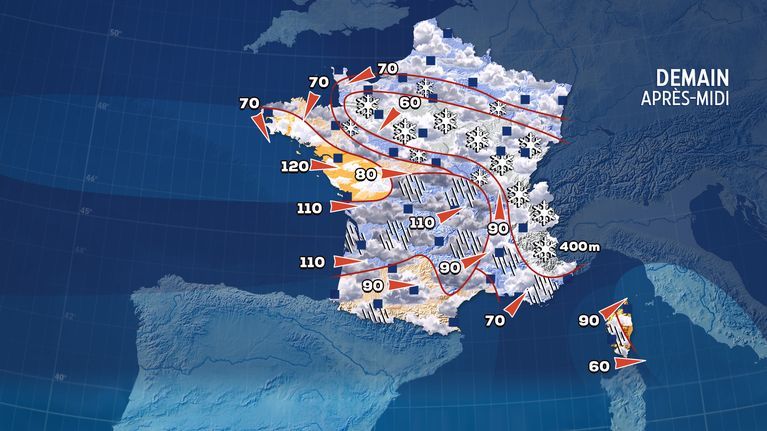
In total, 32 departments have been placed on orange snow-ice alert by Météo-France, to which must be added 17 departments which will be battered by the winds of winter storm Caetano.
Watch out for ice the following night
To the extent that these snowfalls occur during a conflict of air masses, forecasting is particularly delicate. Indeed, the nature of precipitation can be completely different in the space of a few kilometers. The exact trajectory of the depression is therefore essential for making reliable forecasts. If all the models are on the same wavelength, there still remain doubts about the snow’s hold on the ground.
In fact, the soils are still relatively warm and risk being wet during snowfall, which will not make them easier to hold on to the ground. Météo-France generally forecasts between 2 and 5 cm of snow on the ground in the departments placed on orange alert, locally up to 10 cm towards Normandy and Perche, or even 15 cm between northern Burgundy and Jura. Alongside this axis, flakes may occur and whiten the soil locally and temporarily. Likewise, the risk of snow remaining in inner Paris is low.
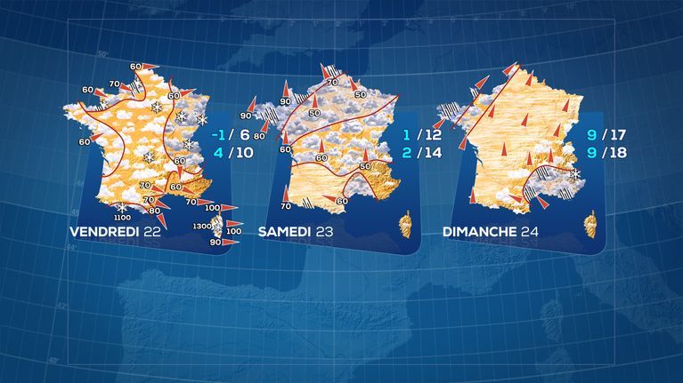
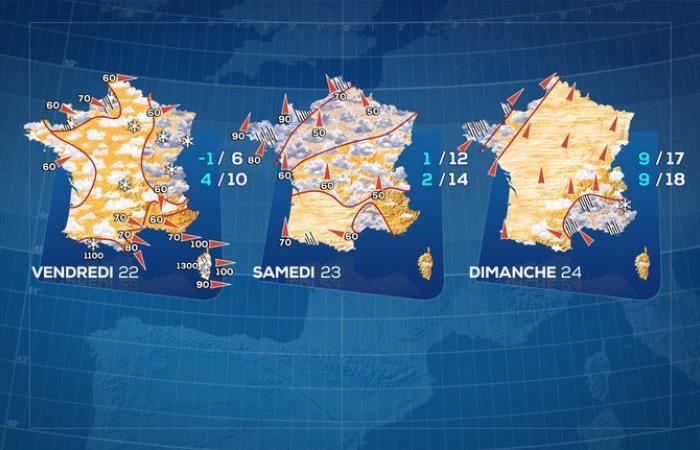
Caution should also be exercised during the following night, due to the refreezing of the roads. Indeed, with the night sky clearing, temperatures will drop sharply. The frosts are therefore expected to be severe, accentuated by the presence of snow on the ground. Locally, thermometers will drop to -5, even -7°C under shelter.
This winter break will close this weekend, with the return of the southerly flow and great mildness. On Sunday afternoon, 15°C will be reached or exceeded in most regions, with even peaks of 23 or 24°C in the southwest.

