Official start of the hurricane season in the Indian Ocean
While the 2024 hurricane season officially ended on the Atlantic side recently, extending from June 1 to November 30, tropical activity is, on the contrary, beginning in the Indian Ocean.
In fact, the hurricane season begins on November 15 in this part of the world, then officially extending until April 30.
It is indeed during this period that the atmospheric conditions are most favorable to the formation of virulent tropical systems, which we also call cyclones unlike in the Atlantic where they are called hurricanes and in South Asia. Southeast where these are called typhoons.
Distribution of tropical system formation zones across the world – Via lagoon-beaches
Even the cyclone season in the South Indian Ocean is less talked about, notably due to the fact that few inhabited lands are affected by cyclone risk unlike North America or South-East Asia. However, cyclones are also very recurrent in this part of the world with the formation of major systems that can cause very significant damage.
Trajectories of major cyclones (category 3+) over the South Indian Ocean from 1989 to 2019 – via cycloneoi.com
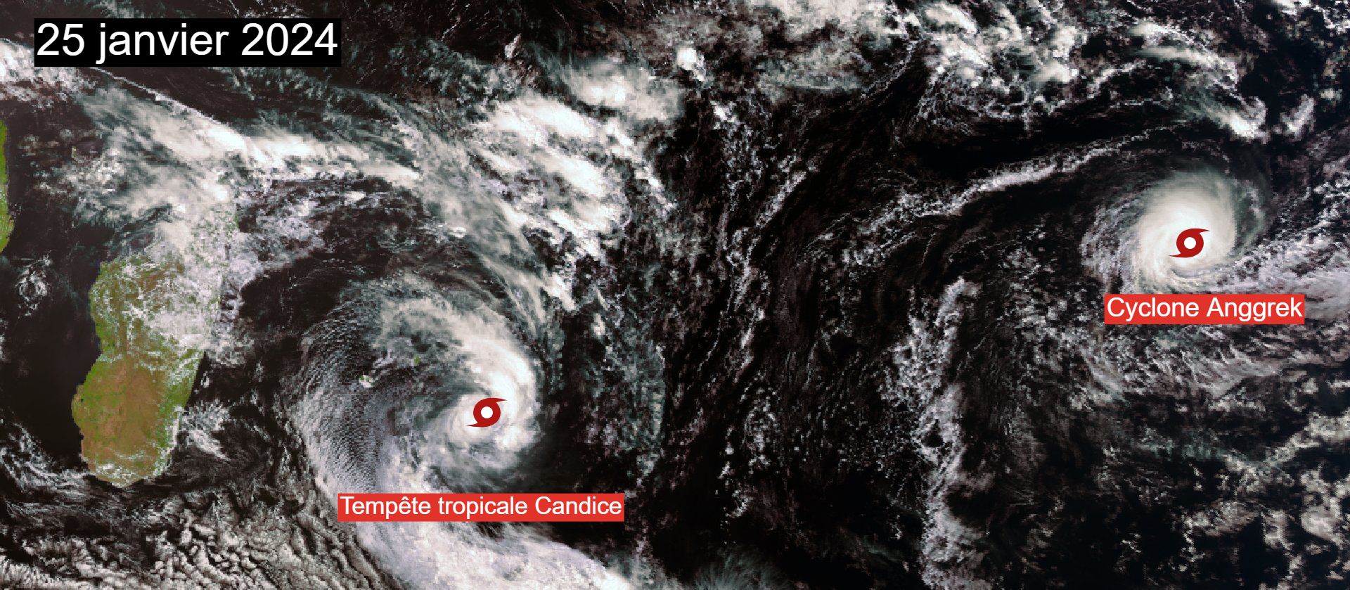
During the 2023/2024 season, for example, two intense tropical cyclones (category 4) were recorded in the basin, Cyclone Anggrek, having formed off the coast of North-West Australia at the end of January and cyclone Djoungou during the month of February to the north of the island of Rodrigues.

Satellite image of Cyclone Anggrek and Tropical Storm Candice over the Indian Ocean on January 25, 2024 – EUMETSAT
This cyclonic activity threatens Reunion Island, Mauritius and Mayotte every year with major systems having already impacted these sectors in the past, causing numerous damages and victims.
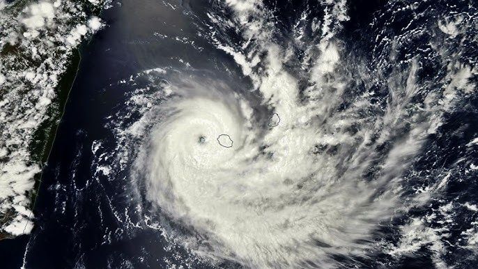
For Reunion, we can for example cite the intense tropical cyclone Bejisa which hit the island in 2014, causing the death of one person, cyclone Dina, memorable in 2002, cyclone Firinga having caused the death of 7 people in 1989 , cyclone Hyacinthe, causing 25 victims in 1980 or even cyclone Jenny, which caused the death of 37 people in 1962.

Cyclone Bejisa hits Reunion at the beginning of January 2014 – EUMETSAT
Does the 2024/2025 season promise to be active?
As every year and for each cyclone basin, forecasts are established by specialized organizations to consider the intensity of the upcoming cyclone season. For this 2024/2025 season, Météo-France envisages cyclonic activity close to or above normal in the Indian Ocean, with the organization even mentioning a trend towards an active season even more than close to normal.
Indeed, 6 to 10 storms are expected to form during this period in this region of the globe, 3 to 5 of which are expected to develop into cyclones according to Météo-France forecasts.
Forecast of cyclonic activity for the South-West Indian Ocean for the 2024/2025 season – Météo-France
More precisely, the most marked cyclonic activity should occur in the eastern part of the basin due in particular to the presence of abnormally warm waters near the Chagos archipelago, providing a greater reservoir of energy for potential tropical systems.
Forecast of cyclonic activity for the South-West Indian Ocean for the 2024/2025 season – Météo-France
Cyclone Chido threatens Mayotte
The activity also started early this year. In August, the first tropical storm formed in the basin, remaining not very intense and above all very temporary, not threatening any land.
In November, intense tropical cyclone Bheki caused damage to the island of Rodrigues as it passed just north of it on November 20. It then quickly lost intensity as it circulated just north of Mauritius and Reunion Island.
Satellite image of intense tropical cyclone Bheki on November 17, 2024 – EUMETSAT
Since the beginning of December, this time it is tropical cyclone Chido which is making news in the basin. After developing into a tropical storm on December 9, it strongly strengthened as it approached the north of the island of Madagascar, becoming an intense category 4 tropical cyclone on December 11, bordering on category 5.
Satellite image of intense tropical cyclone Chido on December 12, 2024 – EUMETSAT
It should now graze the north of Madagascar in the coming hours before unfortunately heading towards Mayotte, which it should touch during the day tomorrow Saturday December 14.
Predicted trajectory of Cyclone Chido over the Western Indian Ocean – Météo-France
The latest forecasts are not reassuring for the island of Mayotte, already placed on orange level cyclone alert this Friday. Météo-France's Arome model foresees a direct impact of the system on Mayotte this Saturday with gusts that could exceed 220 or even 250 km/h in the sector, all accompanied by torrential precipitation that could exceed 100 mm in a generalized manner and a particularly large storm surge.
Latest forecast of maximum wind gusts and cumulative precipitation for Mayotte – Arome via meteociel.fr
The evolution of this system will therefore need to be monitored very carefully in the coming hours. If it actually hits Mayotte head-on, the damage could then be particularly significant on the island.
Related News :
