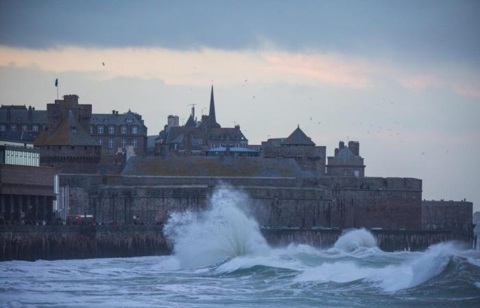
Storm Éowyn is expected to mainly hit Ireland, placed on red alert, then the United Kingdom, but France will also experience the phenomenon to a lesser extent. Winds of up to 90 km/h and heavy rain are expected in the northwest of France.
Storm Éowyn arrived in the British Isles this Friday January 24. Faced with this “dangerous, destructive weather event which will cause damage”, the whole of the United Kingdom has been placed on alert, but a red alert has been triggered for Northern Ireland. A first since the installation of the system which reflects the force of the storm with its winds at 120 km/h and its gusts of between 170 and 200 km/h.
France will also experience the passage of storm Éowyn this Friday, but to a lesser extent. It is mainly the north-west of the country which should be swept by winds estimated at 80 or 90 km/h and rain which could give between 20 and 50 mm of precipitation, starting with Brittany. In this region, the storm “brings lasting and temporarily sustained rain, particularly this evening when the disturbance reactivates” specifies Météo France. For the moment, the agency plans to activate an orange alert for rain-flooding in a single department, Morbihan, from 6 p.m. and for the whole night. However, all the departments of Pays de la Loire, Brittany, Normandy and Haust-de-France are placed on yellow alert. Météo France warns that the rainfall totals in these departments are still uncertain and that an “extension of the orange “rain-flood” vigilance from the evening of Friday and the night of Friday to Saturday is therefore possible”.
Storm Éowyn in Brittany: what are the forecasts?
In its forecasts, La Chaîne Météo specifies that if the winds could reach 100-110 km/h on the most exposed Breton capes, overall, the event will be rather classic for this time of year, with gusts between 70 and 80 km/h inland, and should not present any dangerous nature. The Breton tip will be the first impacted, around 3 or 4 a.m., during the night from Thursday to Friday. Waves of 6 to 7 meters are expected to hit the Breton coast, but the low tidal coefficients will limit damage. There should therefore be no coastal flooding, indicates La Chaîne Météo. The winds, which will blow all Friday morning over Brittany, are expected to weaken at midday.
Heavy rain is also forecast. Between Brittany, the Pays de la Loire and Normandy, up to 40 to 50 mm could fall locally, reports Météo France, which warns: “The accumulation of rain will need to be monitored.” The Weather Channel, for its part, does not hesitate to speak of “copious rains” in the north-western quarter of the country.
After Brittany, head to Hauts-de-France for storm Éowyn
Passing through Normandy, the winds will reach Hauts-de-France early Friday afternoon, between 12 p.m. and 3 p.m., announces La Chaîne Météo in its forecasts. A quick passage since the lull is expected around 4 p.m. Rain “relatively heavy in 24 hours, but not exceptional”, according to La Chaîne Météo, will also be on the program. Precipitation to be monitored because it presents “a new risk of overflows and new floods for the following days [puisque] other disturbances will follow”, warns the channel on this point. The soils being already saturated with water, further rises in watercourses are to be feared for this weekend, as well as the week to come.
-08:42 – Severe storm Eowyn at its worst between Friday and Saturday
If the first rains hit Brittany during the night from Thursday to Friday, the episode linked to storm Eowyn “has not yet really started” specifies Météo France. The worst of the bad weather should occur during the day this Friday, from mid-morning, and especially at the end of the day, particularly for rain. In the different affected regions, Brittany, Normandy and Hauts-de-France, “we expect cumulative precipitation amounts of between 20 and 40mm over the episode, occasionally 50mm”. “The heaviest rain should stop around midnight,” said the weather agency.
08:18 – A month's worth of precipitation expected by tomorrow
If storm Éowyn promises to be dangerous for Ireland and the United Kingdom, in France the expected bad weather is “usual for the season, but requires particular vigilance, due to saturated soils”. The rain associated with storm Éowyn should give significant accumulations between Friday and Saturday in Brittany, Normandy and Hauts-de-France: up to a month of rain is expected in places. However, the soils are already waterlogged after previous rains, the precipitation could lead to flooding in the Oise, Somme and Eure which are under surveillance.
07:59 – A French department on orange alert, but the alert extended by this evening?
Météo France places only the Morbihan department on orange alert for rain-flooding in view of the passage of storm Eowyn over the British Isles. The alert must be activated from 6 p.m. The agency warns, however, that an “extension of orange vigilance from the evening of Friday and the night of Friday to Saturday is possible” especially for the departments of Pays de la Loire, Brittany, Normandy and Hauts-de-France which are currently placed in yellow.
France


