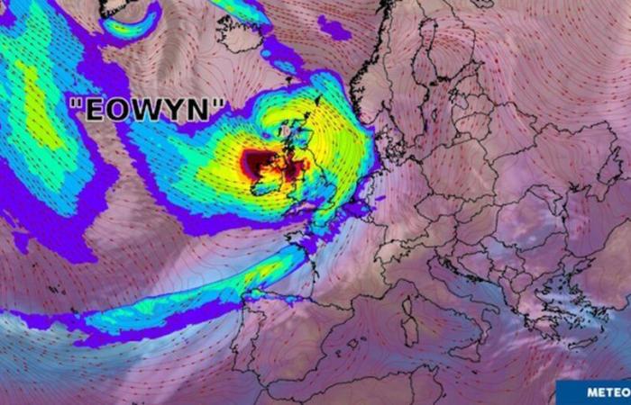
Will Éowyn reach France?
Storm Éowyn brings very unsettled weather to the north-west of France. Winds could sometimes exceed 80 to 90 km/h on the Breton and Normandy coasts, and even as far as Pas-de-Calais between late night and early Friday afternoon.
As Météo France points out, the disturbance associated with Éowyn will enter the Breton tip before the end of the night from Thursday to Friday, then will linger in the northwest of the country until Saturday morning. Rainfall accumulations will need to be monitored, particularly between Brittany, Pays de la Loire and Normandy where we can get up to 40 to 50 mm locally.
“This disrupted situation will also confirm the clear mild spell already underway in the northern half of the country, after around ten days under anticyclonic domination. This change in weather will be confirmed during the weekend, where new disrupted passages are expected, probably accompanied by strong winds from the North-West on Sunday,” assures the operator.
-Can we talk about a “weather bomb”?
This vigorous depression is placed on the rails of a rapid jet (tube of strong wind), which will direct it towards Ireland then Scotland. Certain depressions have the particularity of deepening very quickly and very strongly (typically when the atmospheric pressure reaches more than 24 hPa (hectopascals) in less than 24 hours), we then speak of explosive cyclogenesis. This is the case for Éowyn, with the pressure expected to increase from 970 hPa to 940 hPa between Thursday and Friday, when it passes just to the north of Ireland. It is customary in this type of configuration to speak of a “weather bomb”.
In Ireland, schools closed
France


