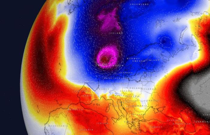
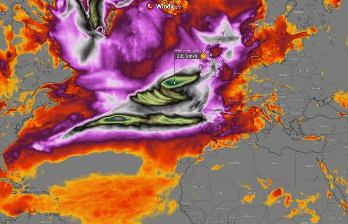
The ongoing disruptions of the Polar Vortex aloft led to its southern lobe emerging over North America. Its related cold wave will drag Arctic air mass onto the North Atlantic and produce intense storms. Those will travel into Western Europe, impacting Ireland, the UK, and France over the weekend and into the next week.
Powerful windstorms are likely to develop as a significant temperature and pressure gradient is forecast to occur between the North Atlantic and continental Europe.
The first intense Atlantic storm with violent winds is forecast to blast into Ireland and the UK early Friday. Met Office and Met Eireann will name this storm once the event is fully verified on the forecasts.
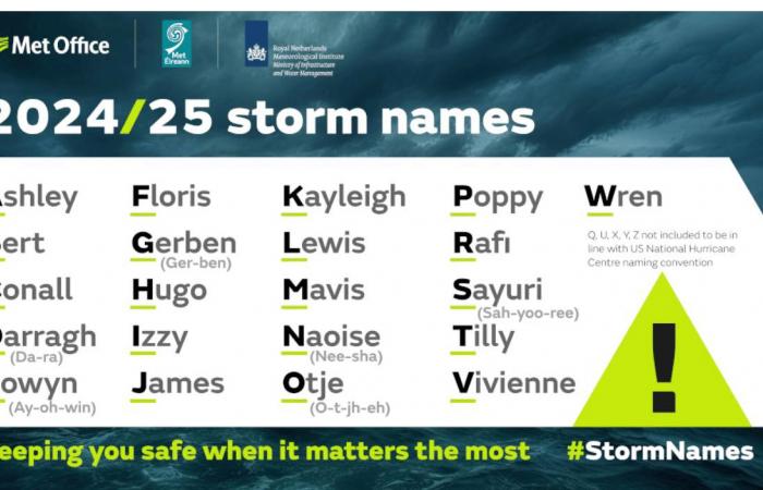
Irish and UK meteorological agencies and offices use storm names for better public awareness regarding warnings of potential severe impacts. For the 2024/25 season, the UK Met Office has designated 21 storm names to be used.
Four storms were already taken this season; the next one from the list will be storm Eowyn.


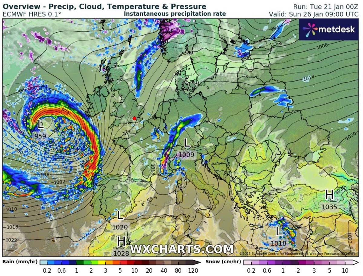
Another significant and profound frontal system will follow this storm around Sunday. It will likely impact France, Spain, and Portugal as well.
Let’s dig into the details of evolution as the weather pattern strengthens in the coming days.
A deep North Atlantic trough establishes and develops an intense Winter Storm Eowyn on Friday
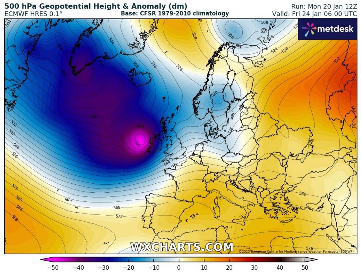
As discussed earlier, the impact of the deep southern lobe of the Polar Vortex moving over North America will also drag Arctic air mass into the North Atlantic. Late this week, the interaction of frigid upper levels and warmer oceans will develop intense storms.
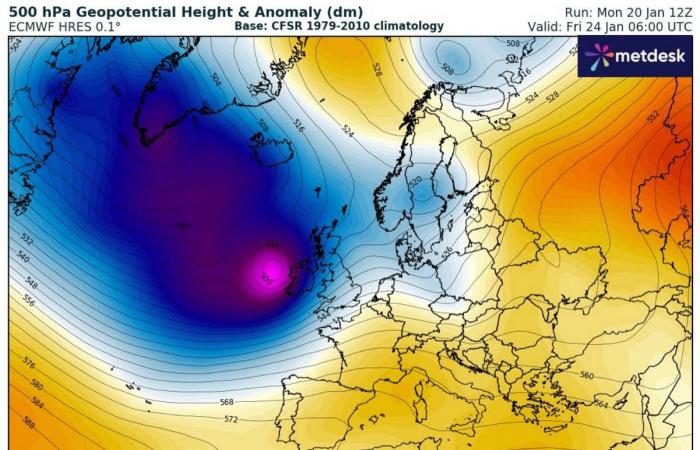
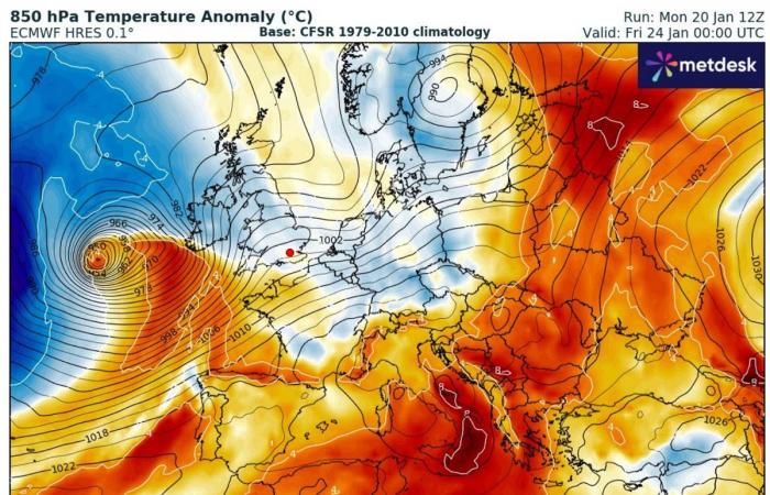
A large-scale and deep upper-level trough forms and moves towards west-northwest Europe. The clash of cold air mass in the Arctic region with warmer air from the Azores region will introduce explosive cyclogenesis.

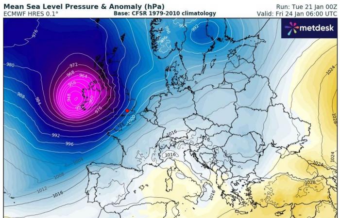
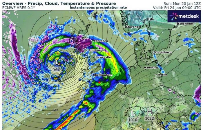
The surface low will develop a significant pressure drop, from around 1000 mbar to nearly 945 mbar, as it moves from the Atlantic towards western Europe, with around 50 mbar change in 24 hours. This is extreme and known as bombogenesis or a bomb cyclone.
A rapidly deepening low-pressure system is forecast to track across Ireland to the northern UK Thursday night into Friday. It will continue deepening and expanding in size and effects while grazing across both countries on Friday.


With extreme pressure falls, both heavy precipitation and winds will develop. Snow is likely to spread in the early stages of the system before the warmer air mass takes over and changes it to rain.
Warm air mass drags from the Bay of Biscay towards the north, first spreads into southern Ireland and the UK, and continues northward with time during the nighttime. But it remains cold to the north.
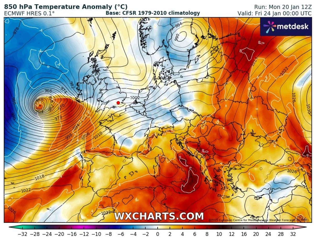

With such intense winter storms, the warm advection becomes pretty powerful, so the forecast for wintry precipitation becomes complex and changes hour to hour as the system tracks across the region while intensifying.
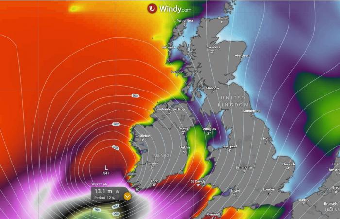
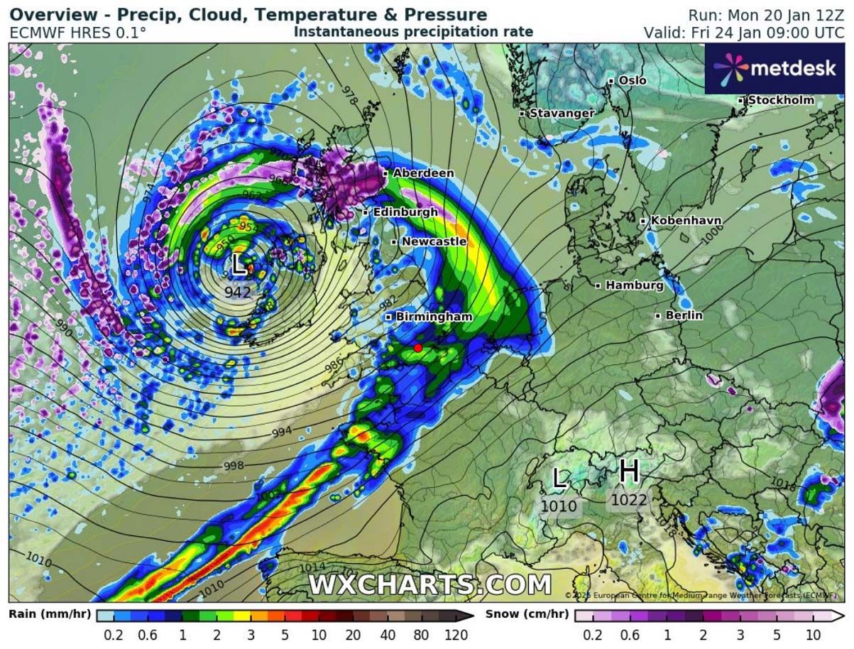
The following chart indicates Thursday night’s frontal system position, with a deep center low approaching Ireland and a well-defined, strong cold front racing across the Bay of Biscay towards the east-northeast.
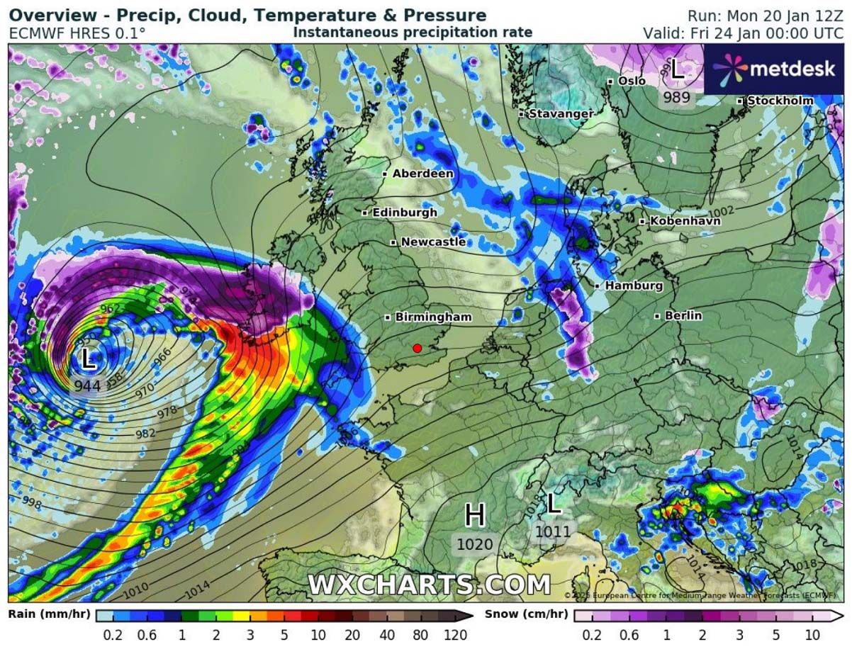

By Friday morning, the winter storm will reach Ireland and North Ireland, with central pressure pushed toward the low 940s. This will also result in severe winds.
The system will be near its mature stage, fully developed into a violent windstorm. While the main cold frontal boundary moving towards France will gradually lose its strength, the intense squalls from the Atlantic will have the main impact further north.
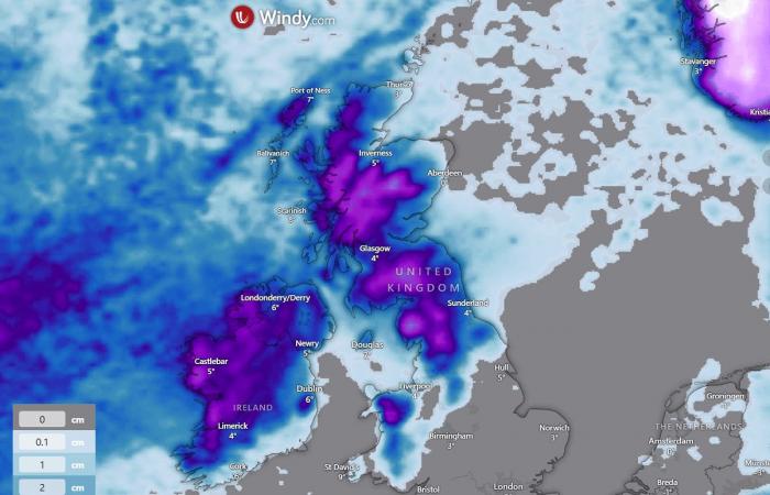
At first, snow is likely to be heavy at times and will be most persistent over Scotland, where warm advection from the south will have a less impactful effect.

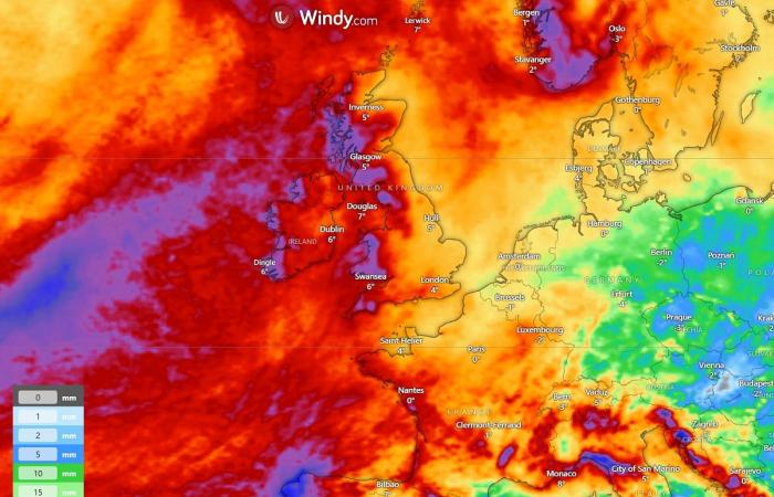
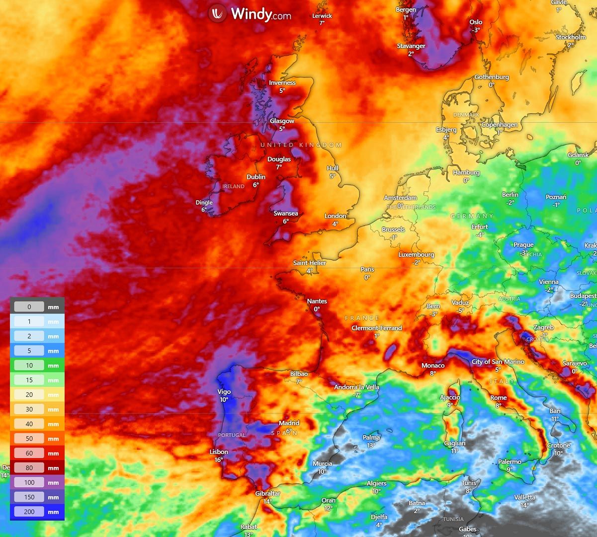
Local precipitation is expected to exceed 100 mm by the end of the weekend. The storm’s persistent and intense winds will bring the highest amounts to the higher terrain, where orographic precipitation is the most pronounced.
Combining both orographic and frontal rainfall will bring high sums, which could lead to flooding again.
-A lot of rain is also forecasted in western Iberia, from northern Portugal to Galicia, northwest Spain.

However, as mentioned above, the winter storm grazes into a still-cold air mass over western Europe Thursday night, meaning the system’s early stages will likely bring snow before the warmer air mass takes over.
Although weather models could have some issues handling the snow, a 5-10 cm blanket is likely in the first few hours of the storm. The highest amounts are predicted across the northern half of Ireland, Northern Ireland, north of England, and Scotland.


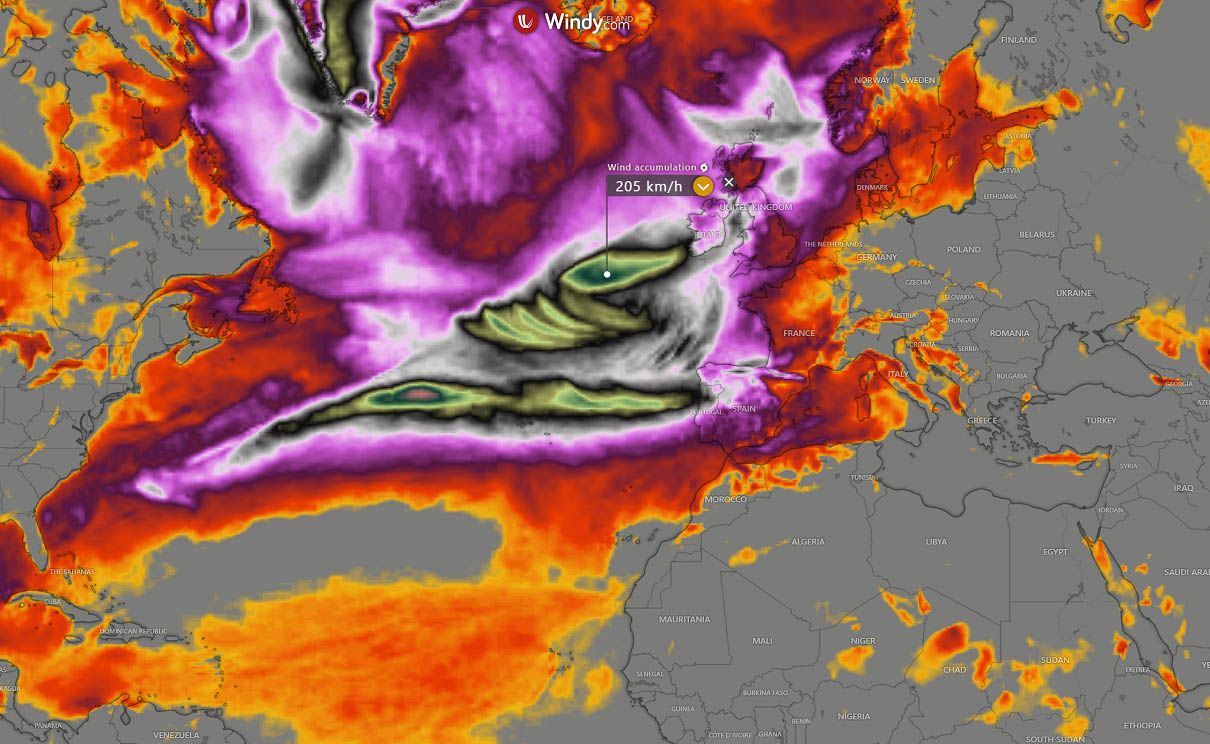
Strong to severe winds are expected to develop across Ireland, Northern Ireland, and Scotland, with the potential for damaging wind gusts and disruption in places. A pressure this deep creates intense gradients, which leads to violent winds.
The strongest winds will be over the open Atlantic before reaching Western Europe. Severe winds will likely affect the coastal areas and be violent in higher elevations.

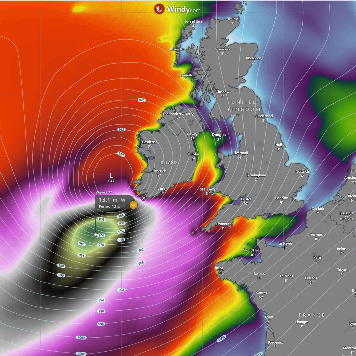
High seas with significant wave heights are also expected. The extensive system will develop a high swell, pushing sea waves higher than 12 meters (40+ ft) across the Bay of Biscay.
Impacting southern Ireland, southwestern England, and northwestern France (Brittany).

Conditions will gradually improve Friday during the day when the winter storm fully matures over the UK and begins weakening its central pressure while moving towards the North Sea.
Another large frontal system is likely to follow on Sunday, impacting most of Western Europe
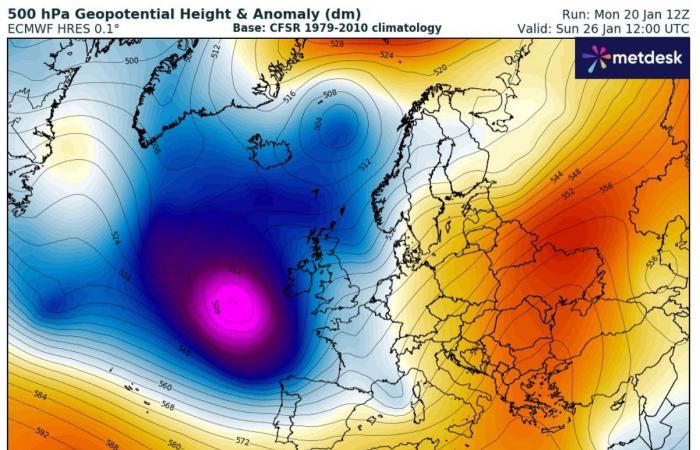
The North Atlantic will remain under the gun of a progressive pattern throughout January as the persistent cold Arctic air mass intrusions from Canada and Greenland continue to feed deep troughs toward Western Europe.
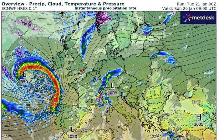
Another extensive, deep frontal system is likely to follow on Sunday, as the core of the trough significantly deepened over the weekend.
The system will also be pushed more southward toward the Bay of Biscay. The European continent remains warm and stable under the omega-blocking pattern.


The ECMWF model does hint at another intense storm on Sunday, which will impact Ireland and the UK again with an intense surface low and frontal system. The storm will likely grow into a very large one. Thus, we expect a significant impact from substantial to severe winds and rain squalls for France, Spain, and Portugal.
Although it is still a couple of days to forecast all the details, the weather model consensus is relatively high that the storm will bring more unsettled conditions across a large part of Western Europe on Sunday. This will also extend into Monday next week.

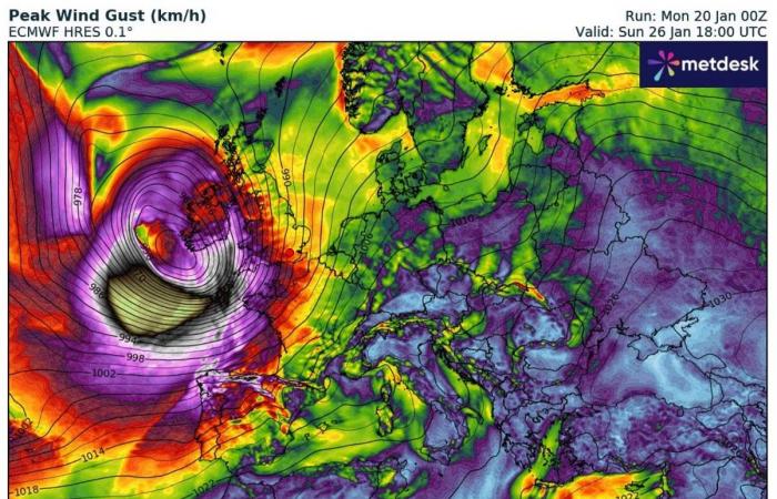
The peak wind gusts forecast hints at another high-risk potential for a violent windstorm, which could drag across the Bay of Biscay towards western France, Ireland, and the UK late Sunday into Sunday night.
Peak gusts could bring potentially violent wind speeds again.


Stay alert for dangerous weather conditions as the progressive pattern develops late this week and will likely continue into the final week of January.
Wxcharts, Windy, and Pivotalweather provided images used in this article.
See also:
Winter Storm Enzo brings rare snowfall to the Gulf Coast, Arctic Blast intensifies


