Cold, arctic air is dropping into Southeast Louisiana right now and that will interact with a developing low in the Gulf of Mexico that will bring snow to New Orleans. A Winter Storm Warning is now in effect for everyone shown here.Widespread snow totals 3-4″ are likely for everyone in the warning.Radar | Download our app | Sign up for weather alerts | Send us your photosOVERVIEW:Snow and cold weather are likely over the next 24-48 hours. We know there will be impacts to travel starting first thing Tuesday. TEMPERATURE FORECAST:An Extreme Cold Watch has been issued for Tuesday night into Wednesday morning where our first Extreme Cold Warning is likely to be issued. Temperatures could possibly feel as low as 10 degrees. PRECIPITATION FORECAST:We’ve been tracking the potential of wintry weather and snow starting Tuesday. Snow is now likely, but we’ll still begin the event with pockets of rain, sleet, and freezing rain. Here’s a break down on the computer forecast data. GRAF (Global high-Resolution Atmospheric Forecasting System) – IBMNow that we’re within two days away from the storm, our high resolution data are in. This forecast starts with sleet, but turns to heavy snow all across Southeast Louisiana by mid-morning and through the rest of the day.These snowfall totals are on the extreme side, and is not what we’re forecasting. Although these totals have backed off from yesterday. NAM (North American Model)The NAM is similar to the GRAF in snowfall amounts too. On the extreme end, for sure!GFS (Global Forecast System – U.S.)The GFS and ECMWF are pretty much in line with each other. Although, the GFS wants to pull in a little more for totals. ECMWF (European – Europe)ACCUMULATION:The North Shore will likely see the heaviest amounts, but the South Shore and River Parishes will likely have measurable snowfall as well. PRECIPITATION TYPES:When the atmosphere gets cold enough, the clouds are actually comprised of ice crystals. When the precipitation first falls, it falls in the form of snow. However, here along the coast the snow usually runs into a layer of air warmer than freezing and melts into rain. If the rain meets temperatures below freezing at ground level and doesn’t have enough time to refreeze, it is called “freezing rain” where the rain drops instantly freeze up into a sheet of ice on the roads and cover the trees, brushes, and fences with a glaze of ice. This is the most dangerous form of wintry weather! If the once snowflake raindrops encounter a deep enough layer of sub freezing air at ground level, it will refreeze into an ice pellet, or sleet. And if the snow never meets a point falling to the ground where the air temperature rises above freezing, it will fall as snow. Here’s a diagram of what this looks like.Be sure to stay with the WDSU First Warning Weather Team for all the latest on Tuesday’s wintry weather.
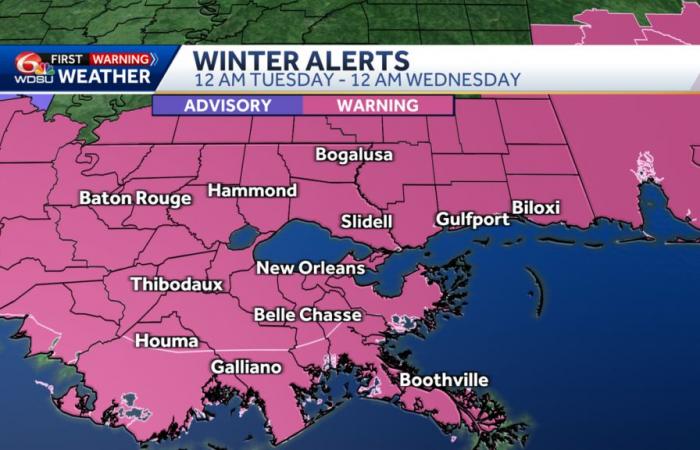
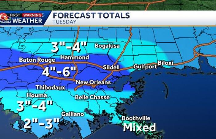
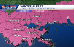
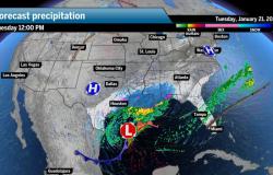
Cold, arctic air is dropping into Southeast Louisiana right now and that will interact with a developing low in the Gulf of Mexico that will bring snow to New Orleans. A Winter Storm Warning is now in effect for everyone shown here.
Widespread snow totals 3-4″ are likely for everyone in the warning.
Radar | Download our app | Sign up for weather alerts | Send us your photos
OVERVIEW:
Snow and cold weather are likely over the next 24-48 hours. We know there will be impacts to travel starting first thing Tuesday.
TEMPERATURE FORECAST:
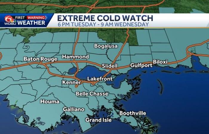
An Extreme Cold Watch has been issued for Tuesday night into Wednesday morning where our first Extreme Cold Warning is likely to be issued. Temperatures could possibly feel as low as 10 degrees.
PRECIPITATION FORECAST:
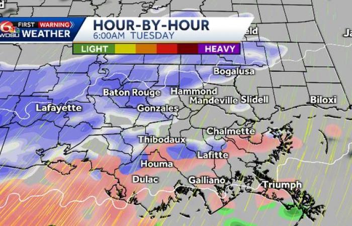
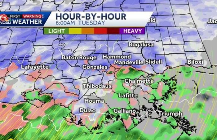
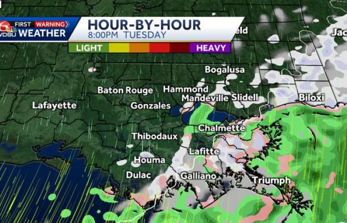
We’ve been tracking the potential of wintry weather and snow starting Tuesday. Snow is now likely, but we’ll still begin the event with pockets of rain, sleet, and freezing rain. Here’s a break down on the computer forecast data.
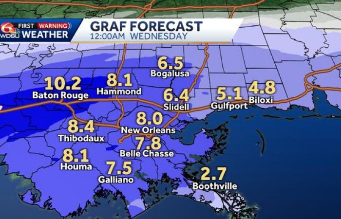
GRAF (Global high-Resolution Atmospheric Forecasting System) – IBM
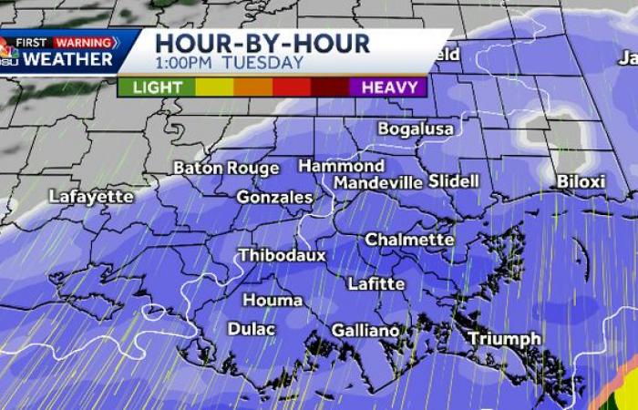
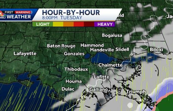
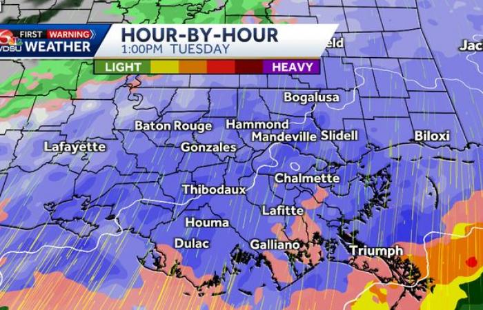
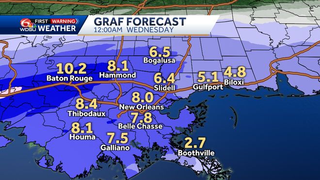
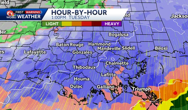
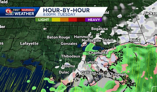
Now that we’re within two days away from the storm, our high resolution data are in. This forecast starts with sleet, but turns to heavy snow all across Southeast Louisiana by mid-morning and through the rest of the day.
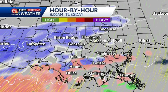
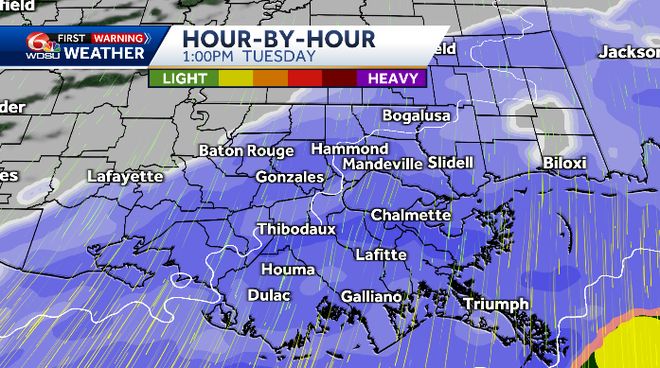
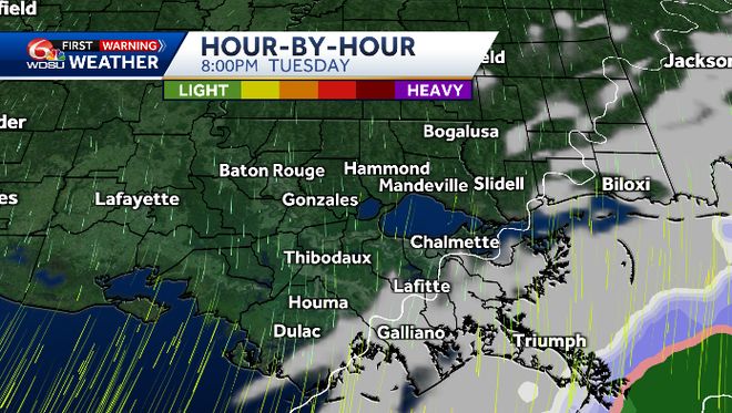
These snowfall totals are on the extreme side, and is not what we’re forecasting. Although these totals have backed off from yesterday.
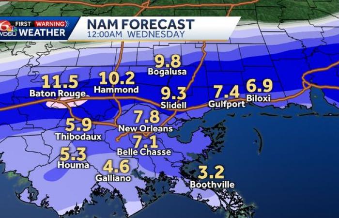
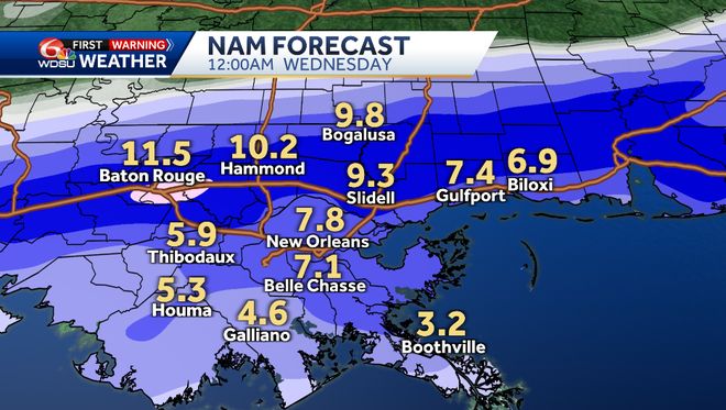
NAM (North American Model)
The NAM is similar to the GRAF in snowfall amounts too. On the extreme end, for sure!
-
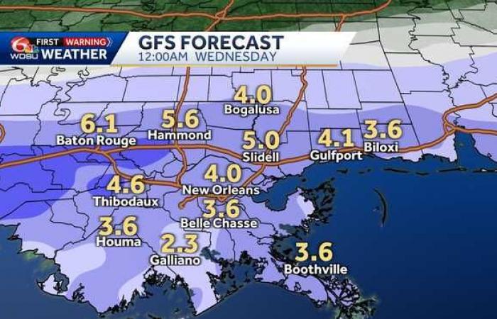
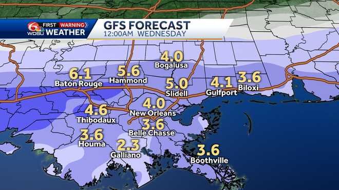
GFS (Global Forecast System – U.S.)
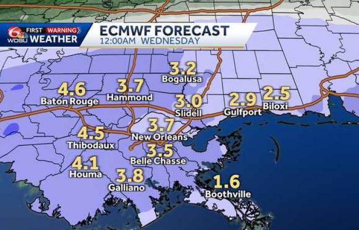
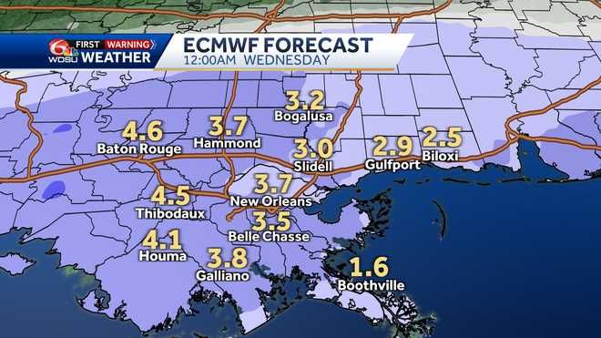
The GFS and ECMWF are pretty much in line with each other. Although, the GFS wants to pull in a little more for totals.
ECMWF (European – Europe)
ACCUMULATION:
The North Shore will likely see the heaviest amounts, but the South Shore and River Parishes will likely have measurable snowfall as well.

PRECIPITATION TYPES:
When the atmosphere gets cold enough, the clouds are actually comprised of ice crystals. When the precipitation first falls, it falls in the form of snow. However, here along the coast the snow usually runs into a layer of air warmer than freezing and melts into rain. If the rain meets temperatures below freezing at ground level and doesn’t have enough time to refreeze, it is called “freezing rain” where the rain drops instantly freeze up into a sheet of ice on the roads and cover the trees, brushes, and fences with a glaze of ice. This is the most dangerous form of wintry weather! If the once snowflake raindrops encounter a deep enough layer of sub freezing air at ground level, it will refreeze into an ice pellet, or sleet. And if the snow never meets a point falling to the ground where the air temperature rises above freezing, it will fall as snow. Here’s a diagram of what this looks like.
Be sure to stay with the WDSU First Warning Weather Team for all the latest on Tuesday’s wintry weather.

