SAGINAW, Mich. (WNEM) – Outside of some lake-effect in the Thumb this weekend, we’ve had a chance to dry out this weekend. However, that break is expected to be short-lived.
Advisories have been issued for our counties along US-127 and our northern most counties along M-55. These advisories will go into effect late tonight and last most of Monday. It’s possible more counties could be added based on forecast trends, but we’ll let you know if that happens. You can find specifics on our Weather Alerts Page.
For a complete look at your forecast, be sure to check out your TV5 First Alert 7-Day Forecast!
This Evening & Overnight
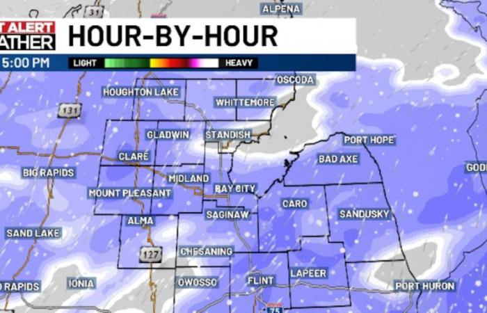
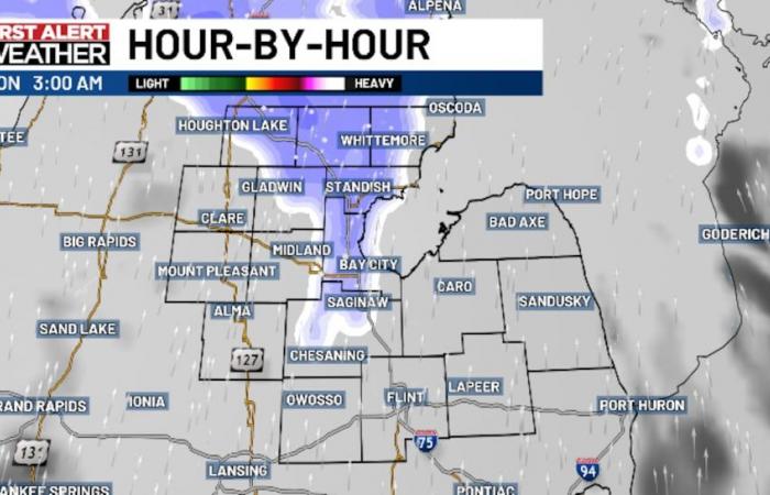
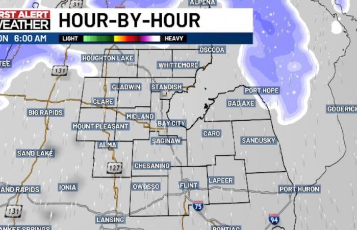
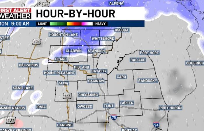
We do not expect many issues in the near term this evening, with snow expected to largely hold off until after midnight. Although the first snow showers are possible on Monday morning, we expect the snow that passes through during the morning to be scattered, so many will have a chance to get through the morning commute dry.
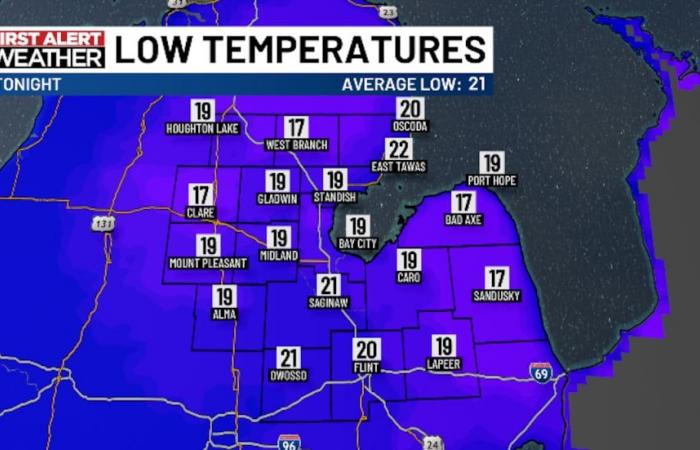
Our northern counties and the northern Thumb appear to have the “best” shot to see snow early in the day. Any accumulation through the morning drive should be fairly light (generally under 1″) but with temperatures dropping off into the teens and low 20s tonight, road conditions of course will have to be monitored.
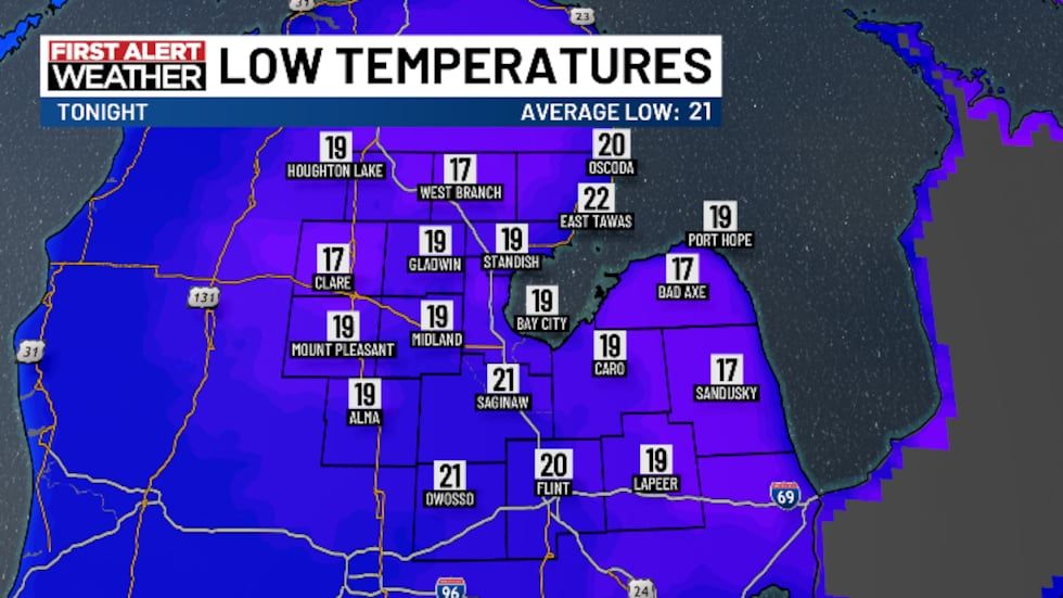
Winds will be southerly around 5 to 15 miles per hour, bringing wind chills into the lower and middle teens on Monday morning.
Monday
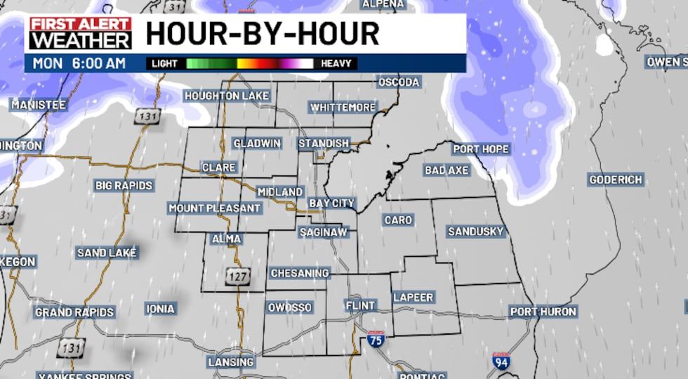
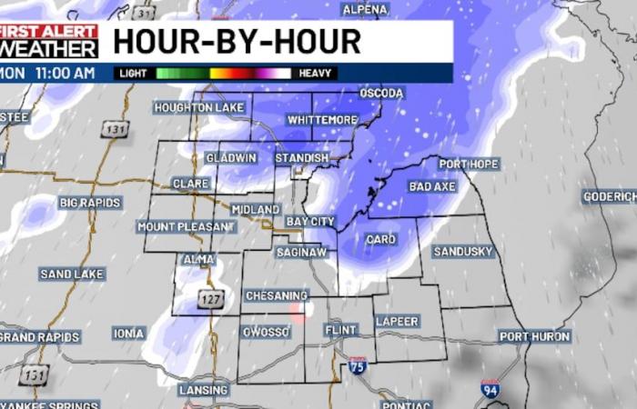
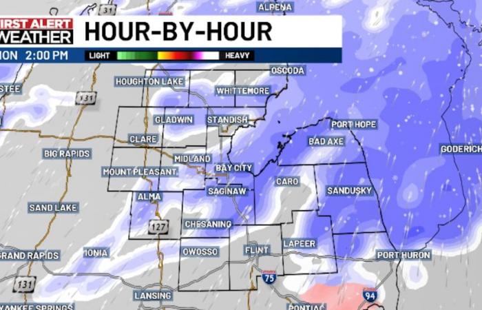
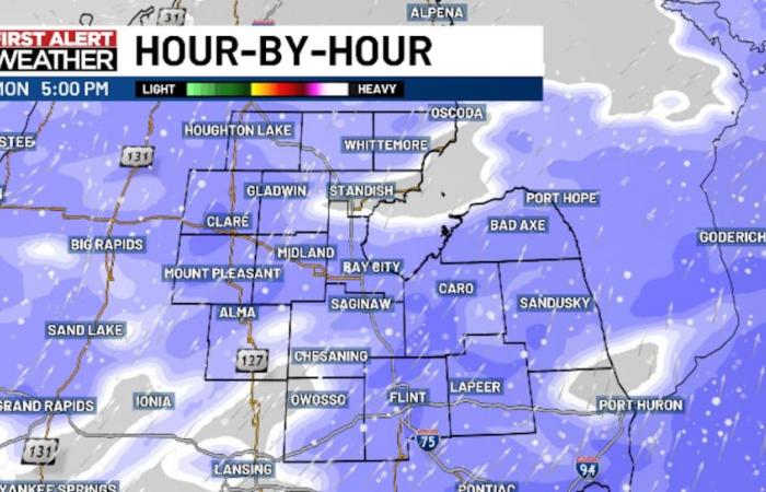
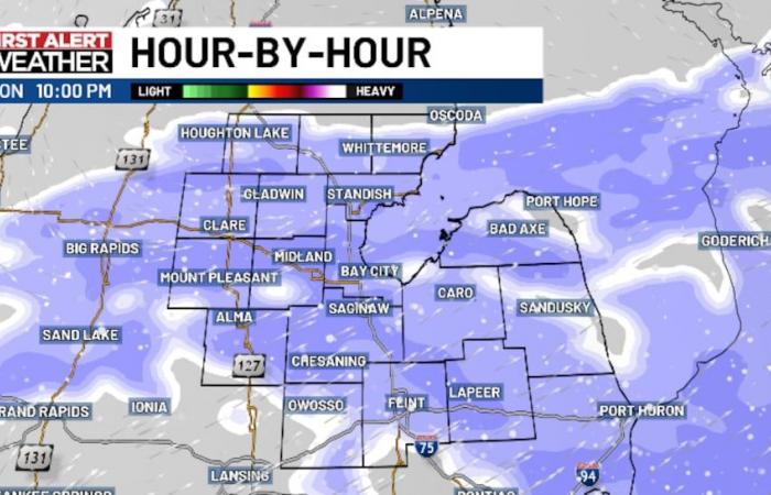
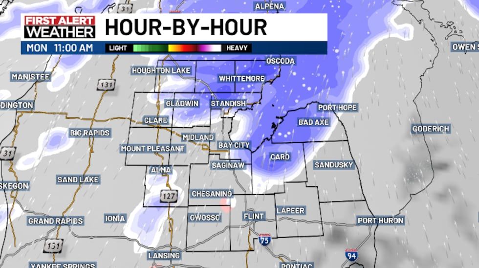
Snow will become more common late in the morning, continuing to expand over the area during the afternoon and evening hours. For a broad time frame of the heaviest snowfall rates, we expect 11 AM to 5 PM to be that window of time. Those farther north of the Tri-Cities region will be closer to the 11 AM start, with those farther south closer to 12-1 PM.
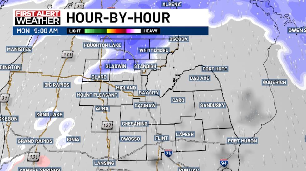
During that window of time, snowfall rates of 0.5″ to 0.75″ per hour are expected. Probabilities for any snow approaching 1″ per hour seem fairly low at this time (20% or less).
Temperatures will have a chance to warm up into the lower and middle 30s on Monday afternoon, with winds expected to be south southwesterly around 5 to 15 miles per hour.
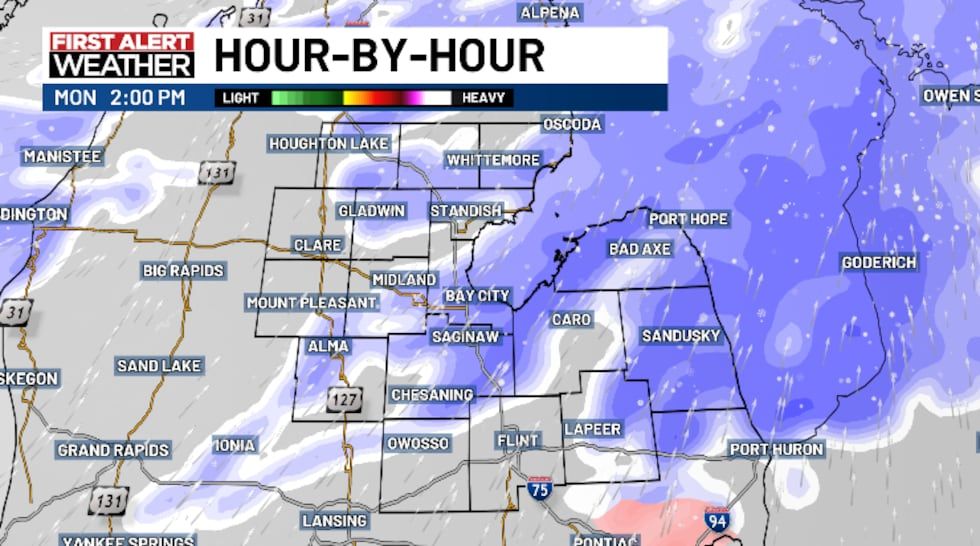
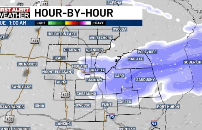
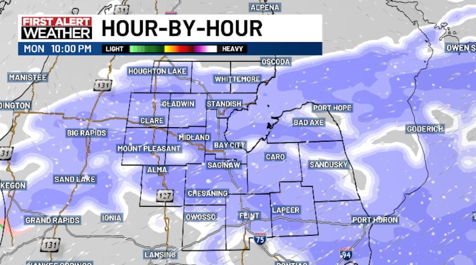
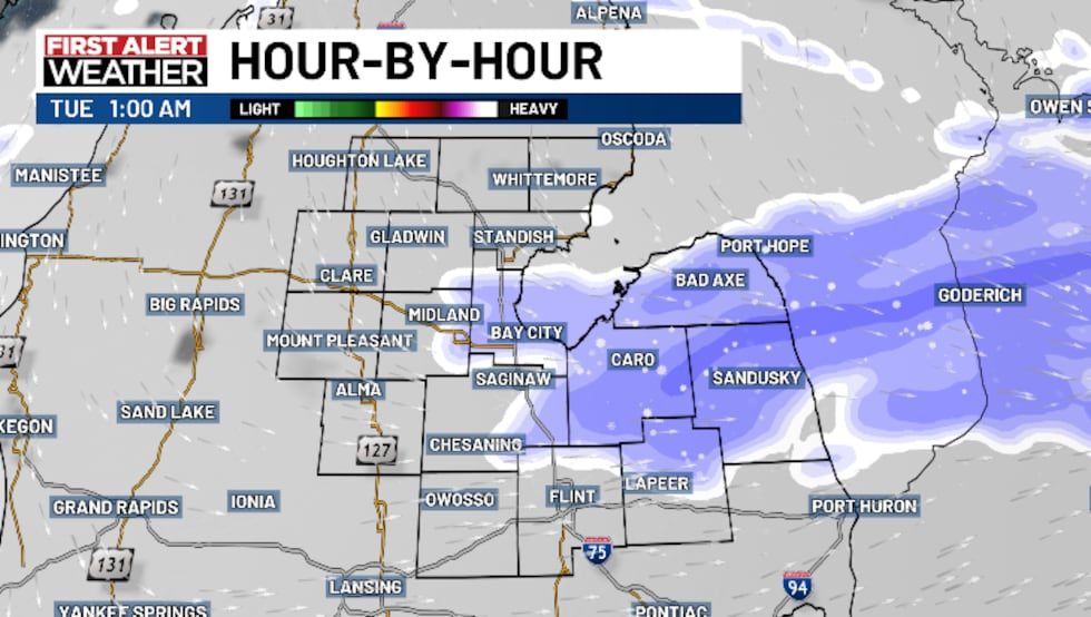
Snow will gradually taper off from northwest to southeast through the evening hours and should be pretty much wrapped up in all areas around midnight or so. Temperatures will drop into the lower and middle 20s on Monday night, so road conditions will need to be something to monitor on Christmas Eve for any travel early in the day.
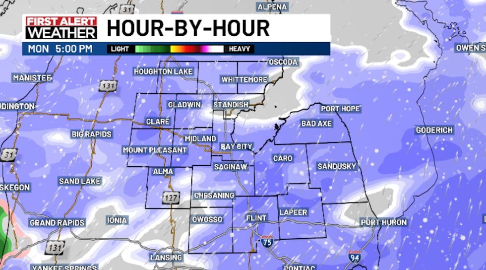
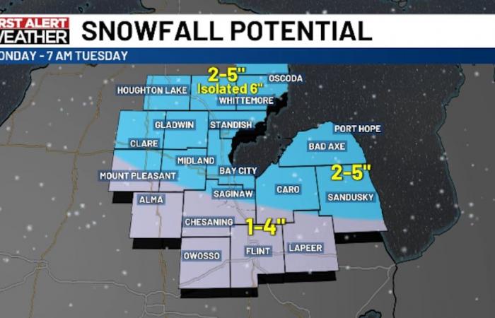
As for the amounts, we expect most of the area will pick up 2-5″ like we received last Thursday and early Friday. There could be some areas of refinement as we have 1-4″ farther to the south near areas like Flint, Lapeer, Owosso and Alma and we’ve allowed for some isolated totals near 6″ north of the Tri-Cities region.
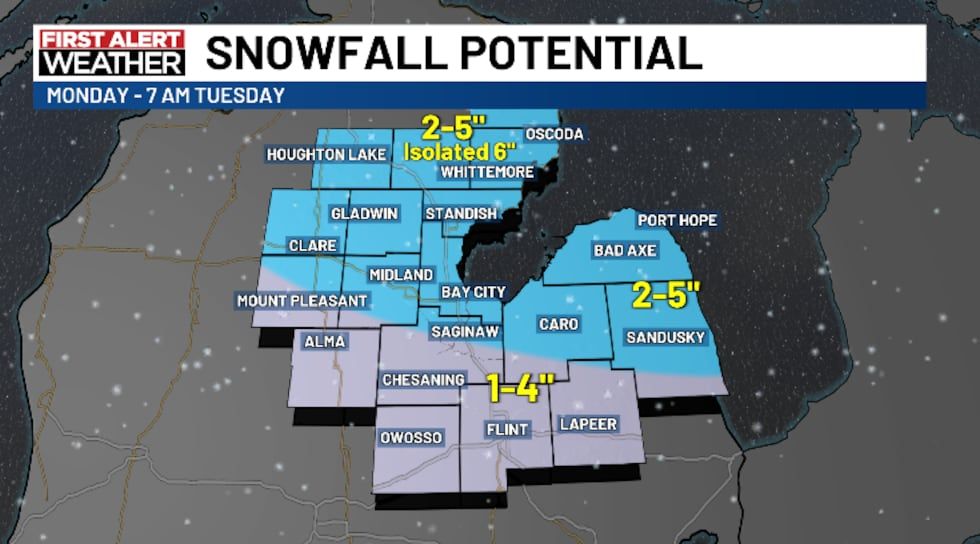
If we made adjustments based on some things we’re watching tonight, we could see some of our northern counties go just a shade higher and we’re also watching for any mixed precipitation potential (sleet or freezing rain) in the south which could cut down snow totals there. We will see not only what tonight’s data brings, but we’ll also have one more crack at a snow map in the morning, so Meteorologist Mathieu Mondro will have you covered Monday morning.
As always, please drive carefully and stay tuned for updates! We’ll have you covered on-air, online, and on social media if any updates are needed.
Copyright 2024 WNEM. All rights reserved.

