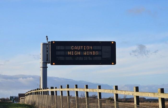
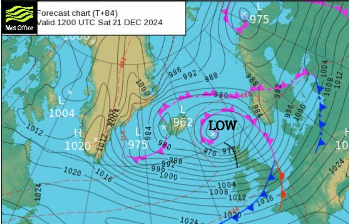
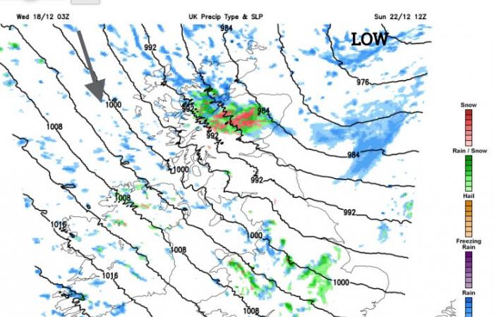
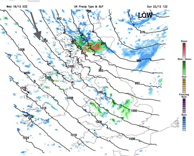
There is already a wind warning for Saturday from the Met Office. It is an early heads-up, highlighting severe weather for northern and western Scotland and coastal Northern Ireland as the pre-Christmas getaway begins. Travel disruption to ferry and air services is likely but more widely across the UK there could be tricky conditions on the roads, especially for higher-level routes and along exposed coasts. An Atlantic low will move between Iceland and Orkney on Saturday resulting in windy weather across the UK but especially for the far north of Scotland. These winds will be from the west and southwest. As the low heads away towards Norway on Sunday, a colder northwesterly wind will take hold. There will be bright, even sunny weather accompanied by a rash of showers for exposed areas. These will bring a mixture of rain, sleet and snow.
If you have a Christmas night out or a day event, it will feel cold in that wind, with damp even wintry weather on the way. And the strong, gusty wind will do its best to wreck your hair styling.
Things to consider for the weekend; the wind strength, where is likely to see showers and where will be more sheltered, the air masses and how it will feel in those winds.
Temperatures
If you are out on Friday night there will be an increasing amount of dry, clear and nippy weather. A frontal band will be clearing away from southeastern Britain on Friday evening. The patchy rain on this cold front could take its time to move away from London and the Home Counties and it will add to the cold, damp breezy weather. Elsewhere it will be drier, with clear skies, dipping temperatures and a chilly breeze. Not the windy weather of this week but still enough to make it feel cold.
On Saturday a deepening low nips in from the Atlantic. Wet and windy low pressures seem to favour the UK over recent weekends. There will be mild air (Tropical Maritime air) caught up in the warm sector lifting temperatures into double figures, say 11 to 14C in southwesterly winds. Through the weekend we will see Returning Polar Maritime then Polar Maritime air take hold from the northwest, so colder air with a host of showers including wintry ones. By Sunday the daytime temperatures will be around 6 to 9C. For both days you should consider fresh to strong gusty winds making it feel colder. Saturday night will be colder due to the air mass change and the wind chill. Sunday morning will feel cold in the wind if you are heading out early on. Don’t be fooled by any sunshine out of the window, there will be sleet, hail and snow showers in the wind.
Precipitation
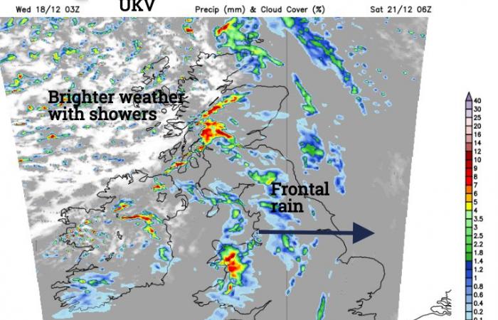
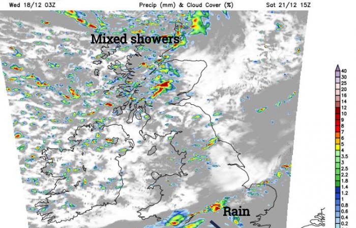
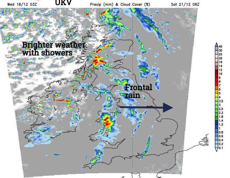
The frontal system arrives early on Saturday morning from the west. This will bring more cloud and outbreaks of rain and sweep across the UK but take its time over Wales and England. The frontal rain will clear southwards, taking until evening to clear from southern England. Behind there will be brighter skies with sunshine but also lots of showers. These will turn to sleet and hail and become heavier later in the afternoon over Scotland. It will be cold, damp and windy by Saturday evening.
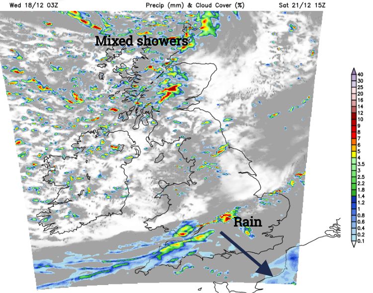
Clusters of showers will run in on the northwesterly flow. A mix of rain, sleet, hail and snow will particularly affect northern Scotland but reach well inland to other parts of Britain and Northern Ireland. The strength of the wind will push the downpours right across the country. The showers will come and go. Don’t be surprised if you see wintry ones on Sunday morning for Wales, northern England, Scotland and Northern Ireland, even into the Midlands and SW England. Eastern Scotland will be more sheltered but not immune and northern Scotland will see a lot of wintry weather on Sunday. Southeastern Britain will be drier with just a few rain showers reaching that far.
Winds
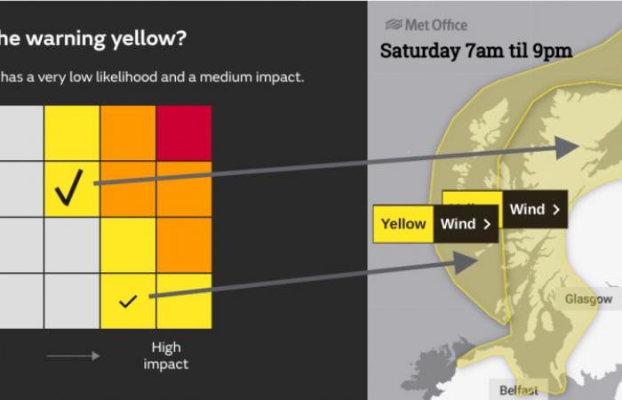
There are two areas of yellow wind warning, both run from Saturday morning into the night. The differences are shown within the matrix. We can assume all the warning areas have “a medium likelihood and a low impact” but the exposed region has an additional “very low likelihood and a medium impact”. Subtle but important.
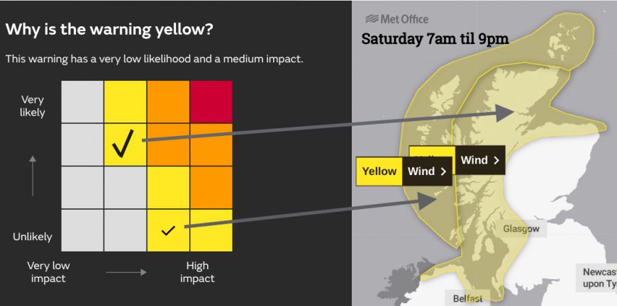
The text detail from the Met Office mentions
“Very strong westerly winds are expected to develop … with gusts of 65-75mph expected. There is a small chance that gusts in excess of 80mph could occur” “large waves an additional hazard, especially in respect of causeways”
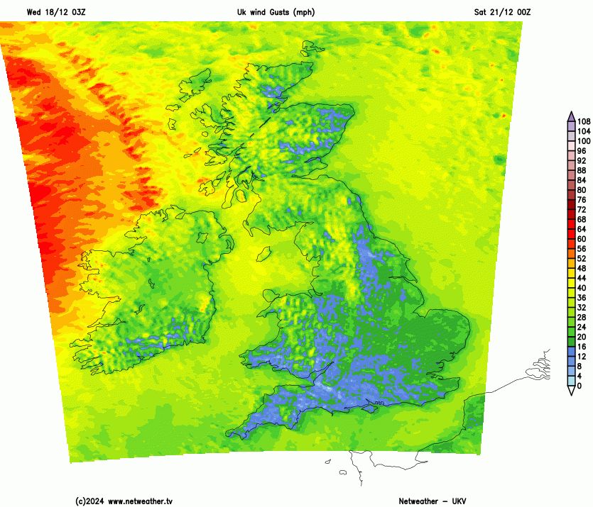
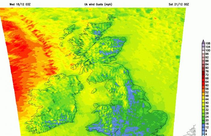
South to southwesterly winds will strengthen early on Saturday around the Irish Sea, northern Britain and Northern Ireland. Everywhere becomes windy through the day but western Scotland will be hit with westerly gales, even severe gales as the core of extreme winds moves over northern Scotland during the afternoon and evening. The UKV focuses this over Orkney on Saturday evening. Ferries services to the Northern Isles could be lively for all the wrong reasons on Saturday night.
The winds continue through the night as the colder air takes hold with a dig of northwesterly gales heading to western Scotland by Sunday morning, to the north coast of Northern Ireland and down to the Irish Sea. Westerly winds could also cause issues through the Central Belt on Sunday. It will be a cold, windy day with the potential for disruption to ferry services in the Irish Sea as well as along the coasts of Scotland. The winds will ease down through Sunday night.

