Highlights of this day
– gray weather as dense as Saturday with more fog in the morning
– almost no more frost on the plains
– more sun near the Mediterranean
Duration of sunshine Sunday © the weather channel
Matin
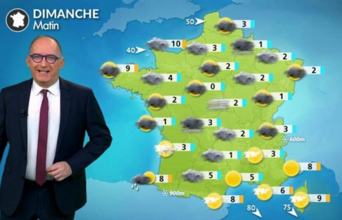
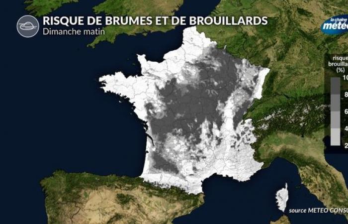
Despite high pressures (around 1025 to 1030 hPa), clouds monopolize the skies of France. Some drizzle may affect you from the Pyrenees to Rhône-Alpes to Alsace with a few flakes from 500 meters altitude. Be careful if you are traveling in mist and fog between the plains of Aquitaine and the north-east where they can reduce visibility to less than 200 meters. Near the Mediterranean, you find the sun with a little mistral and tramontane.
In the morning, temperatures change by 1°C in Dijon and Rouen, 2°C in La Rochelle and Paris, 5°C in Toulouse, 6°C in Nice and 11°C in Ajaccio.
Risk of fog Sunday morning © the weather channel
Afternoon
Grays and clouds remain stubborn over most of the country. A disturbance brings you some scattered rain near the Channel. Conversely, near the Mediterranean, you retain full sun with mistral and tramontane winds blowing up to 70 km/h in gusts.
You have 4°C in Metz, 5°C in Limoges, 7°C in Lille and Toulouse, 8°C in Paris and Rennes up to 11°C in Perpignan and 13°C in Ajaccio.
Soirée
No change expected with the maintenance of a thick cloud layer over ¾ of the country with one or two drops or a little drizzle possible and still a clear sky near the Mediterranean.
Things to remember over the next few days
Until Wednesday, the weather is calm due to the strengthening of the Azores anticyclone. But the gray weather remains stubborn north of the Loire and in the valleys and plains of the Center-East. On the other hand, near the Mediterranean and in the mountains, it is full sun. The end of the week promises to be more turbulent with the return of the rains, initially mild, before cooling off and the return of a little snow on Friday.


