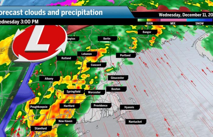
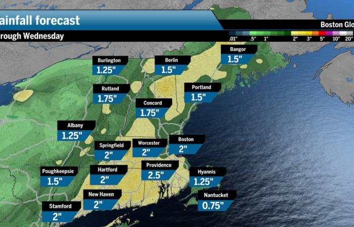
About 1 to 4 inches of rain has fallen across portions of New England Wednesday as steady to heavy rain continued into the evening amid another wave of precipitation. A potent cold front pushing into the region from the west was unleashing about an inch of rain an hour in some areas. Many locations were expected to see an inch or two more of precipitation by midnight from the downpours.
Southeastern Massachusetts and Rhode Island were seeing the greatest rainfall, with numerous flooded streets reported. Coventry, R.I., saw one of the highest rainfalls, at 4 inches, while Providence saw 3½ inches, according to the National Weather Service. The following are rainfall totals so far today:
In Rhode Island, a flood warning was extended for the Pawtuxet River at Cranston and the Wood River at Hope Valley in southern Rhode Island through early Thursday afternoon. The Pawtuxet was expected to rise a couple of inches above flood stage (9 feet) overnight while minor flooding was occurring at the Wood River. Both were forecast to recede Thursday.
Rainfall was not as intense up north, with a few areas in Northern New England nearing around an inch of rain. However, flood watches still remain in effect until early Thursday morning due to the rapid snowmelt.
The continued bouts of heavy rain have been persistent and widespread, elevating the risk for flooding in parts of New England, especially as very warm temperatures accelerate snowmelt across interior portions of New England. Flood watches remain in effect for Central and Western Mass. through 7 a.m., Thursday.
Let’s break it down between the expected amount of water from rainfall and how much could melt from the snowpack due to temperatures rising into the 60s today.
An uninterrupted river of moisture has been funneling above New England during this storm. Rainfall totals of 1 to 4 inches have been recorded so far across most of New England, with the most intense rainfall expected to fall across interior portions. This means that the higher totals can stretch across parts of mountainous regions in Vermont and New Hampshire that can exacerbate water runoff with varying terrain.

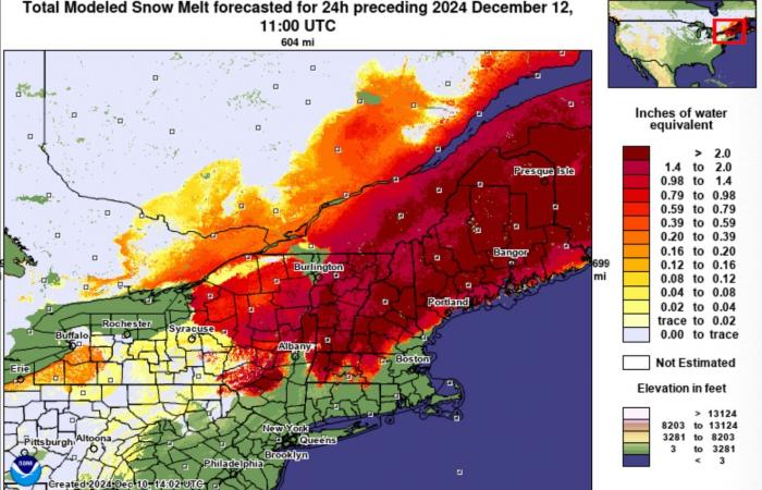
Adding to the volume of water is the melting snow. There’s still enough snow on the ground across Central and Northern New England from previous storms that is quickly melting and could add 1 to 2 inches of water that will certainly amplify flooding chances.
Here’s the forecast snowmelt from this storm:

Some good news is that this storm should make a lasting impact on the ongoing drought. Most of the river and stream levels have been very low for some time, meaning that most should be able to handle the excessive runoff from rainfall and snowmelt. But there could still be some spots that take on too much water too fast and become overwhelmed.
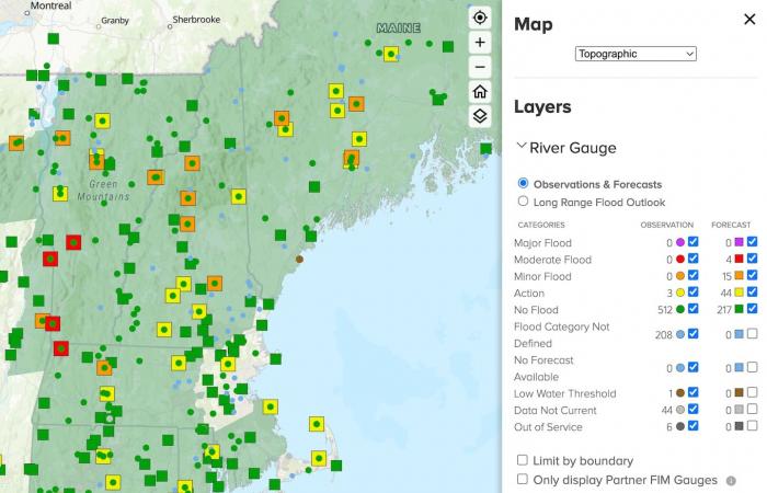
Four rivers in the Berkshires and Southern Vermont, near Rutland and Bennington, could see moderate flooding from the ongoing deluge, expecting to peak shortly near or after midnight tonight.

In Rhode Island, a
It’ll come down to where the most intense rainfall rates develop and if it’s over areas with rapidly melting snow. It also helps that the storm will accelerate faster as the night progresses — which should limit impacts as it moves out of the region.
Ken Mahan can be reached at [email protected]. Follow him on Instagram @kenmahantheweatherman.


