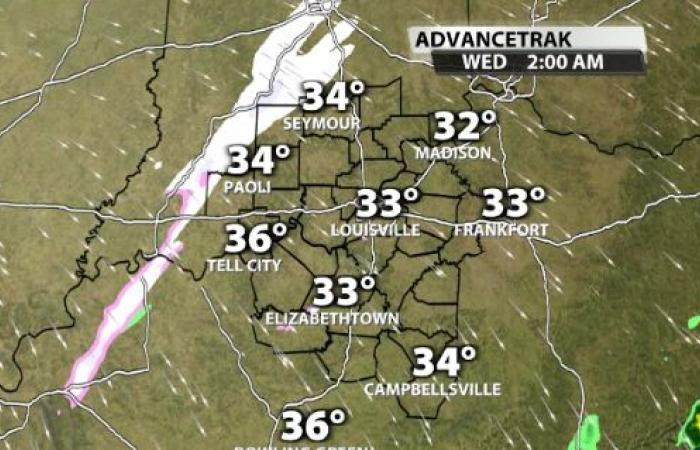
We don’t have a major snow storm on our hands or anything, but we could see some snow showers tonight, then snow squalls Wednesday afternoon. Let’s begin with tonight. A little light snow or snow showers could dust up elevated surfaces like your grass, car, deck or grill by Wednesday morning. Since temperatures drop down to the freezing mark, please use caution on the roads, especially less travled and untreated. At 2 AM snow showers are in Southern Indiana, by 4 AM in Louisville, then east if I-65 by 6 AM. The best chance for a quick covering is along and east of I-65 as the band get a bit more organized before completely moving out by 8 AM…
We need to use extra caution Wednesday afternoon as snow squalls or snow bursts begin forming. These short, intense bursts of snow can lead to sudden whiteout conditions and slick roads. Even though they only last 15 – 45 minutes, the snow rates can overcome warmer pavements temperatures. Think of these as winter’s version of a summertime storm. Not everyone will seem them, but where they strike travel becomes quite dangerous as visibilites drop and roads get covered by snow. The window opens tomorrow at 2 PM, we should reach a maximum around 4 PM, then snow showers winds down by 10 PM. Anyone is fair game for up to 1/2″ of snow which also means you may get nothing. Take it easy out there!


