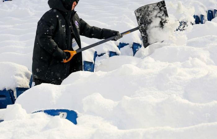
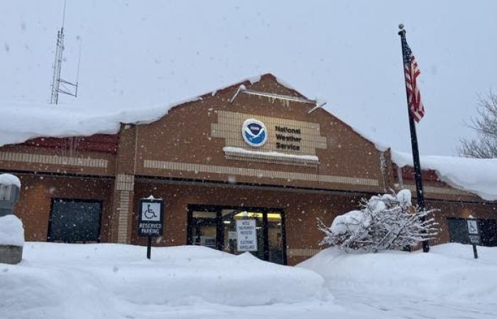
Epic snowfall totals have been reported in Great Lakes communities from Michigan to New York as an historic lake-effect snowstorm continues to pound the region. FOX Weather Storm Specialist and Meteorologist Mike Seidel was in Mayville, New York, on Monday, where snow the snow continues to pile up after the Sun made a brief appearance earlier on Monday morning.
BUFFALO, NY – A long-duration lake-effect snowstorm is continuing to pummel the Great Lakes region after dumping 3-5 feet of snow in cities from Michigan to New York that paralyzed travel as people tried to get home after the busy Thanksgiving holiday weekend.
This has been the first significant lake-effect snowfall of the season, and snow totals have been nothing less than epic in numerous communities.
HOW TO WATCH FOX WEATHER
Western New York has been plagued with at least three feet of snow in some areas, amid lake-effect snow warnings. The National Weather Service office in Buffalo, New York, expected some snowfall totals to top 4 feet by Monday, and in some of the embedded snow bands, thundersnow and waterspouts were reported.
The highest snowfall totals so far have been found in cities and towns downwind of Lake Erie and Lake Ontario from northwestern Pennsylvania to western and northern New York state.
Portions of Ohio, too, have been impacted, and forecasters say more winter weather is on the way before the system begins to finally wind down on Tuesday.
The impacts from the historic lake-effect snowstorm have been far-reaching, not only because of the sheer amount of snow that fell but also because of the intense snowfall rates reaching up to 4 inches per hour, which overwhelmed crews who were relentlessly working around the clock to remove the snow and ice from roads and highways such as the heavily traveled Interstate 90 from New York state to Ohio.
DOWNLOAD THE FREE FOX WEATHER APP
A video shared by FOX Weather Exclusive Storm Tracker Brandon Copic shows crews hard at work trying to clear snow from US 20 in Fairview, Pennsylvania, on Sunday morning.
I-90 had been closed along that busy stretch due to dangerous winter weather that had affected travel in the region.
However, thanks to the hard work of Department of Transportation crews across the region, I-90 was first reopened to passenger travel late Saturday in portions of New York, and the highway fully reopened to both passenger and commercial vehicles early Monday morning.
Travel is expected to remain treacherous in areas still impacted by bands of heavy snow coming off the Great Lakes. Drivers are being urged to stay off the roads if possible, significantly slow their speeds, and leave plenty of distance between vehicles to ensure the safety of people out and about on Monday.
DRIVING ON THE ICE AND DRIVING IN THE SNOW: WEATHER DRIVING TIPS FOR DRIVING IN INCLEMENT WEATHER
The lake-effect snowstorm that has blasted the Great Lakes region is continuing on Sunday, and video shot from over the weekend shows crews hard at work removing snow from roads while other vehicles struggle to get around.
Dangerous travel conditions have been reported for days, with FOX Weather Storm Tracker Brandon Copic witnessing vehicles struggling to make it through the snow as it was falling.
“Honestly, it’s just chaos out here,” Copic said on Saturday from Erie, Pennsylvania. “The trucks are going on roads they shouldn’t be going because the highways are closed, and that just leads to more cars getting stranded.”
TRAVELING THIS WINTER? HERE’S WHAT TO KEEP IN YOUR CAR IN CASE YOU GET STUCK
Storm trackers Corey Gerken and Brandon Copic teamed up along a very snowy interstate in Erie County, Pennsylvania to help pull a car stuck along the shoulder. “This was the third car we’ve rescued today so far,” Gerken said.
Copic said he spent hours on Friday trying to help those who became stranded in the extreme weather conditions. Copic also sent in drone video that showed stranded vehicles on Pennsylvania’s Route 5 near the border with New York that showed cars and trucks stuck in the snow.
“The trucks that are jackknifed up the road is what caused the gridlock,” he said.
States of emergency have been declared in three states – New York, Pennsylvania and Ohio – and National Guard troops had been called up to help with the storm response efforts.
DON’T LEAVE ANY OF THESE ITEMS IN YOUR CAR THIS WINTER
FOX Weather Exclusive Storm Tracker Brandon Copic was streaming live video from Blasdell, New York, on Saturday evening when thundersnow was reported and lightning illuminated the sky.
And it wasn’t just the snow that was making headlines over the weekend. The paralyzing lake-effect snowstorm also produced rare thundersnow and even waterspouts off the shores of Lake Erie.
NOW IS THE TIME TO PREPARE YOUR VEHICLE FOR COLD WEATHER
Thundersnow can be heard rumbling across the Buffalo area in western New York as a high-impact, lake-effect snowstorm pounded the Great Lakes region over the weekend.
A video shared by Copic showed lightning flashing in the sky as the snow fell in Blasdell, New York, and loud rumbles of thunder could be heard in another video shared outside the Buffalo, New York, area.
Similar to thunderstorms, thundersnow requires a significant amount of atmospheric instability, and in areas where the phenomenon occurs, snowfall rates can be exceptionally heavy.
REMOVING ICE FROM YOUR WINDSHIELD CAN BE EASY – IF YOU DO IT THE RIGHT WAY
(FOX Weather)
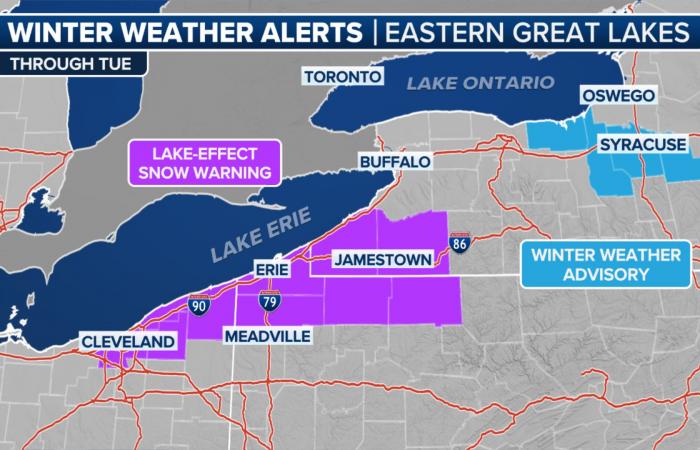
Winter weather alerts remain in effect across the region, including Lake-Effect Snow Warnings from Cleveland to southwestern New York that will remain in effect until at least Tuesday morning.
Winter Weather Advisories also remain in effect for parts of central New York, including the Syracuse metro, where several waves of lake-effect snow will impact the area through Tuesday afternoon.
THE SOUND OF SILENCE: WHY IT’S QUIETER AFTER A SNOWSTORM
(FOX Weather)
Lake Erie snow to continue Monday
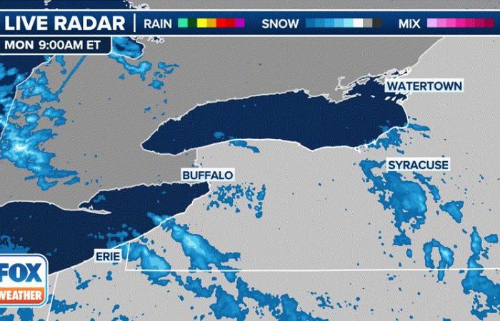
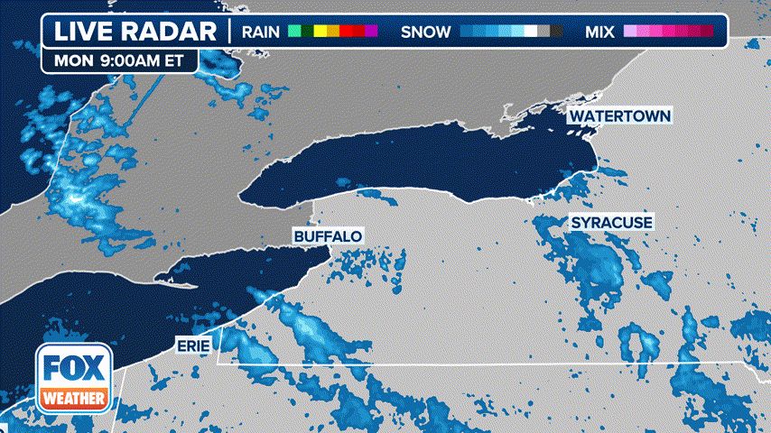
The FOX Forecast Center said the primary band of snow coming off Lake Erie will sink back to the south on Monday, and the main challenge for forecasters is trying to forecast exactly where the heaviest snow will fall and how far inland it will extend.
The snow band is expected to remain close to the southern lakeshore temporarily, but a shift to northwesterly winds will likely push it farther inland.
Some areas could pick up an additional foot or more of snow, with the highest totals likely occurring from parts of Erie County, Pennsylvania, through Chautauqua and Cattaraugus counties in southwestern New York.
The city of Erie, Pennsylvania, already got buried on Friday when it reported its snowiest day on record with a whopping 22.6 inches of snow before storm totals vaulted to 42.5 inches by Sunday night.
Travel could again become dangerous on major roads and highways across the region, including I-90, I-86 and I-79, which could become nearly impassable. In the heaviest snow bands, visibility could drop to less than a quarter-mile, and strong winds could blow snow that has already fallen.
(FOX Weather)
Lake Ontario also impacted
The FOX Forecast Center said the intense band of snow coming off Lake Ontario has weakened and shifted south after dumping 65.5 inches of snow south of Watertown, New York, in the town of Barnes Corners.
The snow threat there has now ended, and as the winds shift more northwesterly, the attention will change to new areas farther south of Lake Ontario.
The focus will be on a stretch of Interstate 90 from Rochester to Syracuse, where snow bands could produce snowfall rates of 1-2 inches an hour.
That could make travel treacherous on that stretch of I-90, which hasn’t seen too many issues during this lake-effect snowstorm.
Lake Superior, Lake Michigan communities could see whiteout conditions
(FOX Weather)
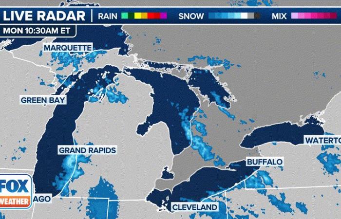
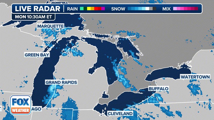
The FOX Forecast Center said multiple bands of lake-effect snow will continue well into Tuesday in western and northern Michigan across areas downwind of Lake Michigan and Lake Superior.
The bands aren’t expected to contain snowfall rates as high as what has been seen in Pennsylvania and New York but will still be heavy enough to lead to near-whiteout conditions and dangerous travel.
Cities like Gaylord, Michigan, have already seen historic snow totals, with 43.7 inches piling up since Thanksgiving morning. The 24.8 inches that fell in Gaylord on Friday alone vaulted Nov. 29 to the city’s snowiest calendar day on record.
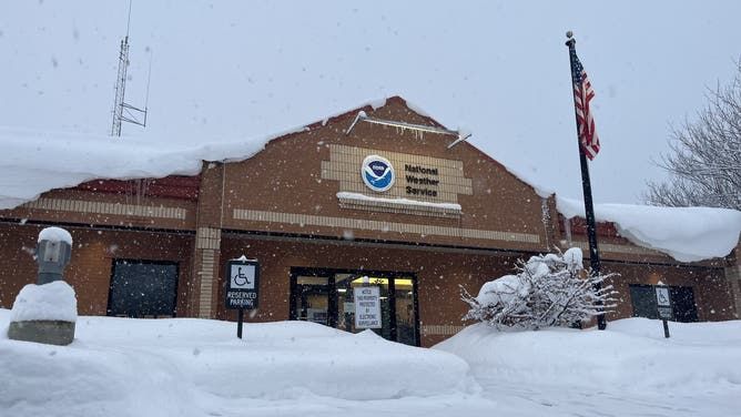
The National Weather Service office in Gaylord, Michigan, has measured 43.7 inches of snow since Thanksgiving morning, and it was still snowing when this photo was taken Monday morning, Dec. 2, 2024.
(@NWSGaylord / X / FOX Weather)
But the FOX Forecast Center said the main difference on Monday will be the shift in winds. The winds will have a more northerly component, which forecasters said will make the bands of snow coming off Lake Superior the most intense.

