Meteorologists will be watching this storm system carefully as it takes shape in the Great Plains on Wednesday and marches toward New England just in time for Thanksgiving. It’s still early and the forecast could certainly change, but the timing is looking like most of Thanksgiving through much of Friday morning could get messy.
The jet stream is now very active and has been pushed farther southward. When it buckles like this, that means upper-level air is moving at various speeds and often creates voids of air. Low-pressure systems at the surface are made up of rising air that fill in the void in the upper atmosphere, thus ‘plugging’ into the jet stream and typically traveling across the country where the jet stream is positioned. And New England is a direct target.
One important point to note with this storm: Tuesday’s quick-moving system will bring some colder air into the region ahead of Thursday’s storm, which will open the door to possible snow in New England. But the big question is will it be cold enough to actually produce substantial snow?
Scenario one: A more intense storm
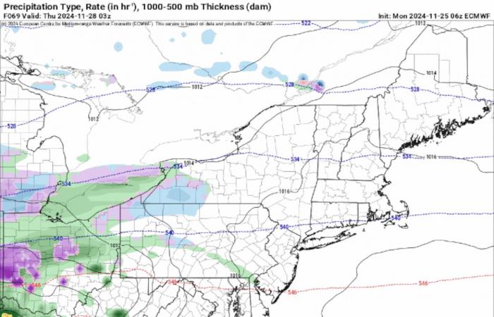
The jury’s still out, but two scenarios are on the table: One, the Euro model, points to a more impactful system with the core of the low tracking inside the coastline with a steeper pressure gradient — influenced by another system to the north — meaning more intense rain and snow.
Scenario two: A weaker system
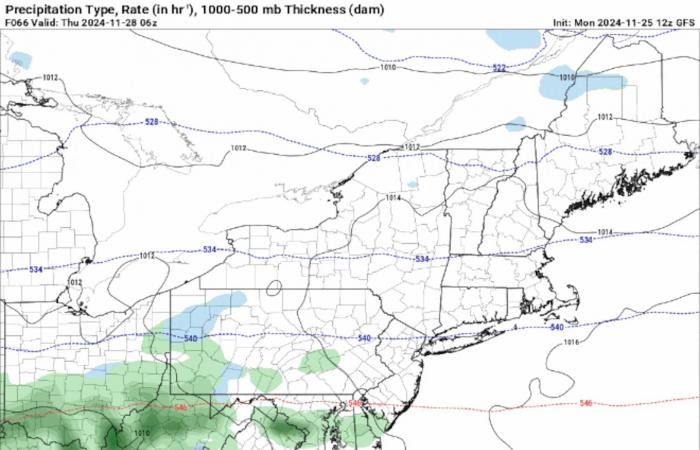
Other models, such as the GFS or American model, have the approaching storm keeping south of New England, more influenced by a pocket of high pressure off shore. This will fan out the storm, stretching it thin and thus more room for cold air to filter in — increasing the chance for snow, but with much lighter amounts of precipitation.
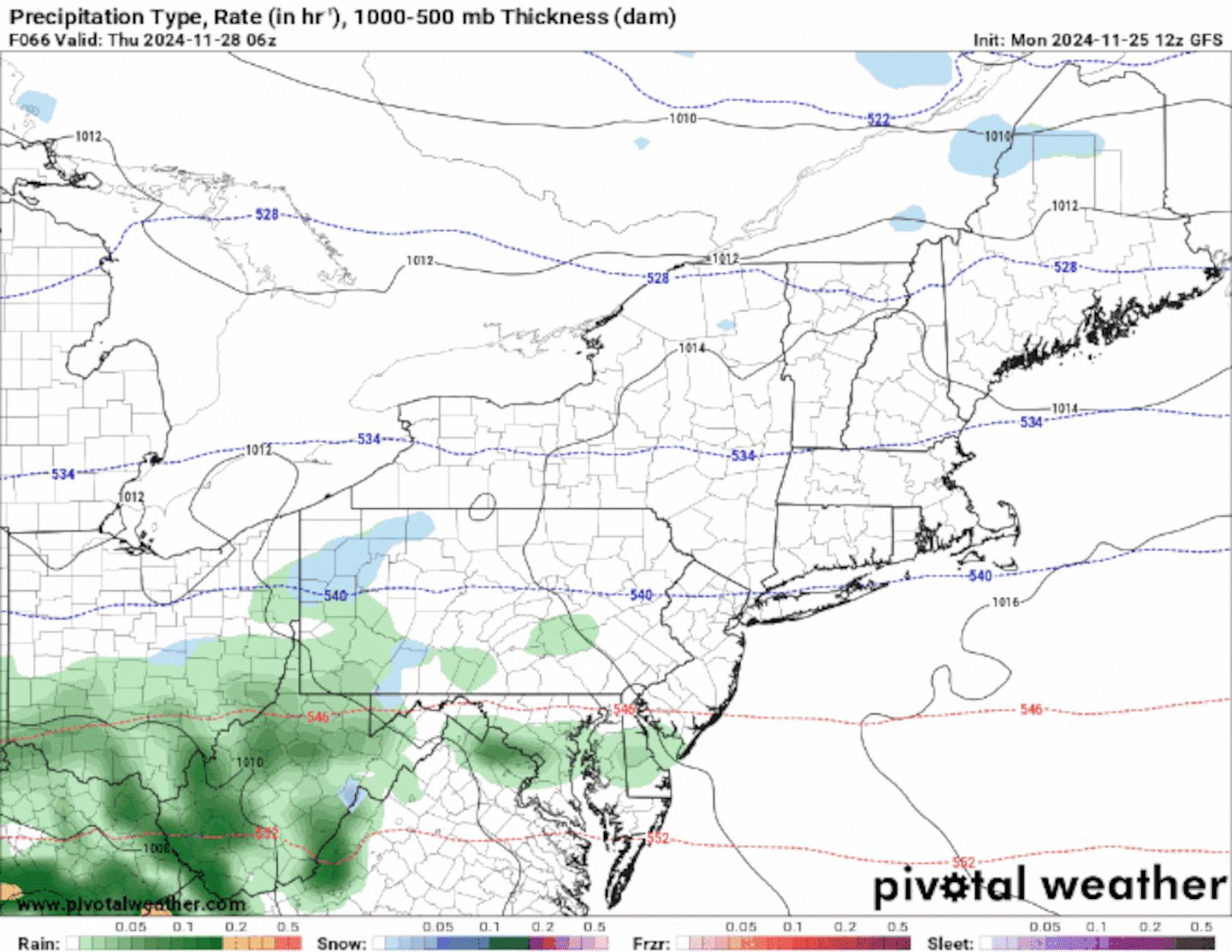
This storm may actually avoid turning into a large-scale snowstorm regardless of the exact track. That’s because a southerly to easterly air flow influenced by the storm and a separate offshore high should bring enough warm air into the region to keep most of Southern New England and coastal Maine seeing only rain. And with the general setup, there might not be enough cold air present in the atmosphere needed for blanketing snow.
Timing and rain/snow line
Scattered showers will start falling by mid- to late morning on Thanksgiving across Western New England on Thursday and ramp up and spread through the region as the day progresses. Wet weather will continue through the evening until tapering off Friday morning.
Southern New England forecast
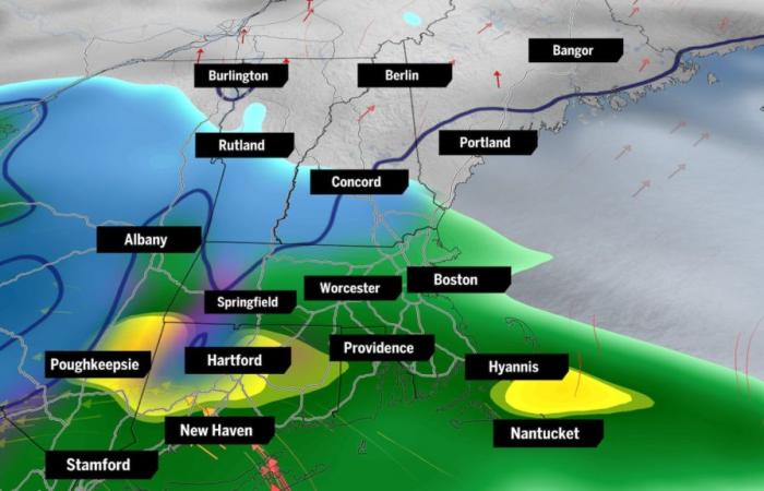
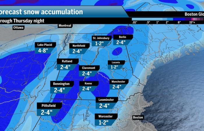
This will most likely be a near exclusive rain event for most of Southern New England. There may be a few periods of snowflakes across the Berkshires and possibly in the Worcester Hills, but that’s really about it in terms of snow potential across Mass., Rhode Island, and Connecticut.
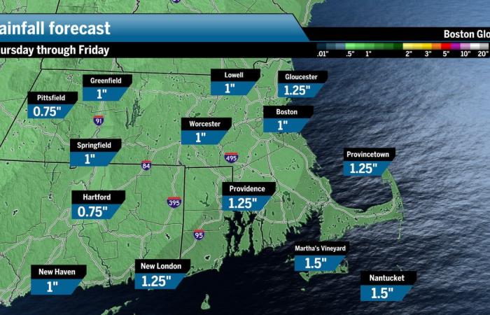
We’ll see what track this storm takes, which will obviously dictate where the rain-snow line sets up, but the latest trend has that line closer to the Massachusetts-Vermont/New Hampshire border. I’m expecting a likely scenario between 1 and 1½ inches of rain across Southern New England with possibly the higher elevations in Central and Western Mass. seeing 1 to 3 inches of snow, should timing and temperature line up.
Windy conditions will spread across most of Southern New England with wind gusts ranging from 30 to 40 miles per hour for some on Thanksgiving. With warm air blowing in off the ocean, this is another factor that will limit snow potential.
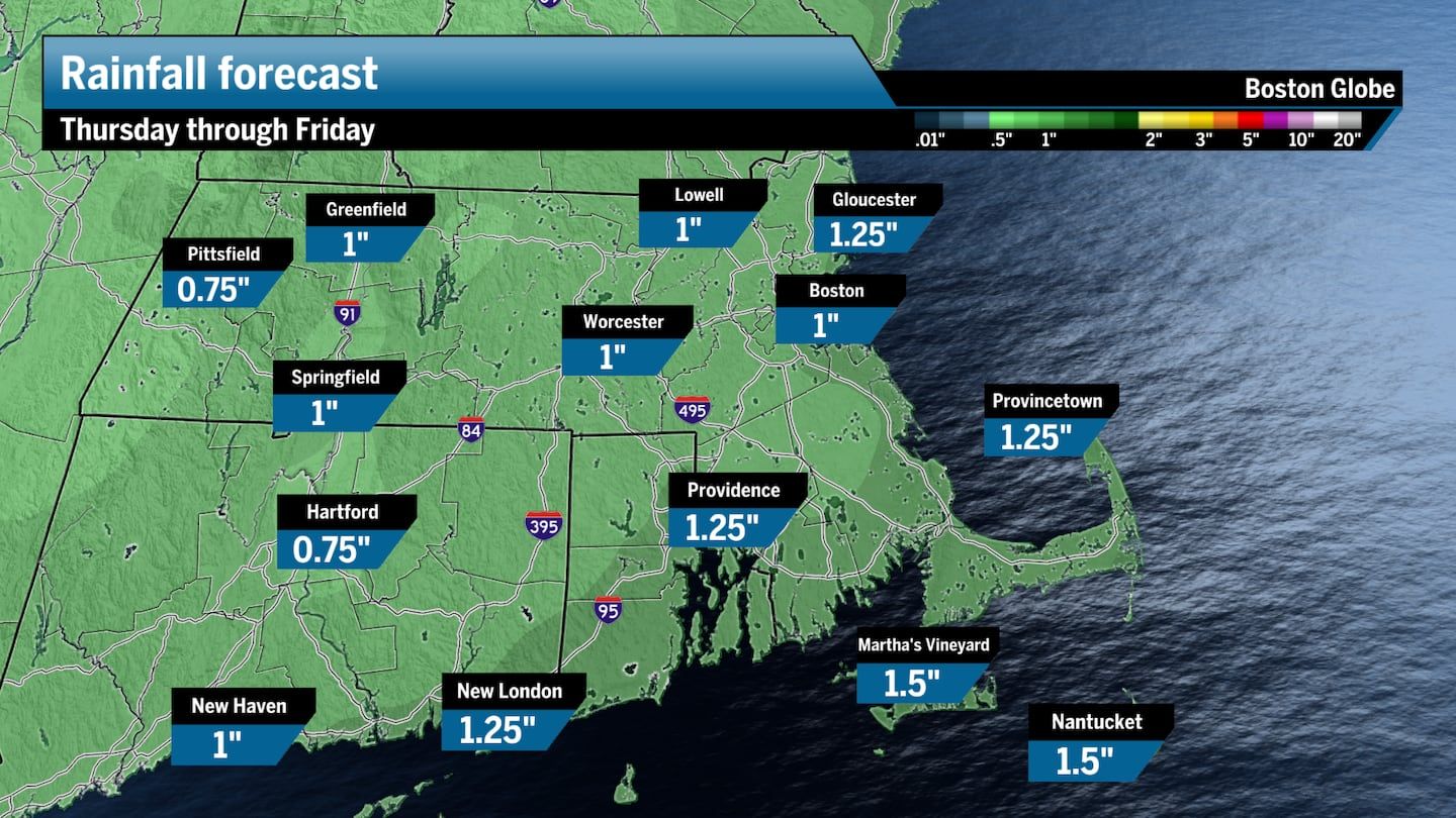
Northern New England forecast
Northern New England, especially across ski areas in Vermont, New Hampshire and Maine, will see a decent shot of snow on Thursday. About 2 to 4 inches of snow are forecast for central and northern parts of Vermont, New Hampshire, and Maine. Higher elevations might push closer to double-digits. Although depending on the possible scenarios, the amount of snow could change.
Southern and coastal sections of Northern New England should stick to rain with a few glimpses of a wintry mix overnight as temps dip.
Regardless of how this storm sets up when it pushes into New England Thursday, you’ll want to make sure you’re taking extra time on the roads and not rushing to your destination.
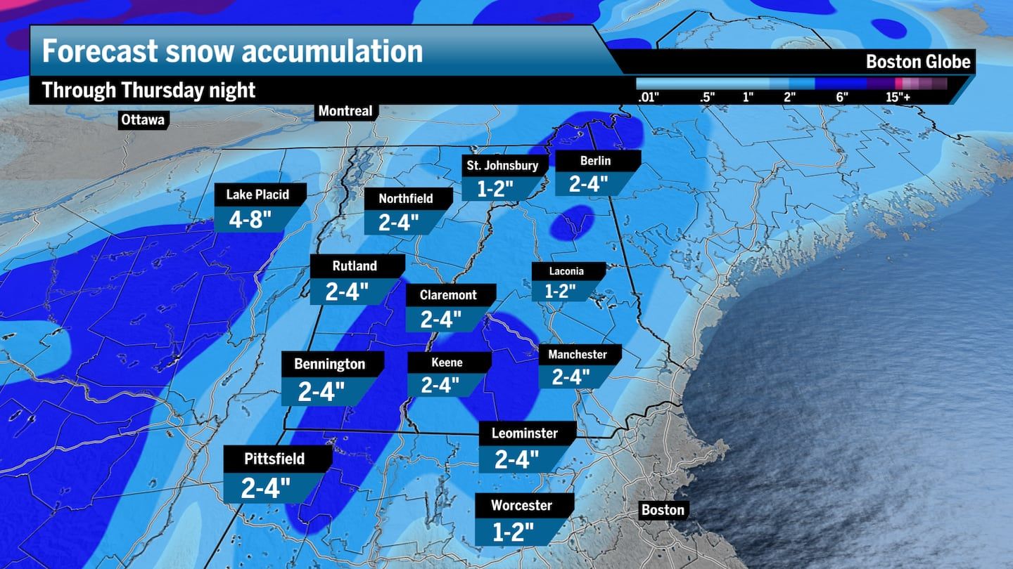
Surge of Arctic air into the weekend
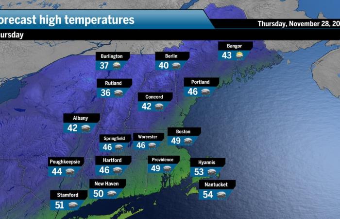
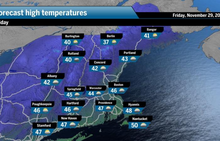
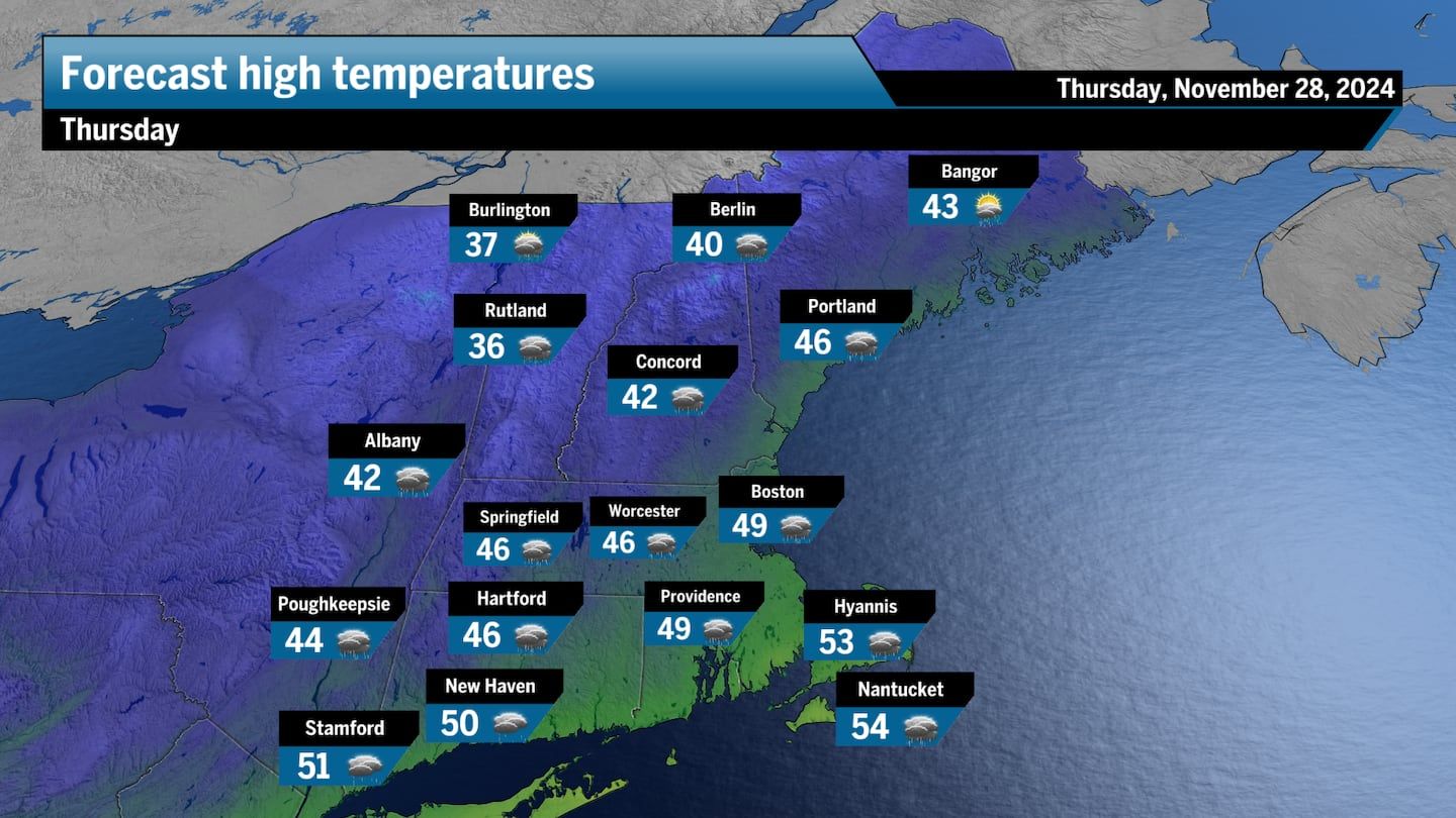
Temperatures will certainly plummet, getting colder and colder from Thursday and into the weekend. Colder air will filter in behind the system as it progresses through New England on Thursday. Highs are likely to only reach the mid- to upper 40s across Southern New England.
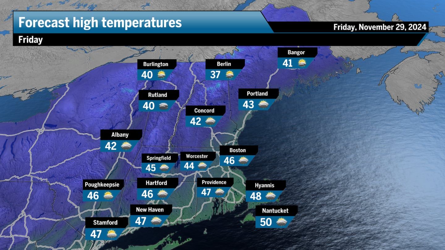
Black Friday will likely seeing temperatures barely reaching the mid-40s in some locations. The morning will be much colder as shoppers head out before sunrise to grab some early holiday bargains.
Behind the passing system Thursday, a deep pocket of high pressure will push southward from Canada and deliver a shot of Arctic air across New England, sending high temperatures into the 30s by Sunday.
These upcoming storms, combined with the 1 to 3 inches of precipitation from late last week, are expected to help ease the severe drought conditions after an exceptionally dry fall — on Nov. 17, Boston broke a 110-year record for its driest fall. Months of high pressure dominated the region, leading to extremely dry conditions throughout New England and an unprecedented number of wildfires in Massachusetts.
Want more forecast details? Sign up here for our daily Globe Weather Forecast that will arrive straight into your inbox bright and early each weekday morning.
Ken Mahan can be reached at [email protected]. Follow him on Instagram @kenmahantheweatherman.

