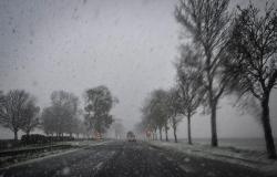
Snow should fall “in the Paris region, at least until 8 p.m.”, warns meteorologist Patrick Marlière who urges Ile-de-France residents to be careful, particularly on secondary roads.
Published on 21/11/2024 07:10
Reading time: 2min

“The snowfall will arrive a little faster than expected in the Paris region. They were expected at midday, they should arrive between 9 a.m. and 10 a.m. this morning”announced Thursday November 21 on franceinfo Patrick Marlière, meteorologist, forecaster and director of Medias-Weather. 54 departments are placed on orange vigilance. 33 for “snow-ice” and 21 for “wind”.
In Île-de-France, snowfall will fall “at least until 7-8 p.m.”. “It’s a bit worrying, you have to be extremely careful”particularly on “secondary axes”underlines the forecaster. We expect 5 cm of snow in Île-de-France, particularly in the south of Île-de-France, Yvelines and Essonne.
At 6 a.m. Thursday morning, the first snowflakes fell on the tip of Brittany and will slide slowly towards the east. “In all these areas, we expect 5 cm of snow locally, 10 cm on the heights,” explains Patrick Marlière. In the Vosges, the Jura and the Alps, we expect more than 50 cm of snow. “The snowflakes should fall until 4-5 p.m.” in the north-west of the country, “in the Paris region, at least until 8 p.m.”, adds the forecaster. “In the northeast of the country, it will accumulate until tomorrow [vendredi] matin”he continues.
21 departments – from Brittany, to Pays de la Loire, via the Massif Central to the Alps – are placed on orange alert for strong winds. “We have already had peak winds of more than 110, even 130 km/h in Ouessant. On the Gironde, the Charentes, we will have gusts of wind at the seaside around 120 or 130 km/h for the peaks the most important, 100 km/h inland”, he predicts. At more than 1,000 meters, gusts can reach up to 150 km/h in the Alps.
The temperatures will play yo-yo, since a “extreme gentleness” is expected at the end of the week in the north of the country.
France


