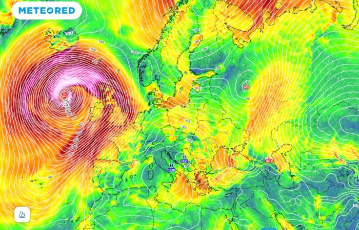
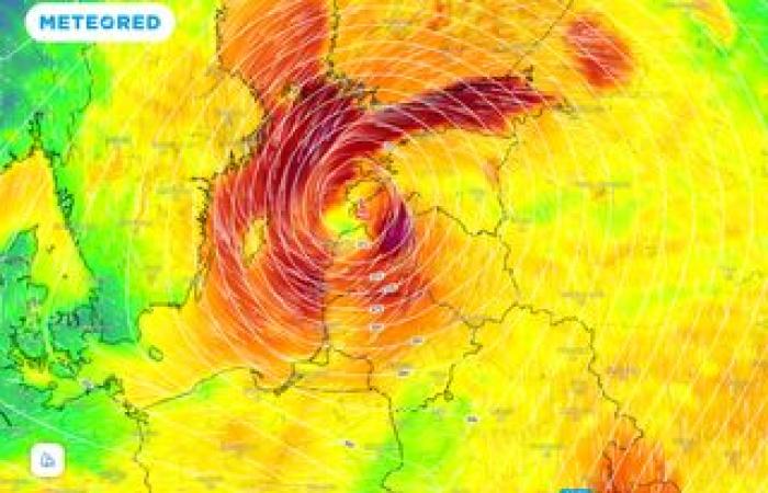
The maps show that between 3pm on Friday and Saturday there will be a pressure drop of 40 hPa or more; if this scenario were to materialize, it would be a very adverse and anomalous extratropical cyclone for the month of November.
The first real cold wave of the season is currently pouring over central-western Europe, bringing the first snowfalls of the season right up to the plateau. All thanks to the descent of an Arctic trough, linked directly to the polar vortex.
In practice, the erection of a subtropical anticyclonic promontory up to Greenland caused the descent of very cold air from the Norwegian Arctic towards the British Isles, through a trough filled with very cold air at high altitude.
Strong south-westerly wind over Tuscany and the Apennines
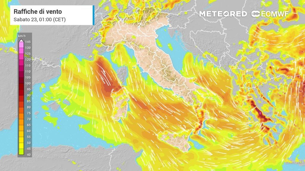
In these hours the effects of the bad weather are starting to be felt in some regions of the central-northern area, where it is currently underway an intense south-westerly wind that is lashing the Tuscan coasts and the Tuscan/Emilian Apennines.
The gale-force winds, active on the warm side of a fast frontal system that is crossing Italy, have caused considerable damage and inconvenience between Tuscany and the Apennine areas of Emilia.
In the Tuscan-Emilian Apennines, speeds reached 190km/h, peaks of over 120-130km/h in the Romagna Apennines where damage was reported due to collapsed trees and branches. After having crossed the Apennine ridge, the south-westerly wind poured, through strong gusts, onto the Marche coast, channeling itself along the valleys, where it acquired further speed (channelling or venturi effect).
On the Tuscan and eastern Ligurian coast the gusts they reached 60/80 km/h, making both the Ligurian Sea and the upper Tyrrhenian Sea very rough, with waves up to more than 5 meters high.
Possible snowfall tomorrow at very low altitudes
Tomorrow, part of the cold air that has slipped into the heart of central Europe will break through into Italy, affecting the northern regions, where we will have a worsening of weather conditions.
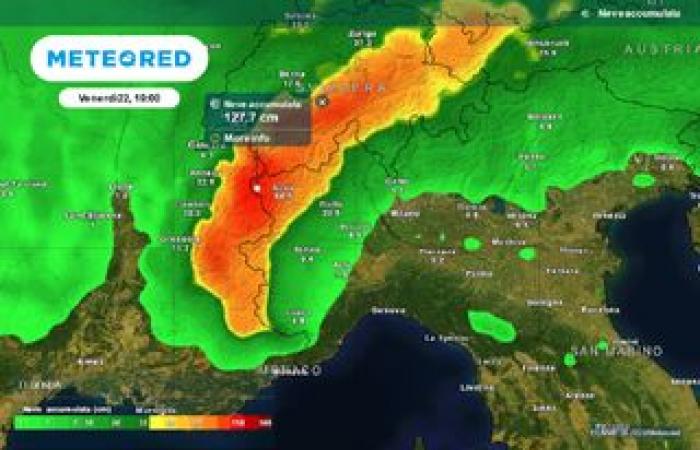
From the second part of the day rains and showers will hit the North-West, subsequently extending to the rest of the northern regions. Precisely in this phase, with the further drop in temperatures, the snowflakes will be able to reach the Alpine valley floors of Piedmont, Valle D’Aosta and Lombardy.
The possibility of seeing some snowflakes reaching the level cannot be ruled out, especially in the westernmost Piedmont towards the evening. But it is a probability, and not a very high one.
The disturbance will then extend to the regions of the middle/upper Tyrrhenian Sea, causing rain, showers and thunderstorms, locally also hail-generating. By the following evening these storms will push towards the lower Tyrrhenian Sea, risking also affecting Tyrrhenian Calabria and northern Sicily.
Possible snowfall in these areas on Friday
In the morning of Friday 22 November the disturbance will produce before moving away towards the south-east more precipitation between Veneto and Emilia/Romagna, which will become snowy up to hilly altitudes, with snow in various locations.

From the afternoon the situation will improve throughout the North, with large-scale improvements in all regions. Bad weather will persist in the central and southern regions, with rain, showers and local thunderstorms. Phenomena that may also be abundant between Campania and Tyrrhenian Calabria.
It will snow on the Apennines, but at higher altitudes, between 1200 meters in the central Apennines and 1400/1500 meters in the southern Apennines. Snowflakes also at higher altitudes between Aspromonte and the hills of northern Sicily.
All eyes on the weekend’s bomb cyclone
Meteored is keeping an eye on the deep extratropical depression that will form in the Atlantic later this week. This depression seems to follow the pattern on modello “Shapiro-Keyser”.
Many extratropical cyclones that follow the development of modello “Shapiro-Keyser” they show rapid deepening during their developmental phase and can therefore be characterized such as rapid cyclogenesis (as in this case). As in this case too.
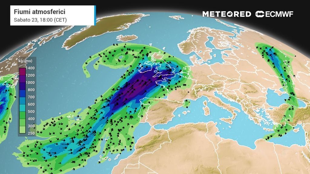
The radius of action of this great storm will be very large and its effects will be felt across much of the North Atlantic, but from the weekend also across much of Europe, and therefore also here in Italy.
Recall that cyclogenesis refers to the formation of a cyclone. It is considered explosive in our latitudes when the pressure at the center of the minimum drops by 24 hPa or more in less than 24 hours.
According to the latest forecasts of our reference model, this process will be particularly intense between Friday and Saturday, as we will see below.
An unusually deep cyclone
The maps show that between 3pm on Friday and Saturday there will be a pressure drop of 40 hPa or more; if this scenario were to materialize, it would be a very adverse and anomalous extratropical cyclone for the month of November, which will generate gigantic waves, torrential rain and hurricane-force winds in a wide radius of action.
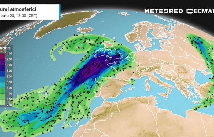
The deepening cyclone will help push an abnormally warm for the season air mass over much of western and southwestern Europe.
The situation could be potentially dangerous for the British Isles in the final stretch of the week, as the center of the storm could come very close to Ireland and Great Britain. Much of Europe will be affected, with the passage of very active fronts and strong west-southwest winds that will push mild and very humid air masses.
The 3 phenomena that this colossal storm will cause in Italy
Even though Italy will be far from the center of this great storm, very powerful and extremely deep for the time of year, we too will feel its effects.
The wind will turn from the southern quadrants, pushing warmer air, especially at altitude, which will cause a rapid increase in temperatures, more marked in Sardinia. On the southern regions peaks of +22°C +24°C could be reached at the weekend.
The rise in temperatures, which will be more marked in the centre-south, will also cause the rapid melting of the snow cover, which fell on the Apennines in the previous days.
At the same time, the warmer, but also more humid air rising from the South will favor the formation of low clouds, such as stratocumulus, which may produce some local drizzle or brief showers in the final part of the weekend.


