Weather switches to winter –
Snow is approaching – up to 30 centimeters is possible even in the lowlands
A small low pressure area will direct a surge of moist air into Switzerland from the west on Thursday. The result: snow down to low altitudes. But everything could turn out differently.
Published: November 20, 2024, 09:07
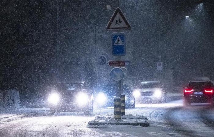
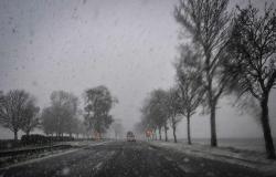
It will probably look like this on many streets on Thursday evening.
Photo: Keystone
Subscribe now and benefit from the read-aloud function.
BotTalk
- The weather forecast for Thursday in Switzerland is uncertain.
- A low pressure area brings moist air and possible snowfall to the lowlands.
- The snowfall limit could rise to 1,500 meters regionally, especially in French-speaking Switzerland.
- Traffic chaos possible due to 10 to 40 centimeters of fresh snow in cities.
Anyone who has looked at the weather forecast for Thursday in the last few days and hours will probably have had a few question marks. The scenarios spit out by the weather models changed at regular intervals – depending on the region and altitude.
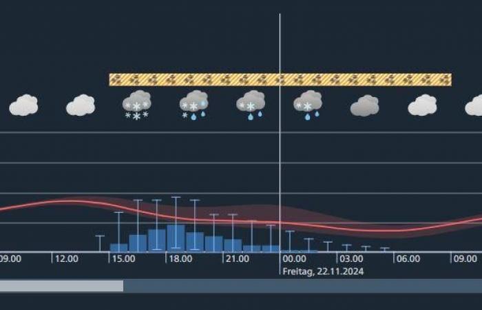
This is exemplified by the greater Zurich area. The range of forecasts here lies between icy temperatures and up to 40 centimeters of fresh snow on the one hand and wet and cold six degrees with constant rain on the other.

The weather forecast from Meteo Switzerland for Zurich for Thursday and Friday. The uncertainties are still great.
Source: Meteo Switzerland
How does this uncertainty come about in the weather forecast? And what actually happens on Thursday?
To shed light on this meteorological darkness, it is advisable to first look back at the events of the last 24 hours. During the course of Tuesday, a storm over northern Germany took control of the weather over Central Europe. Over the course of the day, this initially directed mild sea air towards the Alpine region with strong high-altitude winds. A cold front crossed Switzerland on Wednesday night. This brought widespread squalls, and colder air of polar origin flowed in from the northwest.
This also had an impact on the snow line. This was around 600 meters on Wednesday morning. The air will continue to cool through Thursday morning. In the open atmosphere (at around 1500 meters) there are frosty -7 degrees, in the lowlands the mercury only rises a little above zero degrees. The snowfall limit drops to low altitudes.
So everything is ready for a hearty load of fresh snow in the lowlands. All it needs is moisture. This will come in the course of Thursday in the form of a small but intense low pressure area. This moves – exemplary in the area of the border between the cold polar air over Central Europe and the milder subtropical air over the Mediterranean – from France towards Switzerland.
According to current model calculations, this low will move with its core over the Lake Geneva basin and then drain over the Western Alps to northern Italy. On its way, the low pushes a surge of moist air in front of it, which is milder at higher altitudes. A boundary is forming over Switzerland between mild, humid and cold, dry air masses.
In winter, such air mass limits mean one thing above all: lots of snow.
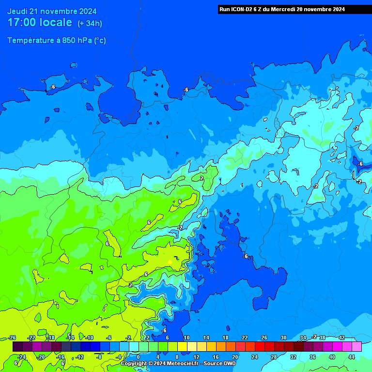
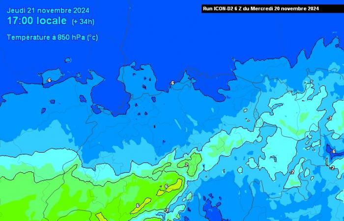
The map shows the temperature at around 1500 meters altitude early Thursday evening. According to this model (Icon-2), the mild air (yellow and green) would temporarily cause the snowfall limit to rise significantly, especially in French-speaking Switzerland.
Those: meteociel.fr
So much for the theory.
In reality, however, things are a little more complicated. Such small-scale low-pressure areas are often difficult to detect in advance by the weather services’ forecast models. Even the smallest changes in the train path have a significant impact on the weather forecasts. But these small changes can decide whether a winter fairy tale takes place in a certain place – or whether everything sinks into the mud.
This is also the case on Thursday. If the low pressure area maintains its current path favored by most models, the snowfall line in French-speaking Switzerland will rise to over 1500 meters on Thursday, so it will almost certainly rain there.
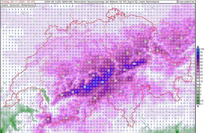
However, the mitigation cannot prevail further east. This means that the moisture introduced would almost always fall there in solid form as snow. Even in the lowlands and in cities like Basel and Zurich, 10 to 30 centimeters of fresh snow would be expected by Friday morning, which experience has shown would lead to traffic chaos. Meteo Switzerland has one for this appropriate storm warning published.
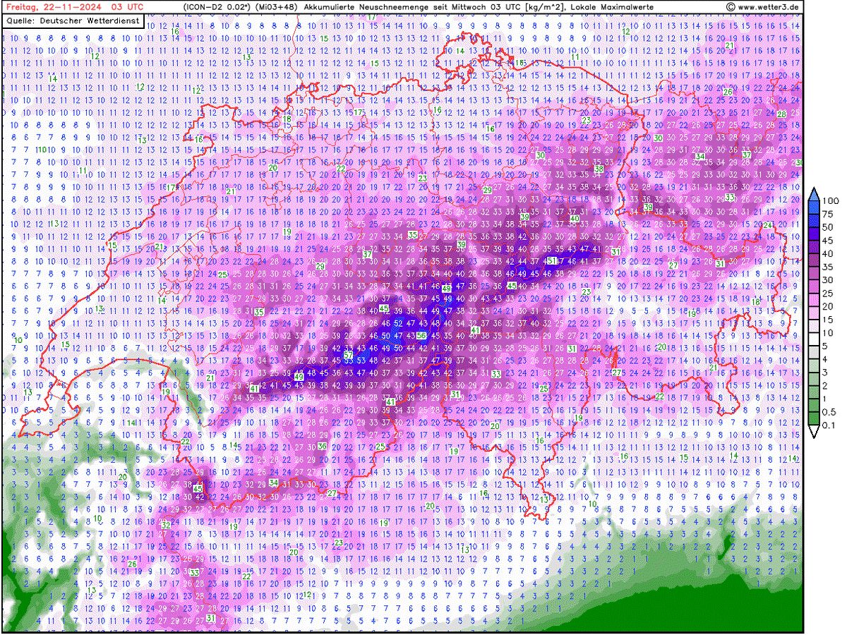
Snow for everyone? Accumulated amount of snow until early Friday morning according to the Icon-2 model.
Those: wetter3.de
But if the low moves just a little further north, things look completely different: then the mild air would move further east, and instead of snow there would be rain or sleet. However, if the depression moves slightly south (which is also conceivable), it will remain cold in the east – but then the moisture necessary for snow will be missing.
Which scenario will prevail in the end is currently still uncertain – around 24 hours before the event. As it stands at the moment, the chances of snow in the western midlands are rather poor. In northwestern Switzerland, in the central plateau and in northeastern Switzerland (especially near the foothills of the Alps), a good amount of snow is expected to fall on Thursday.
Either way: If you haven’t installed your winter tires yet and haven’t covered your sensitive garden plants yet, you’re well advised to hurry up.
Celsius
Get the most important background information and analyzes about climate and weather.
More newsletters
Log in
Found an error? Report now.
32 comments

