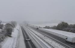
Forty-nine departments were placed by Météo-France on Orange alert from Thursday morning, thirty-two for snow and ice on an axis going from North Brittany to the Grand-Est, and seventeen for strong winds further south. south.
“On Thursday, the Caetano depression will cross France from west to east, and will generate snowfall to the north of its trajectory on an axis going from North Brittany/Normandy to the Grand-Est, and strong winds in its southern part, notably from the Atlantic coasts to the Alps”, specifies Météo-France in its bulletin.
Snowfall is expected “between the end of the night from Wednesday to Thursday and the evening of Thursday” and could make traffic conditions “difficult”, according to Météo-France, which has led several departments to take measures to limit road traffic.
The depression “will give snow, 1 to 3 cm possible in Paris and the inner suburbs, up to 7 cm in Essonne and more in the regions further east and at altitude (up to 20 cm on the Belfort)”, warns the forecaster.
Snow will also affect northern and central Brittany and Normandy.
In Ile-de-France, the speed limit will be lowered by 20 km/h and trucks weighing more than 7.5 tonnes will not be able to “perform an overtaking maneuver” on certain roads from 11:00 a.m., the company said. police headquarters. The same in Loiret, the prefecture said.
The ADP group, manager of Paris airports, announced on Wednesday evening that “all of (its) resources are ready to be mobilized if necessary” to clear snow from the runways.
– Risk of avalanches –
The Normandy region has “decided to suspend school and commercial transport lines” in the departments of Orne, Manche, Calvados and Eure.
In Eure-et-Loir, where expected snow depths could reach up to 10 cm in the hilliest areas of Perche, school transport will also be suspended on Thursday. It will be the same in the agglomeration of Saint-Lô in La Manche.
The A84 will be prohibited for vehicles over 7.5 tonnes in Calvados, as well as between Fougères and Caen in Manche.
In Loire-Atlantique, the Saint-Nazaire bridge will be closed to traffic in the event of wind gusts of more than 120 km/h.
Strong winds could also cause avalanches in the Alps. “Extreme vigilance is required for the practice of all mountain activities and mainly ski or snowshoe hikes” and Haute-Savoie “has an avalanche risk of 4 out of 5 on the Mont-Blanc massif”, a indicated the prefecture.
The departments concerned by snow and ice vigilance are: Aube, Alpes-de-Haute-Provence, Hautes-Alpes, Calvados, Cher, Côte-d'Or, Côtes-d'Armor, Doubs, Eure, Eure-et-Loir , Ille-et-Vilaine, Loir-et-Cher, Loiret, Manche, Haute-Marne, Mayenne, Nièvre, Orne, Haut-Rhin, Haute-Saône, Sarthe, Paris, Seine-et-Marne, Yvelines, Vosges, Yonne , Territory of Belfort, Essonne, Hauts-de-Seine, Seine-Saint-Denis, Val de-Marne, Val-d'Oise.
Orange wind vigilance particularly affects Loire-Atlantique, Vendée, the departments of Poitou-Charentes, northern Limousin and northern Auvergne.
The passage of this depression occurs as part of an “early winter episode” with the arrival on Wednesday of a “polar air mass” causing temperatures to drop. The latter should “ceil between 5 and 10°C at the best of the day, i.e. values comparable to the January averages”, indicates Météo-France on its website.
The cold should persist on Friday before a “powerful mild spell” expected during the day on Saturday.
In the southern part of the depression, more precisely on the Atlantic coasts from Aquitaine to Pays de la Loire up to the Massif Central, strong wind gusts capable of exceeding 100 km/h are possible.


