Today’s Forecast:
A storm system over southeastern New Mexico will bring rain to the southeastern Plains this morning, with little to no impact for areas up and down the I-25 corridor. In Colorado Springs, we’re waking up to mostly cloudy skies this morning. As low pressure moves away from the state this afternoon, sunshine will prevail, with highs this afternoon around 10 degrees warmer than Sunday.
Colorado Springs forecast: High: 55; Low: 24. A return to sunshine this afternoon and warmer highs, with our afternoon temperatures climbing into the middle 50s.
Pueblo forecast: High: 58; Low: 25. A dry, mild and breezy start to the week, with westerly wind gusts this afternoon up around 20 mph.
Canon City forecast: High: 57; Low: 29. After a chilly Sunday, our highs this afternoon will be around 10 degrees warmer, with mostly sunny skies on tap for our Monday
Woodland Park forecast: High: 48; Low: 15. NW winds will be on the breezy side today in Teller County today, with gusts around 20-30 mph. Skies will stay dry throughout the day.
Tri-Lakes forecast: High: 40s/50s; Low: 10s/20s. Warmer than Sunday, with Monday’s high temperatures the upper 40s and lower 50s.
Plains forecast: High: 40s/50s; Low: 10s/20s. Rain showers, mixed with snow at times, will continue to impact the far eastern Plains this morning. Skies will clear out by the afternoon, allowing for highs to top out in the 40s and 50s.
Walsenburg and Trinidad forecast: High: 40s/50s; Low: 20s. Dry skies Monday, but breezy, with sustained westerly winds today around 10-20 mph, and gusts to 30 mph.
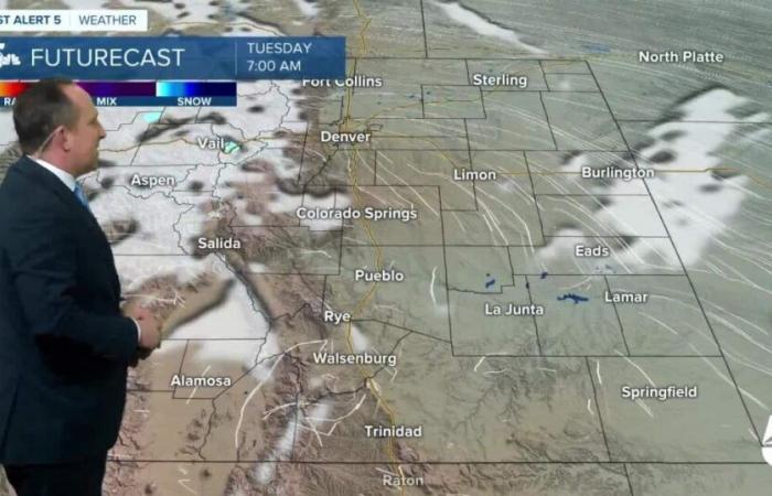
Mountains forecast: High: 30s/40s; Low: 10s/20s. A chilly and gusty day for the mountains, with afternoon wind gusts up around 30-40 mph. By this evening, we’ll start to see the potential for a few snow showers, with snow in the mountains again on Tuesday. Most of the snow that falls will be in the central and northern mountains.
Extended outlook forecast:
A colder storm will move into the state on Tuesday, dropping our high in Colorado Springs down to the 30s. While snow is looking less and less likely on Tuesday outside of the mountains, we can’t rule out a few flurries in the Pikes Peak Region. It will also be windy, with gusts up around 30 mph.
Wednesday morning will start out with frigid temperatures in the teens, with our high in Colorado Springs on Wednesday only warming into the 40s. High pressure will return late this week, with highs in the 50s on Thursday, and the 60s from Friday to Saturday.
____
Curious about the First Alert 5 Weather Storm Impact Scale? Check out our cheatsheet explainer.
Watch KOAA News5 on your time, anytime with our free streaming app available for your Roku, FireTV, AppleTV and Android TV. Just search KOAA News5, download and start watching.


