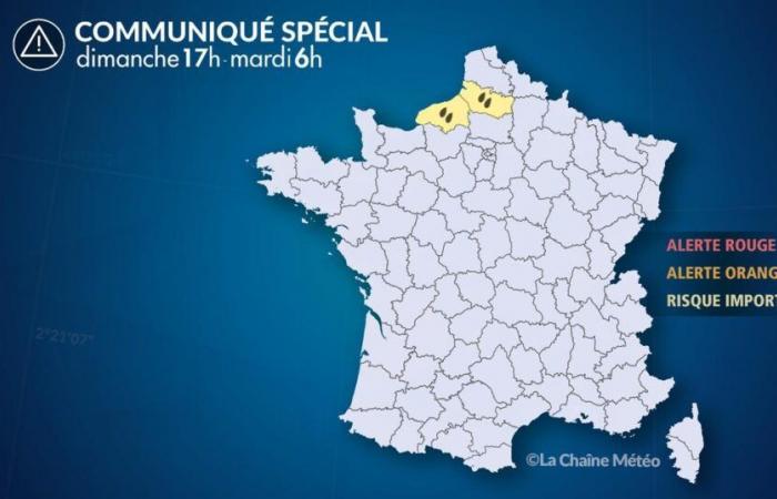
Of
Sunday November 17 at 5:00 p.m. au
Tuesday, November 19 at 6:00 a.m.
Situation
This Monday, a disturbance descends from the British Isles. Slowed down in its progression by the anticyclone which resists over France, the Channel coasts are affected by sustained rains.
Under the undulation of the disturbance, part of Normandy and Hauts-de-France are experiencing continuous rain of moderate intensity for 24 hours.
Even if the weather has been dry in these regions for 3 weeks, the arrival of these heavy rains should be monitored. Accumulations could locally reach 50 to 80 mm in the space of 24 hours, corresponding to 3 weeks of rain in the month of November.
These heavy rains are likely to cause some hydrological reactions and a very localized risk of flooding, particularly in the region from Caux in Seine-Maritime to the Somme estuary, the sectors most affected by this heavy rain.
Subsequently, with the onset of a very turbulent, increasingly wintery period, other alerts will be issued by our services for gales and risks of snow reaching the plains between Tuesday and next Friday.
Observation
Rain invades the Channel coasts during the night from Sunday to Monday.
Evolution
Monday, it rains all day in the departments placed on alert by our services, Seine-Maritime and the Somme.
During the night from Monday to Tuesdaythe rains continue in these regions where the wind strengthens with a gale, which is why our alert will be maintained.
Afterwards, With the onset of a very turbulent, increasingly wintery period, other alerts will be issued by our services for other gales and risks of snow reaching the plains between Tuesday and next Friday.
France


