The weather conditions will therefore change over the next few days in France. A risk of snow is confirmed slowly but surely, sometimes as far as the plains.
From this Sunday, the start of the weather change begins. This will bring a risk of gale force winds and a lot of rain… before a risk of snow all the way to the plains. Discover the latest projections through these new lines that we offer you.
Rain and wind at first
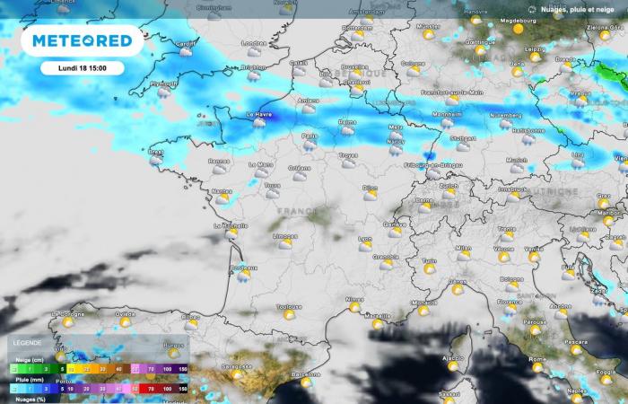
After the weak disturbance this Sunday, bringing a little rain to the north-eastern quarter, a more active disturbance will arrive tomorrow Monday. This will bring regular rains between the Channel and Alsace-Lorraine. Autumn will indeed be here with the added bonus of moderate winds.
In the southern half of France, there will still be many cloudy periods as well as sunny spells. We will have to take advantage of this before the arrival of more disruptive weather as the days of the week progress.
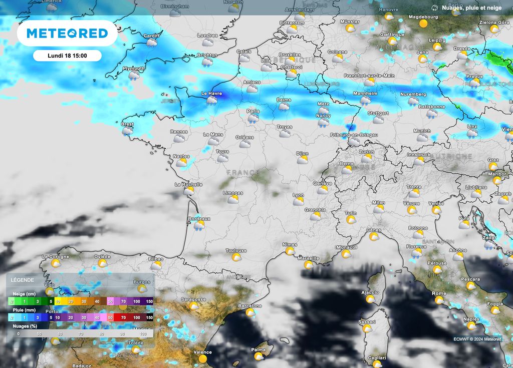
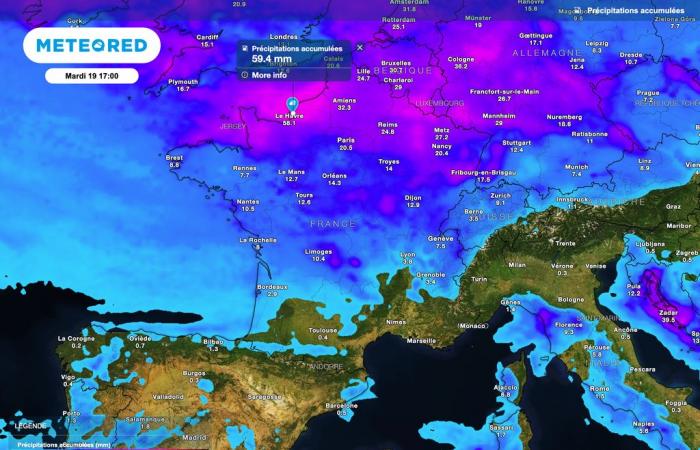
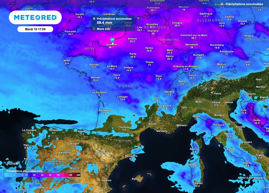
On Tuesday, rain will continue to fall over a good part of France, especially north of the Loire. So, according to atmospheric projections, we should be between 20 and 40mm by the end of Tuesday afternoon of precipitation.
Locally, total accumulations close to 50 to 60mm are possible, for example near Normandy and towards the Ardennes. Overall, these bad weather risks causing a rise in rivers with local flooding.
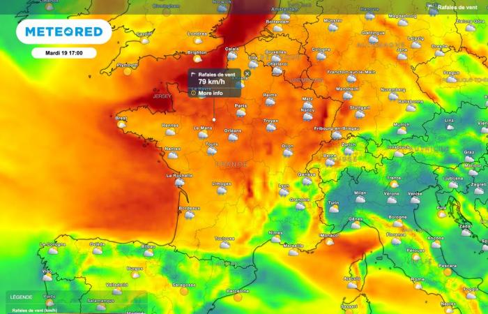
The rain will not be the only thing present. Indeed, the approach of a depression will bring increasingly strong winds over a large northern half. Besides, we will monitor local gusts in the north of Hauts-de-France : the storm threshold could be reached with gusts reaching or even exceeding 100 km/h.
From Normandy to the Grand-Est via the Paris region, the wind gusts should be strongest between Tuesday afternoon and night from Tuesday to Wednesday : the announced values are of the order of 70 to 85km/h, locally 90km/h.
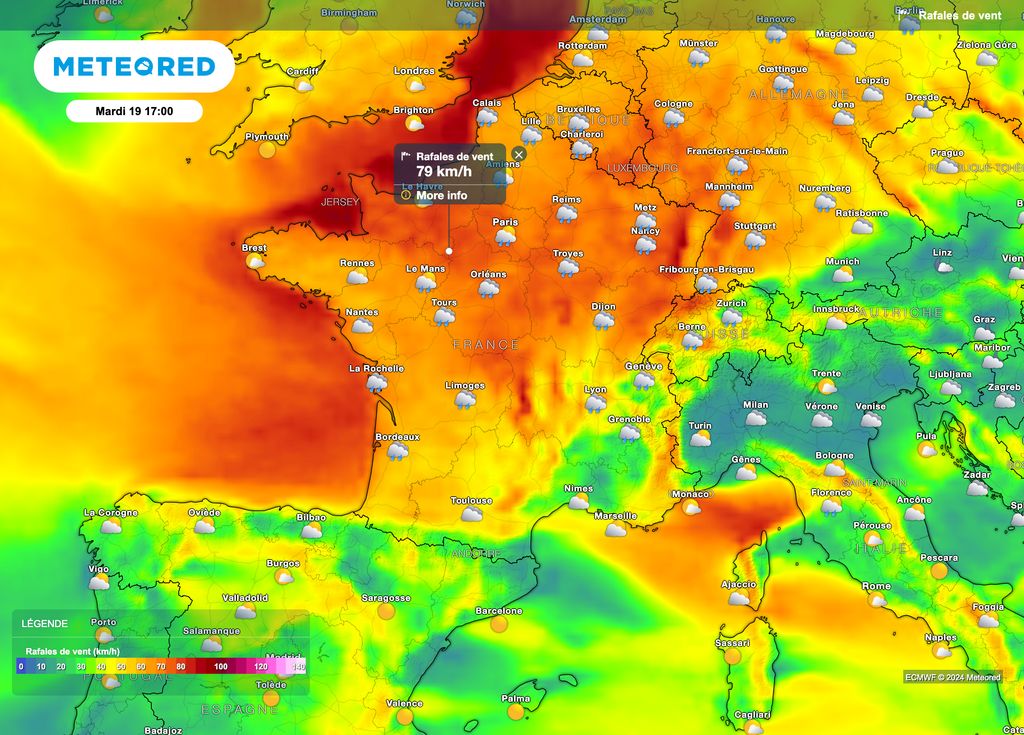
This gale will therefore sometimes be strong inland. So be careful although the situation is not exceptional: falling objects or branches may occur.
Thereafter, the winds should be much less intense while remaining moderate. To watch, sustained to violent gusts in the second part of the week towards the southwest coasts and around the Mediterranean.
Snow from Tuesday evening
A new depression will appear further south for the day on Thursday. This will encounter cold air present in a good part of France. A fairly strong conflict of air masses will in fact be present.
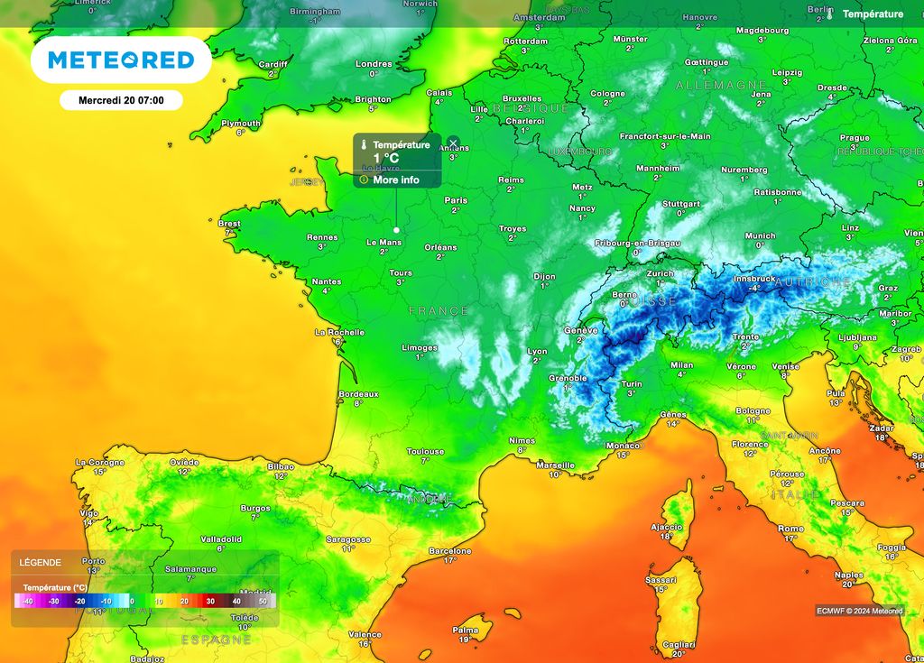
The temperatures being sufficiently low, a risk of snowfall all the way to the plains is slowly but surely becoming clearer in France. To date, this risk persists especially between Brittany, northern New Aquitaine and the Jura.
This conflict zone may still see its forecasts evolve in the coming days. That being said, snowy weather could also occur in the northern half: we will rather speak of snow showers, at least at this stage of the weather forecast.
In any case, It appears that the mountain ranges will experience a “nice snowy episode”the first of the 2024-2025 winter season. THE accumulations of snow on the ground will be specified both for the plains and in the mountains.
Risk of slippery roads
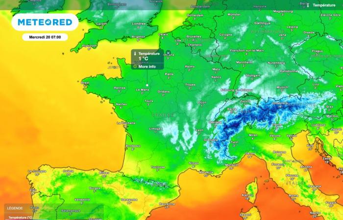
These much more wintry weather conditions will persist until Saturday morning. Isolated showers may still appear in the form of snow. However, we will especially monitor the risk of road refreezing. And for good reason, the minimums could be slightly below 0°C, including in the French plains.
So be careful in the face of these winter bad weather, the first of this season! Note, however, that this weather forecast does not necessarily indicate a much colder and snowier winter.

