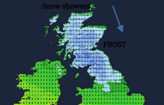
Change is on the way this weekend as cold, Arctic air sets in from the north. Does this mean snow? Probably not for most of the UK on Saturday or Sunday away from wintry showers over northern Scotland. However, the cold air will deepen and stick around throughout next week.
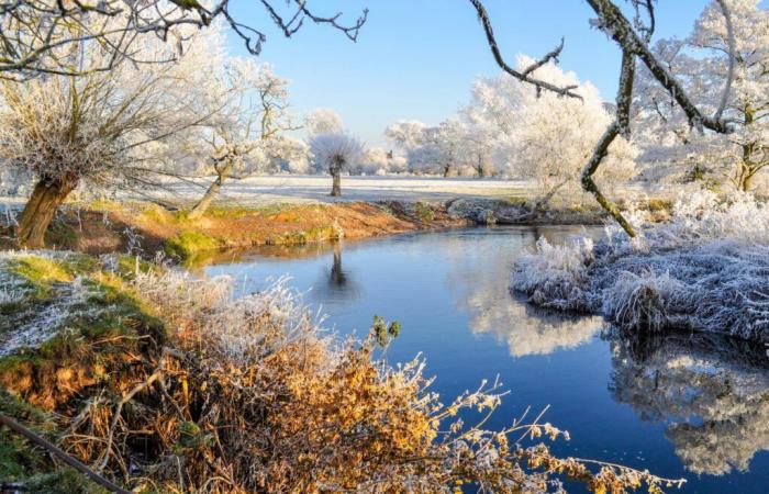
During this week high pressure has brought settled, quiet conditions with brilliant blue skies and sunshine or pockets of low cloud and fog. Winds have been light and the autumn leaves have looked stunning in the brightness. Early mornings have been nippy with northern areas falling to freezing briefly overnight, helping mist and fog to form.
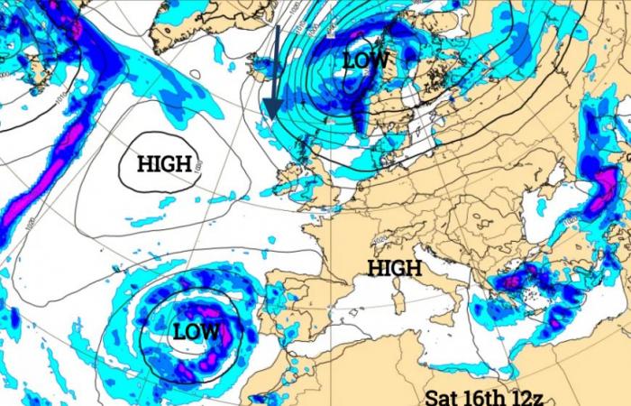
The high pressure retreats over the Atlantic and extends over southern Europe (good news for eastern Spain) as a deepening area of low pressure moves from Greenland towards the Norwegian Sea. This low will influence our UK weekend weather.
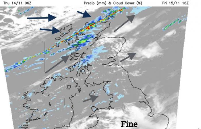
Friday will start quiet for most but breezier in the north, closer to the low. The westerly flow will bring in cloud and damp weather to the Solway Firth and Cumbria in the morning. Northeast Scotland will be sunny whereas west coast Scotland and Northern Ireland will be grey and damp. Southern Britain will have a fine, sunny day although with early fog in places. Temperatures should be between 10 and 13C but the sunshine will make a difference, as will the freshening SW cool breeze in the far north.
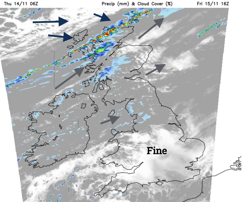
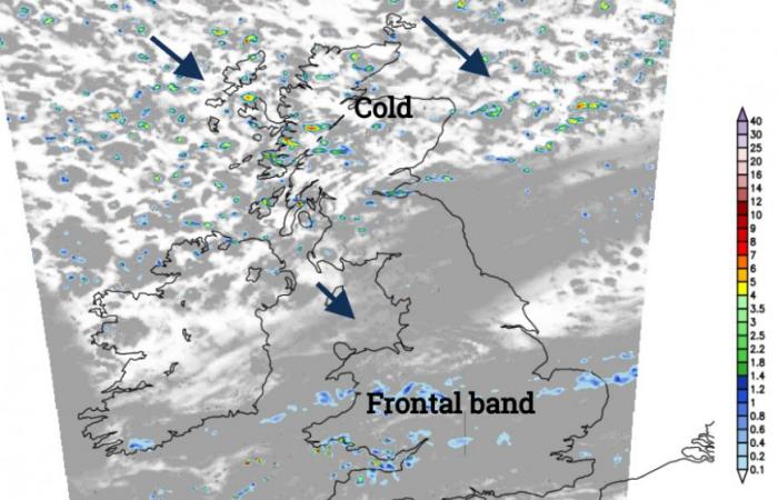
Later on Friday, a cold front will work its way down from the north with a narrow band of lively rain and gusty winds. Behind this will be Arctic air and it will feel much colder in the wind. This is the change for the weekend, this front will be halfway down Britain by noon on Saturday and reach the English Channel by midnight on Saturday night.
Saturday
Around the frontal band, there will be more cloud and it will be mild. In the far southeast of England across to Dorset, it will be a nippy start where skies remain clear. The frontal band of patchy rain is forecast to move over Wales, Merseyside, the north Midlands and Lincolnshire in the morning. This sinks over southern Wales and more of the Midlands, into Norfolk, brightening up behind. For Scotland, it will feel cold in the Arctic air and brisk NW winds. Temperatures this weekend will be in single figures, perhaps 8 or 9C for Glasgow and Edinburgh. These brisk winds will bring rain showers but also sleet and snow showers to Highland Scotland.
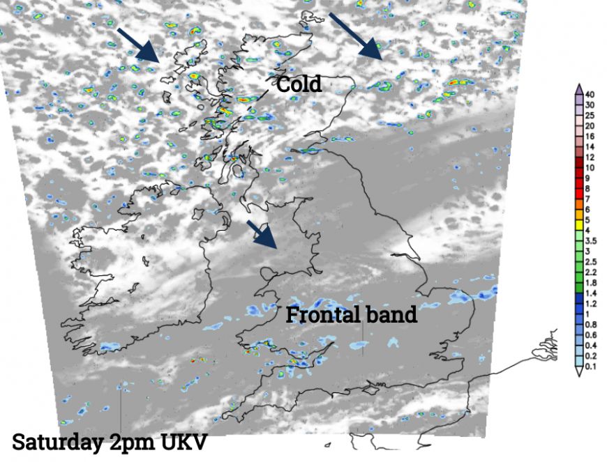
Overnight it will be clear and cold in the north, with more cloud further south.
Sunday
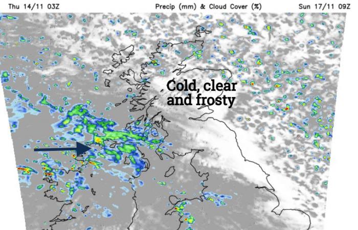
The Grampians will see snow showers overnight with rain or sleet showers for Orkney and Aberdeen. The northeastern half of Britain should see early sunshine but it will feel chilly with a frost inland and very light winds. Further south and west there will be more cloud and incoming patchy rain. This heralds an interesting and tricky part of the weekend forecast. A small low south of Iceland could nip across the Irish Sea on Sunday. To the south of this would be moderate to fresh westerly winds, quite a change after the recent calm conditions for southern Britain.
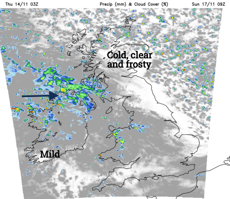
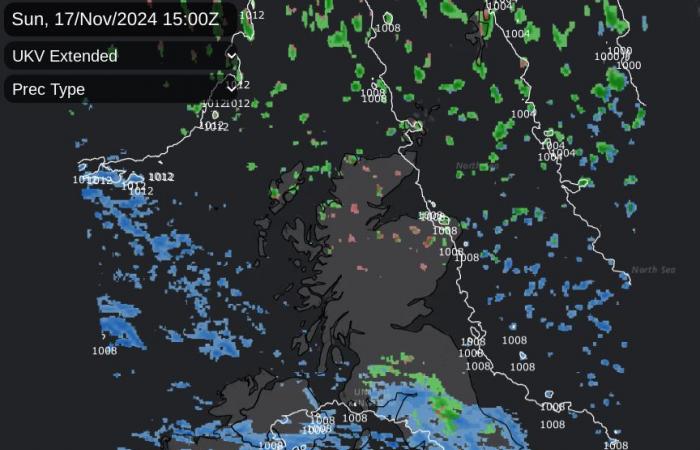
This low will interrupt the deepening cold but its exact track has low confidence. The UKV shows the northern precipitation edge over the northern Pennines, Cumbrian Fells and maybe the Southern Uplands. That could mean sleet and wet snow for these areas and a cold Sunday afternoon. If the low is further south, it would leave fine, cold bright conditions.
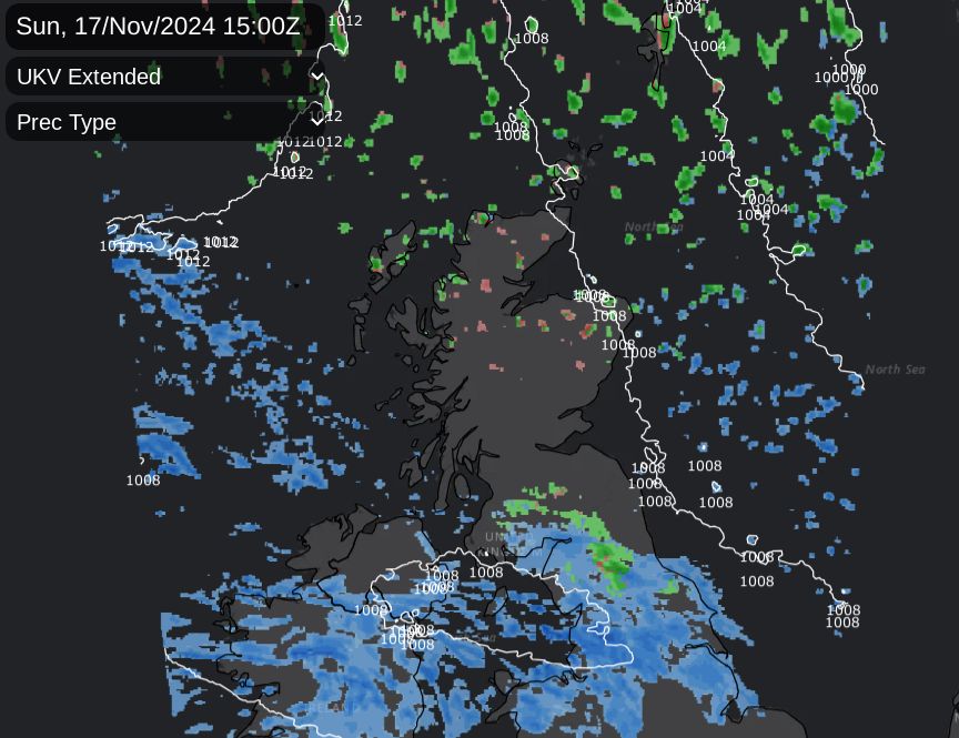
Wales will see a scattering of showers on Sunday before the low arrives but much of England should be dry and fair until later afternoon. The rain should reach Northern Ireland on Sunday morning then cross the Irish Sea. Conditions will deteriorate over a central swathe of Britain during Sunday afternoon but there is uncertainty around the location. That damp interruption speeds on southwestwards and the Arctic air encroaches further.
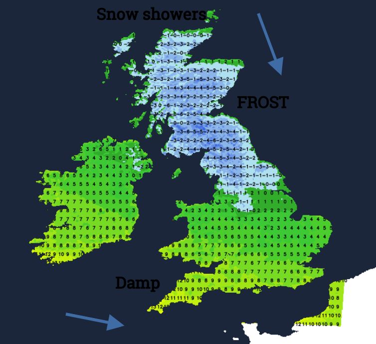
The winter roads lorries will have a busy night. Prepare yourself for Monday morning. Where skies are clear it will be cold with a widespread frost, and patchy fog and you may need extra time to defrost and demist the car. The fun and games for snow forecasting really gets going next week as the Arctic air becomes established along with snow showers for northern Scotland. Will there be any more passing low pressures to throw rain, sleet and snow over different parts of the UK?

