Google Maps has published updated imagery showing the location of unspecified Ukrainian military systems, with the technology giant “working to rectify the situation,” a Kyiv official has said, as forces try to fend off fierce Russian attacks and slow gains, heading into the winter season.
Russia is “actively dispersing” images highlighting Ukraine’s military equipment, Andriy Kovalenko, an official heading the disinformation branch of Ukraine’s National Security and Defense Council, said in a post to messaging app Telegram on Sunday.
Kovalenko did not say which equipment featured in the images, nor the approximate location of the systems. Representatives for Google reached out to the Ukrainian authorities and “said that they are already working to rectify the situation with the images of our military systems,” Kovalenko said in a later statement.
Newsweek has reached out to Google for comment via email.
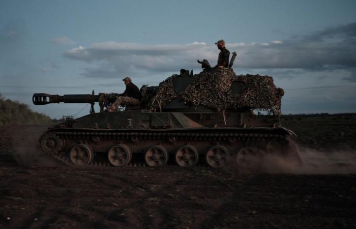
Soldiers prepare to fire from a self-propelled artillery installation at a Ukrainian position on July 31, 2024, in the Toretsk district of Ukraine. Russia is “actively dispersing” images highlighting Ukraine’s military equipment, says a Kyiv official.
More
Kostiantyn Liberov/Libkos/Getty Images
Andrii Ziuz, the former chief executive of Ukraine’s National Security and Defense Council and current head of technology at London-based company Prevail, suggested to Newsweek on Sunday that the impact of updated images would only have a limited impact on Ukraine’s armed forces.
These images would only show stationary objects, such as manufacturing plants and training camps, added Ivan Stupak, a former officer in Kyiv’s SBU security service.
“The front line is constantly changing, so Google Maps are not useful,” Stupak told Newsweek.
Satellite imagery has been routinely used throughout the more than two and a half years of full-scale war, both by the militaries clashing in the conflict and external analysts watching the conflict. It has been used to assess damage to targets after missile or drone strikes, but can typically be only of limited use for planning and launching strikes on targets that can be moved quickly.
On Saturday, Ukraine’s top soldier, Gen Oleksandr Syrskyi, said Ukraine was “holding back one of the most powerful Russian offensives” since February 2022.
Fierce clashes are expected to continue throughout the winter fast approaching in the war-torn country, as Russia forges on with slow but steady gains in Ukraine’s embattled east.
It has claimed a slew of villages in recent months, with battles blazing east of regional hub, Pokrovsk. The Kremlin has also pushed westward of Bakhmut, the devastated Donetsk city Russia captured in May 2023, and poured resources into seizing Toretsk, southwest of Bakhmut.
Russia’s Defense Ministry said on Sunday its forces had captured Vishnevoye, a village southeast of Pokrovsk and west of Selydove, which Moscow said it had seized last week.
The Kremlin said on Saturday it had taken control of Kurakhivka, a village close to Vishnevoye. Kurakhivka sits immediately west of Oleksandropil, which Russia claimed around a week ago.
Newsweek could not independently verify battlefield reports.


