Lingering showers and mountain snowfall will continue through this morning, before gradually tapering off. Gusty north to east winds develop on Sunday and Monday, and then again on Wednesday with the added potential for fire weather concerns.
Discussion
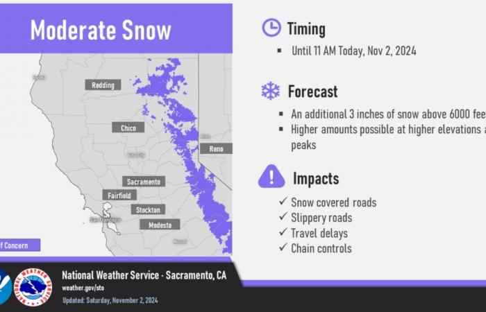
Scattered rain/mountain snow showers continue to trek across interior Northern California early this morning [as of 2 am]. Lingering snow and rain showers present over the foothills and mountains will gradually taper off as the morning continues. Probabilities from the National Blend of Models, advertise a 40-60% chance of an additional 0.5″ of rainfall over the Sierra mountains and foothills with a 50-70% chance of 2″ or more above 6000 feet through 11 AM over the Sierra. As a result, our Winter Weather Advisory remains in effect for locations above 6000 feet in the northern Sierra and southern Cascades through 11 AM today.

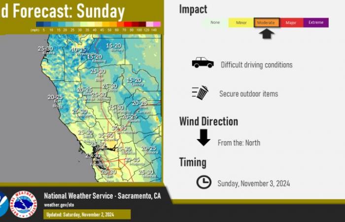
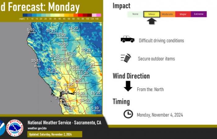
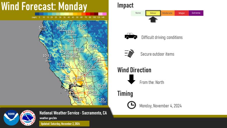
Dry weather and gusty winds develop Sunday morning, as high pressure ridging moves into place over Northern CA and this previous low pressure system moves into the Great Basin. A north- to-south pressure gradient is expected to develop resulting in gusty northerly flow through the I-5 corridor in the Sacramento Valley and Delta on Sunday and Monday. Peak winds are forecast to be 25-40 mph, with the strongest winds around the Delta. NBM probabilities have a 40-85% chance of gusts exceeding 40 MPH from Glenn County to the Delta on Sunday, with probabilities around 20-50% on Monday. The recent periods of rain, cooler temperatures, and good overnight recoveries will help negate any fire weather concerns as a result of the north winds.

Cooler daytime highs kick off the weekend before temperatures warm slightly by the start of the work week. Valley highs will be in the 60s today and tomorrow, before warming into the low to mid 70s on Monday. Highs in the foothills remain in the 50s and 60s over the next few days with mountain high temperatures in the 40s to low 60s.
Extended Discussion (Wednesday through Saturday)
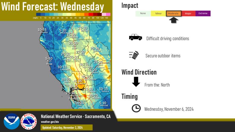

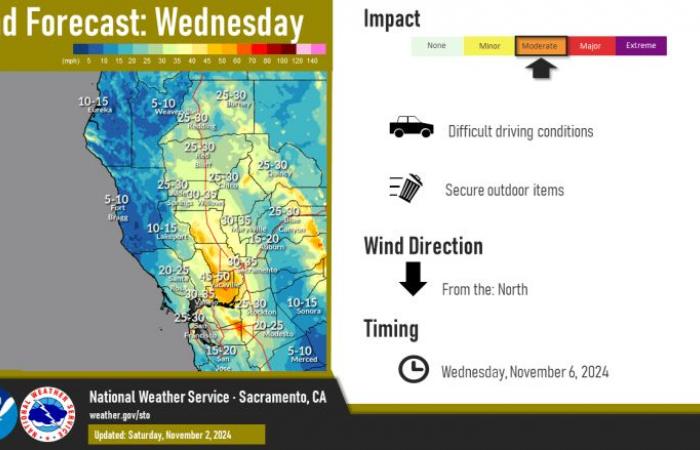
EPAC upper ridging off the West Coast midweek combined with digging upper low in the Great Basin will result in gusty and drying north to east wind Wednesday into early Thursday.
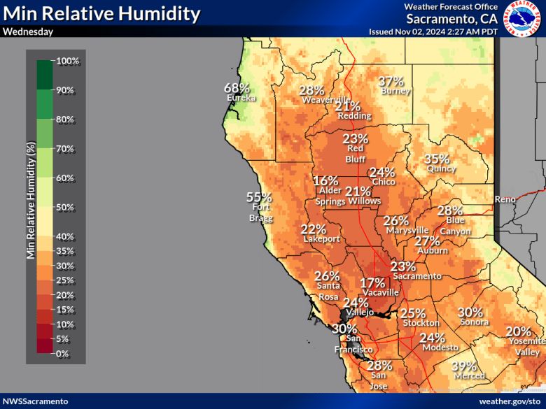

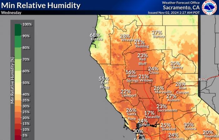
Combined with lower humidity, a period of elevated fire weather potential exists along the western half of the Sacramento Valley extending into the Coastal Range.
Wind decreases early Thursday as upper low begins to progress. By Saturday, upper ridge flattens as short wave troughing pushes into the PacNW. NBM advertising dry weather through the extended forecast period with high temperatures near to slightly below normal.

