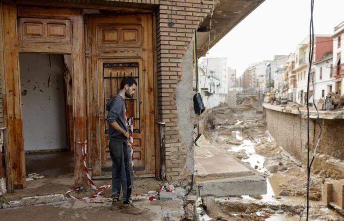
“Be very careful” about letting your guard down, because the episode of torrential rains and heavy flooding that has left more than 155 dead will continue throughout the weekend and “can still cause some scares,” he warned on Thursday afternoon in statements Rubén del Campo, spokesperson for the State Meteorological Agency (Aemet), told this newspaper. And so it has been and very early. At 6:55, Aemet has raised the warning level from orange – the second on a scale of three – to red – the maximum alert – in Huelva and, again and there are many in this situation, due to phenomena already observed but not foreseen. in advance. Huelva is one of the hot spots this Friday, along with the Balearic Islands. So far today, 117 liters per square meter have been collected in Cartaya (Huelva), 92 in Mazaricos (A Coruña) and 59 in Miramar (Valencia).
“Torrential rains are being recorded in towns like Cartaya, with 117 liters in less than three hours, 70 of them in just one hour. The warning remains active, for now, until 9:00. The dana is going to continue causing adverse weather today,” explained Aemet in a message on X. The intensity of the dana (isolated depression at high levels) has already forced Aemet to launch five reds in four days: on Tuesday in Valencia and Málaga, on Wednesday in Cádiz and on Thursday in Castellón.
This virulence, together with the persistence – the special warning was until Thursday and the situation will last at least until Sunday – is surprising meteorologists, who speak of an atypical dana or a new generation of danas, doped by climate change. Although to take stock we have to wait for it to conclude, numerous rainfall records are being produced: for example, Wednesday was the rainiest day in Jerez de la Frontera (Cádiz) since there are records: 115 liters, of which 81 fell in six hours.
As the Andalusian president, Juan Manuel Moreno, reminded the population in a message in take maximum precautions and under no circumstances go anywhere or take a car and, above all, do not ford water passages, even if they have little current. You should not go near the bed of any river and you must take into account if you are in a flood-prone area and you must get to safety. Even if it is not raining in the area, the flow can increase greatly and suddenly, flash floods or flash-floods like those that occurred on Black Tuesday.
This Friday, All Saints’ Day and the beginning of a festive long weekend in which the DGT asks not to travel to Valencia, the epicenter of the catastrophe, adversity is concentrated “in points of the Balearic Islands and Huelva and, facing the At the weekend, the Dana “may once again unleash storms on the Mediterranean and some of strong intensity,” summarizes the Aemet spokesperson. In addition to the red one in Huelva, five communities remain under notice from Aemet, Andalusia, the Balearic Islands, Catalonia, Extremadura and, once again, the Valencian Community. The warning is orange, the second level on a scale of three, in all communities, except Extremadura, where it is yellow, the minimum.
“It is a holiday and there are many trips throughout Spain and the Balearic Islands, where we expect rains and storms with accumulations of even 50 liters in one hour, which can already lead to some sudden flooding of boulevards. There are areas of Mallorca, even, where 120 liters can accumulate in a few hours,” fears Del Campo. This same damage already left road closures and flooding in the Balearic Islands in the early hours of Sunday to Monday. But Friday can also be an “adverse” day in the province of Huelva, where 30, 40 liters per square meter can fall in one hour.
In addition, we must pay attention “again to western Andalusia, Extremadura and the Mediterranean, from Catalonia to the Valencian Community, where 20 to 30 more liters can be added in areas where it has already been raining” the day before. On Saturday, instability continues in the Mediterranean arc. The greatest danger will once again be in the Balearic Islands, where the warning is orange, while Catalonia and the Valencian Community remain yellow.
And on Sunday, “pay attention because it will still be a new day with instability throughout the Mediterranean, from Catalonia to the Strait and the Balearic Islands.” Furthermore, in the area south of Tarragona, north of Castellón and points of Teruel, the same as this Friday, there could also be strong or persistent storms. The Valencian Community and Catalonia will be under notice, both in yellow. “The most adverse part of the storm was originally expected until Thursday, but it is normal in situations like this for it to last a bit. In short, the dana can still cause some scares on the weekend,” concludes the expert.


