


WAUSAU, Wis. (WSAW) – This week is going to bring a little bit of everything. We have potential record highs to start the week, rain arriving by the middle of the week, and a strong storm or two will also be possible Tuesday night/very early Wednesday morning.
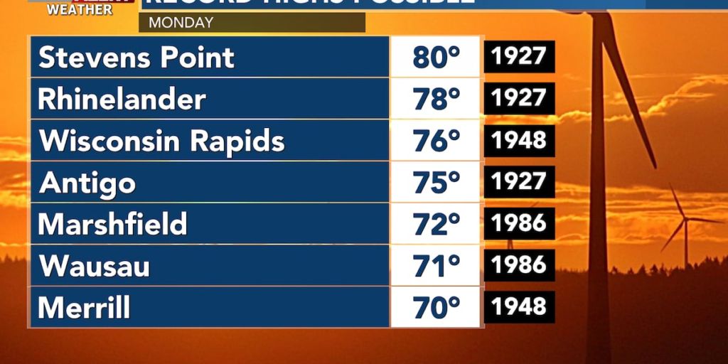
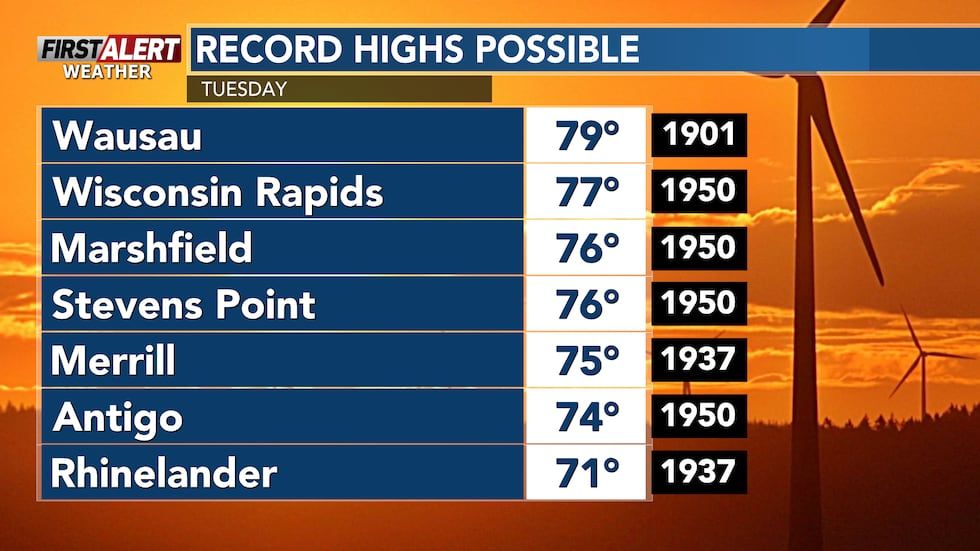
First, let’s focus on Monday. We are looking at mostly cloudy skies with highs in the mid to upper-60s across north central Wisconsin. While a few communities will flirt with record highs on Monday (mainly Wausau & Merrill) I think we will have a much better chance for this on Tuesday area-wide. Despite a decent amount of clouds, highs will top out in the mid to upper-70s. Several record highs are expected to fall on Tuesday, which will be our warmest day of the week.
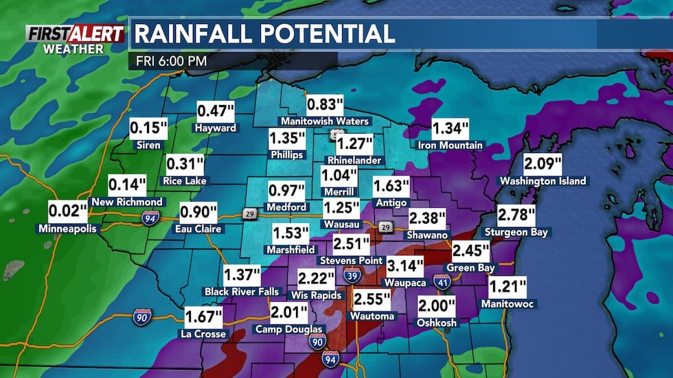
By late Tuesday and early Wednesday, rain chances will increase. While a couple storms will be possible late Tuesday into early Wednesday, most of us will need to wait until after daybreak on Wednesday before rain arrives. Strong to severe storms, if any, are expected to stay west of us. These storms will be part of a much larger system that will continue through Wednesday and even into Thursday. By the time this system is out of our area, some communities could pick up as much as 1-2″ of rain.
Once the cold front passes through, we will be done with this period of warmer temperatures. It will feel a lot more like Fall the rest of the week. More rain will be possible over the weekend with the best rain chance, beyond midweek, on Sunday.
Copyright 2024 WSAW. All rights reserved.
Morocco