At this time, the most likely hypothesis is that of an asteroid from space.
An astonishing discovery while hiking
The most fascinating stories appear in the most unlikely places, even on Google’s mapping services. However, few, if any, stories resemble the one that took place in the Côte-Nord region of Quebec. The discovery is so shocking that several scientists went there to check if it was not a planet.
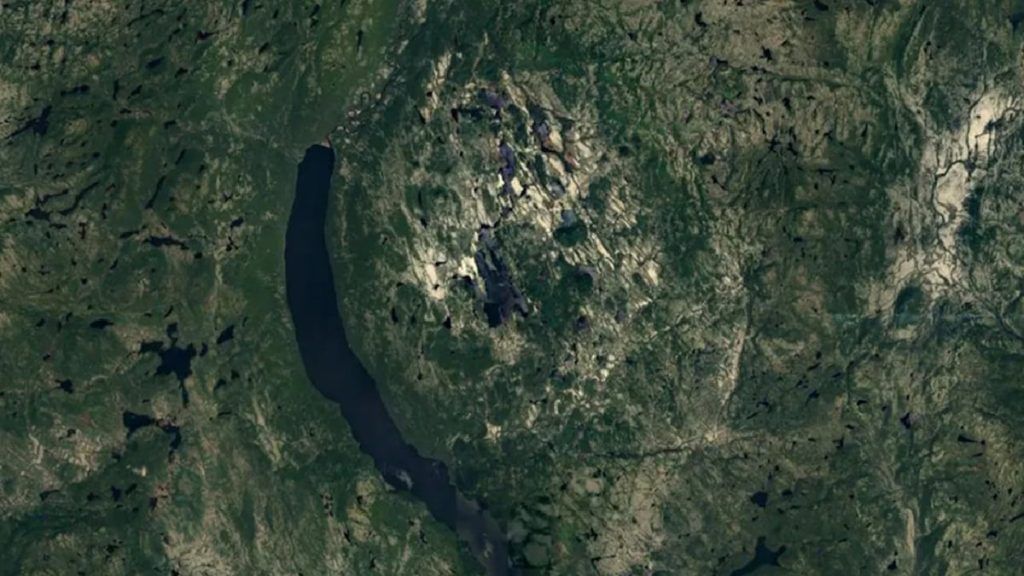
It all started when a hiker, Joël Lapointe, was organizing his next hike. The man is browsing Google Maps while planning a camping trip in the area when he comes across something unusual: a monstrous hole. The images show it a clearly unusual structure. His first research led him to a gigantic spherical structure about fifteen kilometers wide. As he deepened his research, he discovered a ring of small mountains about eight kilometers in diameter surrounding Lake Marsal, about a hundred kilometers north of the town of Magpie, Quebec. Perplexed, he asks for professional help to solve this mystery.
Scientists get involved
Joël Lapointe searches for and contacts geophysicist Pierre Rochette of the Center for Research in Environmental Geosciences (CEREGE) in France to help him identify the strange structure. When the man gives him the coordinates, the latter is impressed. The geophysicist quickly assembles a scientific team and goes there to study what the Google application clearly showed. He has an idea of its possible origin, but he needs to be on the ground to verify his hypothesis.
Photo
As soon as he arrives, everything comes together. “If we look at the topography, it is very suggestive of an impact”, explains the scientist. Intrigued, the geophysicist and his colleagues took a closer look at the area and now believe the ring of small mountains surrounding the lake may have been misclassified in the past. “This formation, interpreted as a formation of volcaniclastic diatremes called Marsal breccia, in an area devoid of post-Grenvillian magmatism (…) in fact corresponds more to a molten rock poor in clasts coming from the bottom of the crater, quite similar to the case of Mistastin and Janisjarvi »writes the team in a new article.
Several tracks
As the researchers explain, the area shows no signs of a gravitational anomaly, that is, an area where gravity is stronger or weaker than expected based on the amount of mass thought to be there in the area. However, they believe that the data is not precise enough to distinguish an anomaly with a diameter of less than 10-15 kilometers, which requires more in-depth field work.
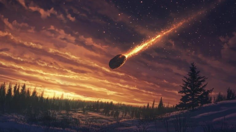
Photo credit: Midjourney
Regardless, the indications provided by Lapointe are more than promising. Scientists suggest hiker stumbled upon ancient impact while browsing Google Maps. By examining samples taken from the site, the team identified silicates, abundant magnetite, sulfides and zircons, all indications of rock melted by the impact. Based on erosion levels, they estimate the impact may have taken place between 450 and 38 million years ago.
According to NASA, an impact crater forms when a meteorite crashes into the surface of a planet at thousands of kilometers per hour, under the effect of shock waves that melt and recrystallize the rock. The final conclusion could come from the next explorations already underway in the region by 2025.


