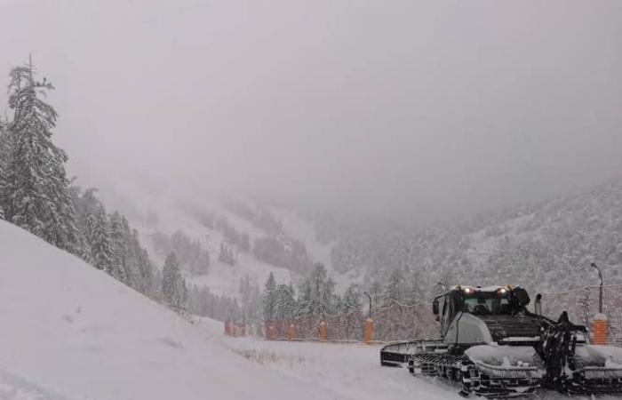
A snowy episode “outstanding” is expected in the Northern Alps, pushing Météo-France to place Savoie, Haute-Savoie and Isère on orange alert for icy snow and avalanches Sunday December 22while Manche, Ille-et-Vilaine and Côtes-d'Armor will be at this same alert level for winds.
The three Alpine departments will enter into orange ice snow alert at 9 a.m., with an end of the episode scheduled for Monday eveningspecifies the public establishment in its latest bulletin published at 6 a.m.
For the risk of avalanches, orange vigilance will begin at 6 p.m. and should also last until Monday evening. Météo-France warns of a snowy episode “outstanding”.
In the mountains, nearly a meter of snow is expected within 48 hours above 1,500 metersand between 40 and 60 centimeters around 1,000 meters.
These accumulations are particularly likely to disrupt access to high altitude stations, specifies the public establishment, and wind gusts ranging from 80 to 100 km/h on Sunday may cause snow accumulation in places.
Motorists must demonstrate “great vigilance” on the roadsbe equipped with winter tires and chains for access to certain mountain areas, while limiting to “maximum” travelrecalls the prefecture of Haute-Savoie in a press release.
Those borrowing the A7 motorway from the south of France are called to “become well informed about the weather conditions before traveling to these regions”alerts Vinci Autoroutes.
Winds of 130km/h expected
The avalanche risk will be high from 6 p.m. on the massifs of Chablais, Aravis and Mont-Blanc (Haute-Savoie), Haute-Tarentaise, Beaufortain, Vanoise and Maurienne (Savoie), and Belledonne, Grandes Rousses and Oisans (Isère).
Of “large avalanches” will be triggered as snow falls during the night from Sunday to Monday, then Monday during the day, adds Météo-France. They “will be able to reach exposed mountain roads as well as high-altitude infrastructure”.
“The expected avalanche activity occurs on average every three to eight years depending on the massifs concerned,” underlines the organism.
On Monday, the snowy episode will be accompanied by a “strong wind”et “the fresh snow will also be deposited on a snow cover that has not yet stabilized following previous snowfalls, which could encourage the start of large avalanches”he concludes.
Regarding the wind, the three departments of the North-West will enter orange vigilance around 10 a.m. (until around 8 p.m.).
Gusts of up to 130 km/h locally on the coast and around 100 km/h inland are expected, in a context of stormy showers accompanied by sleet.


