The Group for Research and Education on Marine Mammals (GREMM) believes that the choice of moving the ferry service's home port to Cacouna could expose, on average, more belugas to ferry noise. The scientific organization nevertheless believes that solutions exist.
Almost five years ago, the Société des traversiers du Québec sought the opinion of the GREMM to assess the impact on belugas of a ferry in Cacouna compared to Rivière-du-Loup.
Its scientific director, Robert Michaud, points out that no matter which route the ferry takes, it finds itself in the essential habitat of the marine mammal.
The idea of a nursery in Cacouna, put forward by activists at the time, does not exist
clarifies the researcher. Females roam throughout critical habitat with their calves.
However, a beluga concentration area is located off the coast of Cacouna.
Using a map of the distribution of the emblematic species, researchers can confirm that the ferry will encounter more belugas on its way.
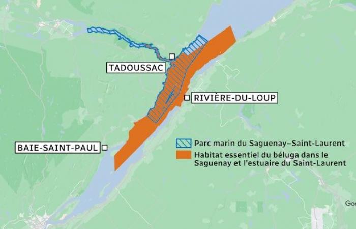
Beluga critical habitat is the area where females give birth and raise their young. This area, demarcated by scientists since 2012, is located between Saint-Jean-Port-Joli to Saint-Simon and Les Escoumins. The habitat also includes the Saguenay River up to Sainte-Marguerite Bay.
It has been protected by the Endangered Species Act since 2016. At all times, vessels must keep a distance of 400 meters, the equivalent of four football fields, from these white whales.
Open in full screen mode
Currently, the marine park covers a small portion of critical habitat.
Photo : -
If the Saaremaa I can adapt its route according to the concentration of belugas measured in real time in the estuary, the ferry's new home port at Gros-Cacouna would then prove to be an advantageous option for the beluga, however, the researcher emphasizes. .
The GREMM is developing a simulator of maritime traffic and the movement of belugas. This simulator is efficient
mentions Mr. Michaud. This tool is developed in collaboration with the Interdisciplinary Socioecological Simulation Laboratory, directed by Professor Clément Chion of the University of Quebec in Outaouais.
This simulator is used to evaluate the number of belugas exposed to noise and, above all, to how many decibels they are exposed to on one route compared to another.
The result is unequivocal: if the ship passes through the north-east of Île aux Lièvres, more belugas are exposed to noise than if we keep the route which passes through the south-west of the island, as the ferry currently does [à partir de Rivière-du-Loup]
explains Mr. Michaud.
Open in full screen mode
Lièvre Island (Archive photo)
Photo: Mathieu Dupuis
Where the port of Gros-Cacouna offers an advantage is that its position would allow the ferry captain to choose a route, from one hour to the next, depending on the season or time of day, based on on the probabilities of encountering belugas. The ship could therefore pass to the right or left of the island.
According to the scientific director of GREMMbelugas gather in large numbers southwest of Île aux Lièvres to eat herring every spring when the fish spawn. It is an important place for female belugas.
Spring feeding of females is thought to be a pivotal element in the reproductive cycle
specifies Robert Michaud. They have specific energy needs at that time.
However, the ferry is currently slipping through this small passage between Île aux Lièvres and the reefs of Île aux Fraises, right into the belugas' larder.
At first glance, Cacouna–Saint-Siméon does not constitute an advantage over Rivière-du-Loup, but if we adopt alternate and adaptive navigation strategies and we have the tools to predict the presence of belugas , we could contribute, at least for this issue of exposure to noise, to the recovery of belugas.
Robert Michaud and his colleague Clément Chion are working to implement a prediction system for the benefit of the Société des traversiers du Québec (STQ).

Open in full screen mode
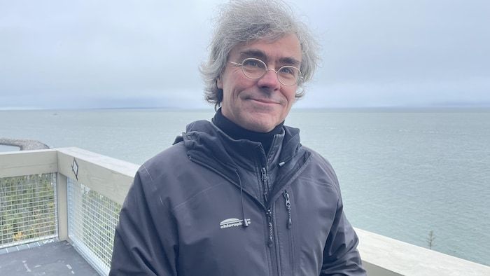
Robert Michaud is president and scientific director of the Group for Research and Education on Marine Mammals (GREMM).
Photo: - / Fabienne Tercaefs
Determine the optimal scenario
During the press conference on Thursday, the STQ has not revealed the route that the ferry will take from Cacouna, starting in 2028.
The Crown corporation was unable to indicate, due to the holiday season, whether it intends to evaluate the option proposed by the Marine Mammal Research and Education Group.
The STQ will continue its work with environmental groups, including GREMMin order to determine the optimal scenario to operate while respecting the critical habitat of the beluga
she responds by email.
We ensure that this aspect is taken very seriously within the framework of the project and the STQ wishes to implement the best possible practices for the operation of Saaremaa I in Cacouna.
Other factors that have repercussions on the beluga will also have to be studied, recalls Robert Michaud. Dredging at the port of Gros-Cacouna planned for 2025 over a period of 10 years, as well as uses at the port of Cacouna and that of Rivière-du-Loup must be taken into account, according to him.
From next January, the STQ intends to launch the environmental authorization process, such as the analysis by the Office of Public Hearings on the Environment (BAPE) in order to develop temporary structures at the port of Gros-Cacouna. This process should last until April 2028.
The GREMM assures he will follow the process. But its scientific director points out that environmental conditions are changing rapidly with climate change.
We have some indicators which suggest that the distribution [des bélugas] could be modified in the coming years. You will have to remain very vigilant
he emphasizes.


