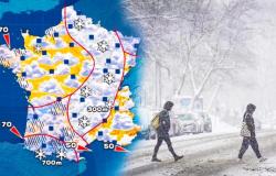
What weather for the start of this Sunday and the start of the coming week in Hauts-de-France? Not great since Monday was punctuated by gray weather, that said, without too many showers! The wind is still blowing strong
The essentials of the day: our exclusive selection
Every day, our editorial team reserves the best regional news for you. A selection just for you, to stay in touch with your regions.
France Télévisions uses your email address to send you the newsletter “Today’s essentials: our exclusive selection”. You can unsubscribe at any time via the link at the bottom of this newsletter. Our privacy policy
The weather for Sunday December 22, 2024 in Hauts-de-France
•
© FTV
The depression named “Enol” is now located between Scotland and Scandinavia. While the rains finish evacuating Picardy, the lag settles behind and showers are already setting in on the coast this morning.
The sky is filling up quickly up front, but we still have time to see the sun. The southwest to west wind is strong. Gusts of 60 or 70 km/h are common in the interior, they rise to 80/90 km/h as they get closer to the coast and can reach 100 km/h on the coast between Boulogne-sur-Mer and Le Tréport. Vigilance is yellow for the wind throughout Hauts-de-France
The weather for Sunday December 22, 2024 in Hauts-de-France
•
© FTV
This afternoon, showers will become widespread throughout the region. Rather rare in Pas-de-Calais protected by the British Isles, they are frequent and can be accompanied by snowflakes or even small icicles due to pervasive cooling of the atmosphere, particularly along the Belgian borders and on the extreme South Picardy in the Château-Thierry area. A sprinkling of the heights of Avesnois and the Thiérache is not excluded. The Somme department is also on storm yellow alert for a greater risk of sleet. The northwest wind is still blowing quite strongly. 100 km/h affects the entire coastline and can go beyond Abbeville in western Picardy. All this unstable activity settles down in the evening and the following night.
The weather for Sunday December 22, 2024 in Hauts-de-France
•
© FTV
Minimum temperatures are around 3 to 6° inland and up to 7 on the coast.
The weather for Sunday December 22, 2024 in Hauts-de-France
•
© FTV
As for the maximums, they are close to 7 to 9°.
The trend for the coming days in Hauts-de-France
•
© FTV
With the approach of a new disturbance, the air warms and stabilizes on Monday. The first day of the week is generally very cloudy but without precipitation, except near the Belgian borders where showers could overflow in the afternoon. The northwest wind is still moderate but not excessive. The minimums vary from 2 to 5° inland, up to 7 by the sea and the maximums are close to 6 to 8°.
Tuesday, the weather is gloomy with a gray sky hiding the flying sleds. Some scattered light rain occurs. The south wind is weak to moderate, it maintains high temperatures for the season. The minimums show 0 to 3° in the land with frost in the heights of Avesnois and Thiérache, as well as in Brie Axonaise where we can approach -1 degree. 4 to 6 degrees at the coast. We have 5 to 10 degrees from east to west.
Wednesday, little change, the cloud cover is thick letting out a few drops of rain from time to time. The wind is weak from the south. The minimums vary from 2 to 8° from east to west and the maximums are around 6 to 10° from east to west.
Air quality on Sunday December 22, 2024 in Hauts-de-France
•
© FTV
This Sunday, December 22, the mixing of the air continues, and gusts and westerly winds allow effective dispersion of the pollutants emitted. The air quality index remains average in Hauts-de-France, with ozone still the main pollutant. Apart from pollution peaks, chronic pollution causes more harmful effects on our health and the environment. Simple actions can limit our impact on air quality. More info on www.atmo-hdf.fr.
The ephemeris of Sunday December 22, 2024
•
© FTV
Today is the first day of winter and we also celebrate Françoise-Xavière. Happy birthday to you !


