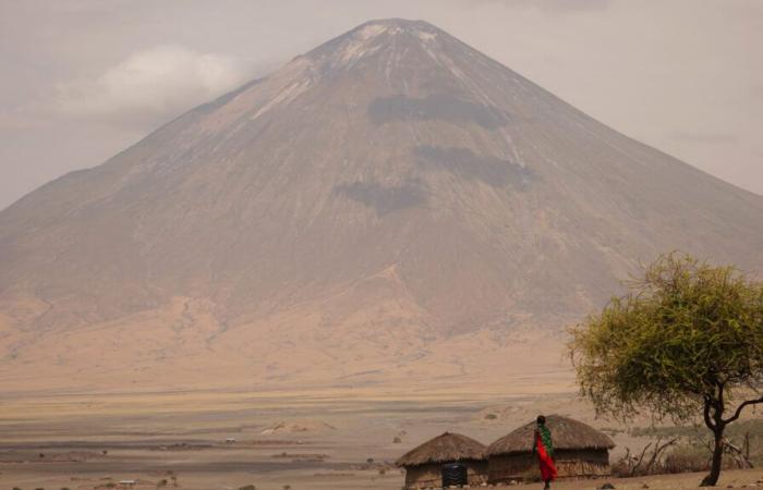
The Ol Doinyo Lengai volcano, located in Tanzania, is one of the most unique in the world. Known for producing rare carbonatite magma, the structure was recently the subject of a study revealing its gradual sinking into the ground over the past ten years. This discovery was made possible thanks to analyzes of satellite data which allowed researchers to better understand the internal dynamics of the volcano and the implications for its future activity.
Singular eruptions
Ol Doinyo Lengai is the only volcano in the world to actively produce magma carbonatite. This type of magma has a silica content of less than 25%, unlike other terrestrial magmas which contain between 45% and 70% silica. This low silica content gives the magma a very fluid consistency, comparable to waterresulting in eruptions characterized by rapid, bizarre lava flows, sometimes described as gushing from a garden hose.
The unique chemical composition of carbonatite magma also means that the lava transforms quickly after eruption. Initially black or dark gray in color, it turns white when dry due to the formation of carbonate minerals such as calcite which decompose quickly in the presence of moisture. This phenomenon makes the volcanic landscape of Ol Doinyo Lengai particularly distinctive and spectacular.
The volcano experienced unusual explosive activity in 2007 that created a second crater, suggesting that the volcano's internal dynamics may change in unpredictable ways. After this explosive phase, Ol Doinyo Lengai returned to an eruptive style dominated by lava flows. However, some data suggested that this explosive-effusive eruptive sequence caused the main cone to collapse. To find out more, researchers recently took measurements.
A volcano in continuous subsidence
Deformation measurements of the tops of active volcanoes are difficult to perform with traditional ground-based geodetic methods. This is due to limited accessibility and intense eruptive activity which could damage the instruments. On the other hand, the interferometric synthetic aperture radar (InSAR) is an efficient method for obtaining satellite geodetic measurements with centimeter accuracy. By processing hundreds of SAR images into time series, InSAR can indeed reveal previously unknown deformation processes over several years.
As part of this study, researchers then discovered that the ground around the summit of the Ol Doinyo Lengai volcano had subsided to a rate of 3.6 centimeters per year between 2013 and 2023. In a decade, the volcano would therefore have lost around 36 centimeters in height.
-According to the team, this subsidence is probably caused by a magma reservoir located approximately 1,000 meters below the volcano which slowly deflates. This hypothesis is supported by the existence of a second, deeper reservoir approximately 3,000 meters below the surface. This reservoir could be responsible for the complex dynamics observed in the Ol Doinyo Lengai volcanic system.
The importance of this discovery lies in the fact that it provides crucial information for predicting future eruptions. Monitoring the subsidence of the volcano could indeed help identify warning signs of increased volcanic activity, which would thus make it possible to better prepare local populations for possible eruptions.
This discovery highlights the importance of technological advances for the study of volcanoes like Ol Doinyo Lengai. Using satellite imagery and remote monitoring methods such as InSAR, it is now possible to monitor subtle and continuous terrain deformations, even in remote and difficult-to-access environments. These new techniques offer researchers a finer understanding of the underlying geological processes, paving the way for more precise predictive models on the evolution of volcanoes and thus making it possible to better anticipate the risks associated with volcanic activities.
A window on the volcanoes of the future
The in-depth study of Ol Doinyo Lengai is not limited to understanding this unique volcano. It also opens new perspectives for the analysis of other active volcanoes in the world. The techniques used, in particular satellite radar interferometry, make it possible to monitor terrain deformations in areas that are difficult to access or dangerous. These technological advances play a key role in reducing volcanic risks by providing precise and continuous data on the evolution of the internal structures of volcanoes. In addition, the better understanding of magma reservoirs and their influence on volcanic dynamics could help refine global forecast models. At a time when there are more and more populations living near volcanoes, this research appears to be a valuable asset for strengthening resilience in the face of natural hazards.
The study is published in the journal Geophysical Research Letters.


