Par
Frédéric Patard
Published on
Jan 18, 2025 at 6:56 a.m.
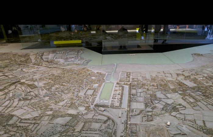
160 m². This is the very large size of the relief map of the city of Cherbourgwhich exceptionally the museum of relief plans shows at Grand Palais along with several other models. An extremely rare exhibition since the relief plan of Cherbourg – by far, the most imposing of all the museum's relief plans – is usually stored in its reserves. Suffice it to say that in this winter month of 2012, there are many Cherbourg residents in a hurry under the glass roofs of the Grand-Palais to take advantage of the bargain.
The relief plan in figures
– 16.91 meters long by 9.46 meters wide, or 160 m². Another relief plan of 15.60 m² is dedicated to the great sea wall.
– the representation scale is 1/600
Because it is a unique opportunity to discover Cherbourg as it was in 1872date on which the relief plan was modified to take into account the latest developments in the city. We also see a Cherbourg which no longer exists today: the covered market (replaced by the cultural center), the large rectangle of Place Divette, the Mielles de Tourlaville or the construction blocks to the south of the Bassin du Commerce (there where the auction is today).
We can sense a Cherbourg that does not yet exist: the theater (built in 1880), the Bucaille district (still in the state of fields) or the side dikes of the great harbor. Everyone is looking for their neighborhood, their street, even his house. Because the reconstruction work done at the time (in wood, paper, silk and metal) is extraordinary in its meticulousness.
-Strategists and architects
To whom do we owe this marvel? Originally, relief plans were used by strategists and military architects. In the 17the century, Vauban makes great use of it to present to the king his fortification projects and the progress of construction sites in several cities in France. He also uses relief maps to refine his attack plans by identifying the weak points of enemy fortifications on models.
And the relief map of Cherbourg? It was Napoleon who gave the impetus. A May 1811he is in Cherbourg to inspect the work of the military port. He goes to the hydraulic works directorate (the building opposite the current police station) where he examines the relief models port projectswhich presents to him engineer Cachin.
On his return to Paristhe Emperor orders the construction of the relief plan of the city of Cherbourg which is started in 1812 (with field visits carried out by topographers and engineers) and completed in 1819while Napoleon has been deposed since 1815. 1872the relief plan of Cherbourg is deeply amended to take into account the evolution of the city (the station, the military hospital, etc.), and in particular the completion of the military port and the arsenal.
The relief plan in Cherbourg?
Today, the project of bringing to Cherbourg – temporarily – the relief plan of the city, is still in the back of the minds of local officials who are in contact with the museum of relief plans of Paris. But for now, we are still looking for a place in Cherbourg where it could be shown in ideal conditions (hygrometry, size). And the budget for such a project (transport, restoration, protection, etc.) is also substantial…
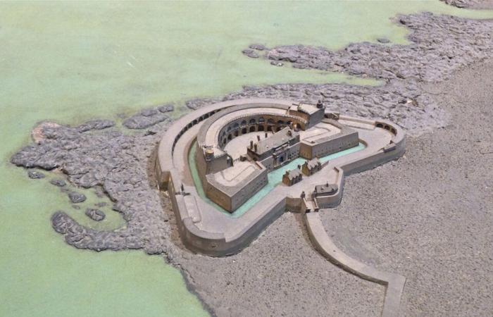
In the meantime, at the Paris relief plans museum (in Les Invalides), we can console ourselves by observing the model of Fort Chavagnac, permanently exhibited, as well as that of Mont Saint-Michel. The museum now preserves around a hundred relief plans, out of some 260 having been built between 1668 and 1870.
To find out more about the museum: https://www.museedesplansreliefs.culture.fr/
Follow all the news from your favorite cities and media by subscribing to Mon Actu.


