Par
Sebastien Lucot
Published on
Jan 7, 2025 at 6:18 p.m.
After sleet showers which affected the department in the morning of Tuesday January 7, 2025 and caused some accidents from the road, solid precipitation will return this Wednesday.
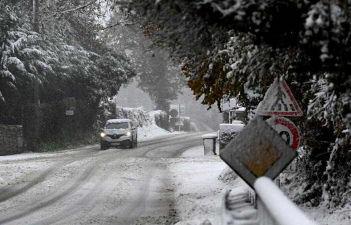
And these bad weather remain less remarkable than during the passage of the Caetano storm and the 30 centimeters of snow measured in the South Channelthey will however be able to make delicate traffic conditions.
Big cities away
Approaching a disruption loaded with humidity and soft air arriving by the Atlantican air mass conflict will take place between the Normandie and the Hauts-de-France.
The cold air present at altitude above our region in the morning will resist until mid-afternoon, particularly north of a line going from Coutances to Bayeux. To the north of this area, the snowflakes should swirl from mid-morning, then intensify until early afternoon.
“In the middle of the day on Wednesday, the disturbance that hit the country on Tuesday is gradually moving northwards. In contact with the colder air to the north, the precipitation becomes snowy”, indicate the Météo-France services which have placed the Manche department in yellow warning for snow and ice.
However, you should not expect to see snow cover the entire department. Exit seasidebut also areas without relief where the altitude is less than 100 meters above sea level, such as Cherbourg, Saint-Lô, Coutances, Avranches or even Granville. Indeed, temperatures should remain positive, between 2 and 3 degrees.
-
Everything will therefore depend on the degree. With the isothermal effect, a meteorological phenomenon draining cold air at altitude towards the ground and lowering the rain-snow limit under the highest intensities of precipitation, the modest relief shaping the Channel could therefore be covered with a white coat.
With altitude, the temperature drops by approximately 0.7°C every 100 meters. Certain hills rising to more than 300 meters in the Center and South Channel should therefore be affected by snow sticking to the ground, since the temperature will be around 0 degrees. The sectors of Percy, Sourdeval and the A84 towards Gouvets are particularly subject to this risk.
Disparate amounts of snow
In the afternoon, a slight warm spell at altitude is planned to reach the south of the department. While the brunt of the disturbance will have crossed the west of Normandy, rain could replace the snow and make road travel simpler.
A new salvo on Friday?
After this rainy-snowy episode, the cold air will regain its rights over Normandy on Thursday, thanks to a rise in high pressure and a north-easterly wind. A brief attempt since a new disturbance will collide with the cold air mass and should, according to the latest weather models, hit our region before sliding further south.
A buffer zone between the mild air further west and the colder air further east would allow further snowfall to affect the Channel during the night from Thursday to Friday.
Two scenarios are envisaged. One where the cold air, more massive, would cause the disturbance to the west of the department to “die”. The thermometer would thus remain close to 0 degrees throughout the day, under an overcast sky with a few snowflakes here and there. The other, where the mild air would progress further, thus auguring a more significant snowy spell for a few hours, with rain taking over afterwards.
These disrupted conditions will then end, with the return of the anticyclone and calmer conditions, accompanied by the usual low clouds covering the north of France.
In the Cotentineven if the relief is less significant, it reaches 150 to 180 meters in Brix, Saint-Joseph, La Glacerie or even Beaumont-Hague. Here too, the snowflakes are possible, particularly at the start of the afternoon, when the heaviest precipitation will cross the Cotentin.
Taking into account all of these factorssnow amounts should be very disparate depending on where you are. Ranging from light dusting from 100 meters above sea level, up to 5 centimeters on the highest hills of the Channel.
Follow all the news from your favorite cities and media by subscribing to Mon Actu.


