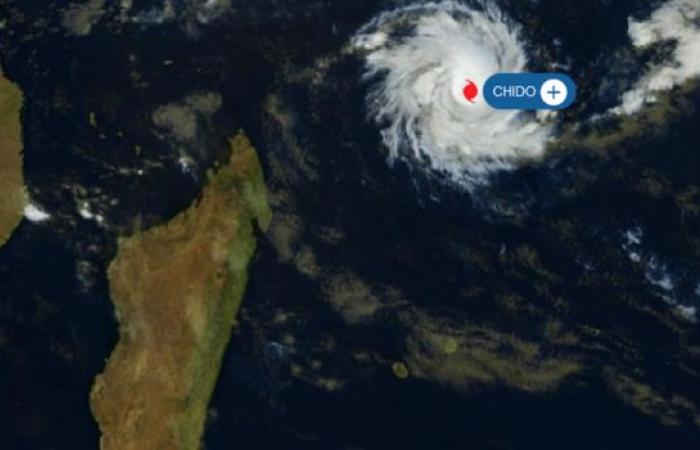
This Wednesday, Chido reached tropical cyclone stage. According to Météo France, the system will continue to intensify. At 10 a.m., Chido was located 1185 km from the Reunion coast.
System information:
Over the next 24 hours, CHIDO could continue to intensify and reach the stage of an intense tropical cyclone. Beyond that, cyclone CHIDO could weaken slightly as it moves towards the west-southwest. On this trajectory, it should pass in the immediate vicinity of the island of Agalega this evening (less than 50km). In the longer term, it could pass near the northern tip of Madagascar on Friday and Mayotte on Saturday. At the end of the weekend, CHIDO could finally land on the coast of Mozambique. The distance and timing of passage to and over these territories are still uncertain, given the deadlines, with more than 150km and 6 to 12 hours of uncertainty.
– Conditions have started to deteriorate on Agalega. Associated with the passage in the immediate vicinity this evening, devastating winds, heavy rain and dangerous seas. Improvement is expected late next night. Residents should keep themselves informed of developments through their national meteorological service (http://metservice.intnet.mu/) and prepare for the arrival of the phenomenon by urgently completing the required prevention measures, and by complying with the decisions and recommendations of local authorities.
– During the night from Thursday to Friday, CHIDO could circulate around a hundred km south of the Farquhar archipelago. A worsening of the weather is expected at the end of the day on Thursday with possible heavy rain, dangerous seas and possibly strong winds before improving on Friday. Residents are invited to follow the evolution of the forecasts, through their national weather service.
France


