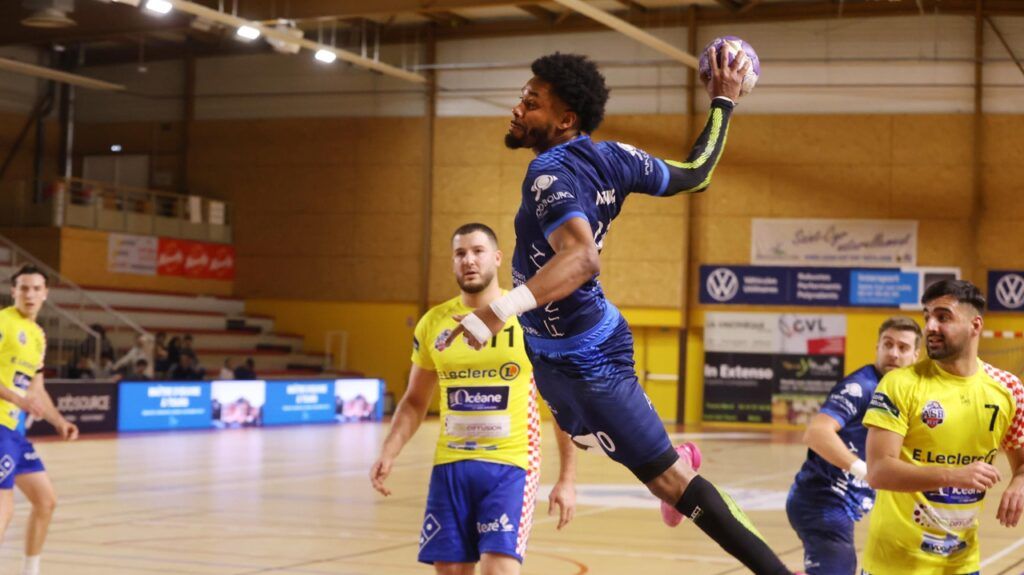
Union Sud Mayenne – L’Huisserie
Saint-Cyr Handball
Higher speed engaged. Lacking consistency at the start of the season, Saint-Cyr Handball (2e) clearly came second last weekend against Rezé (37-22).
Despite the absence of Formeau and Charrier, injured, and the premature exit of Thévenet (disqualification for three times two minutes), Mathis Morin's teammates not only held on in difficult moments, but above all they knew how to put their heads under water to powerless Rezéans who have never been able to adapt.
It must be said that when SCHB plays like this, it is difficult to resist them. Especially with a mobile central defensive block which has seen new relationships emerge, notably with a very active Lai. With, also, Morin or Foucault effective as ball stealers, and in fact, a forward projection that we did not see enough of last season.
Individuals who make the collective shine
On the offensive side, Sacko has found more regularity, Jargeac has gained confidence, M'Tima, Dupont-Marion and Robyns remain as solid as ever, and Périllaud, at the age of 17, did not tremble with a fault on his left wing.
Has Saint-Cyr definitely reached a milestone in recent weeks? That of consistency, the one that makes us forget the defeats against the weaker, balanced by the performances against the stronger? The one without which the Saint-Cyrian group became crumbly and ready to “unpin when the match was close”as the Hennebont coach said (27-34 defeat in September)?
We have blocked the display of this content to respect your cookie choices. By clicking on “Accept”, you accept the deposit of cookies. You can change your choices at any time by going to this page.
Accept
This Saturday's trip to the Sud-Mayenne field (9e) will in any case confirm this improvement. Saint-Cyr Handball will present itself with the confidence linked to its recent performances, but also with the caution and humility that its new status as a successful team requires.
“Meet the challenge”
“It’s a team that has had a very good start to the season, so I’m wary, assures Ibrahima Diaw, the SCHB technician. She is physical, she runs a lot. We will have to take up the challenge in a match which will be, for us, as important as the others. »
Bruno Souillet's players will indeed do battle in a probably full house and will rely on the history of a group which, for six years, has progressed through the ranks from the Regional to the National 1, retaining a good part of its workforce.
So be careful with these opponents who will, each time, want to bring down the teams against whom they have nothing to lose. This is what is now hanging over the noses of Saint-Cyriens…
Saturday November 23 at 9 p.m. in Château-Gontier.