“Let’s open up the fields of possibilities and break the glass ceilings. » The slogan of the Hand'Joy association embodies their values. Located in Seine-Saint-Denis and created by former French handball player, Amina Tounkara, in 2020, the association promotes equal opportunities and promotes inclusion through sport, but also through art and culture. “With Hand Joy, there is a real desire to reach out. I went through difficult times in my life, and I think that at that time, if someone had reached out to me, it would have been easier,” explains the 26-year-old young woman from Aulnay-sous-Bois. The handball player, who played as a goalkeeper, had to end her career prematurely following a concussion in September 2022.
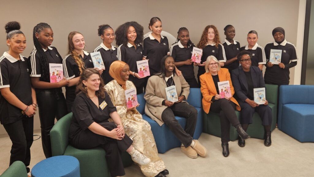
This year, Hand'Joy is celebrating its four years in the most beautiful way, by publishing a comic book series, “Champions: here too, we can shine”. Made up of four volumes, these comics tell the story of fourteen young girls from the Seine-Saint-Denis department. This Monday, November 18, the association took over the headquarters of Adidas, one of the partners of the project, in Paris, to present the first two volumes of the series in preview.
Sorority at heart
This series of comics is the result of one of the three programs offered by Hand'Joy: “Championnes”, an initiative focused on inclusiveness. The “Education First” program aims at socio-professional integration and finally “Let’s draw equality” is focused on awareness-raising. The comic strip project was supported by several partners including the department of Seine-Saint-Denis, Adidas, the Hand'Solidaire Foundation of the FFH (French Handball Federation), which financed the project and the heritage service of Paris 2024.
The fourteen young girls, all handball players, took part in the Champions program. At the start of this adventure, they did not know each other, but one thing led to another, they forged links through different activities linked to sport, to culture, but also thanks to this writing work. Each volume addresses a different theme: physical and mental health, gender equality, self-confidence and racism. All the girls made their contribution by sharing a part of their story with the help of writer Christine Lang.
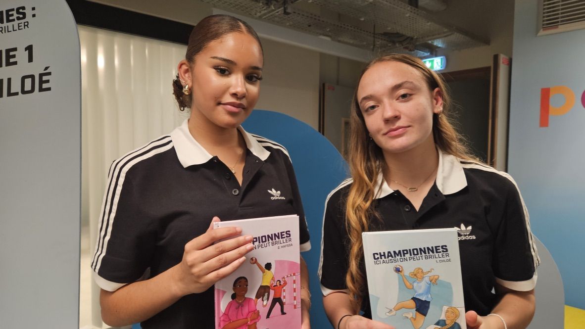
Nina on the left and Manon on the right ©EmelineOdi
“I had to deal with two cruciate ligaments. We wonder how we get back up after this ordeal”
The first volume recounts Chloé's convalescence following cruciate ligament surgery. A story inspired by that of Manon, 17 years old, from Noisy-le-Grand. “I encountered physical difficulties. I had to deal with two cruciate ligaments. We wonder how we get back up after this ordeal. With this comic, we realize that we are not alone. We all recognize ourselves in at least one comic strip. I think that the greatest pride is to have succeeded in writing our history,” rejoices the young girl.
“It’s really this desire to tell stories about ourselves, but also to tell others stories, to help, and perhaps to change certain mentalities, that pushed us to come together to design these comics,” continues Maïssane. The latter participated in the Champions program and in the writing of the comic strip.
“Personally, I have had difficulties related to mental health in sport and I find that it is not taken into account enough in the sporting and women's world. This project gave me self-confidence, I told myself that I could do it,” greets Nina, 16 years old, from Livry-Gargan and Sevran.
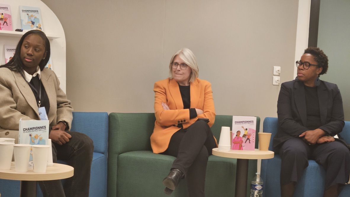
Amina Tounkara (left), Béatrice Barbusse (center) and Zaïnaba Saïd-Anzum ©EmelineOdi
A series of comics under the sign of transmission and identification
With this comic strip project, Hand'Joy highlights the transmission and sharing of experience which is one of the central values of the association. “Transmission is important to me, because young people, and especially young girls, lack role models. If I, Amina Tounkara, talk to young girls from working-class neighborhoods, who experience the same life trajectories as me, they will hear my message. They know that I was in their place one day.” confides Amina Tounkara. His story is at the origin of the second volume in which the heroine, Hafssa, wishes to sign up for handball, but faces refusal from her father who believes that the sport is reserved for boys.
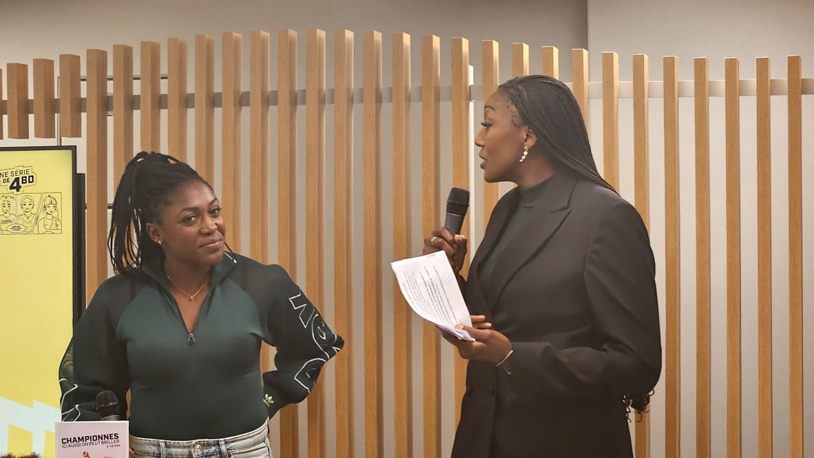
Sharing experience is also the watchword of the association's godmother, Grace Zaadi, French international handball player, world champion in 2017 and 2023, European champion in 2018 and Olympic champion in 2021 in Tokyo. “It is close to my heart to be the godmother of this association because I also have the impression of giving back what was given to me. The realization of this comic book is something that warms my heart. I saw the girls and the way they have evolved since the start of this project, but also how they worked to be able to materialize this. It's something strong! “, smiles the one who cut her teeth at the Villepinte handball club.
Grace Zaadi (left) and Mariama Signaté (right, former handball player) ©EmelineOdi
“In comics, there are very few stories that highlight people who look like us”
This transmission and this identification also occurs through the image. The comic series Champions represents four young girls with different origins and physiques. A detail that was important for the fourteen young girls, but also for the illustrator Halimata K. and the graphic designer Maude-Cécile Carette. “I found it important to highlight the stories of real people from the suburbs. In comics, there are very few stories that feature people who look like us,” justifies Halimata. “What is important in this project is to talk about girls in handball. I was born in 1991 and we didn't hear too much about girls who played football… so handball is another story (laughs). It’s beautiful to highlight these kinds of stories,” adds graphic designer Maude-Cécile.
“I hope that this comic can be distributed massively in high schools and colleges in Seine-Saint-Denis, because these are personalities that we rarely see in comics. How do you want people and young women to identify with people we never see? This is not possible! »insists Béatrice Barbusse, deputy vice-president of the FFH and sports sociologist.
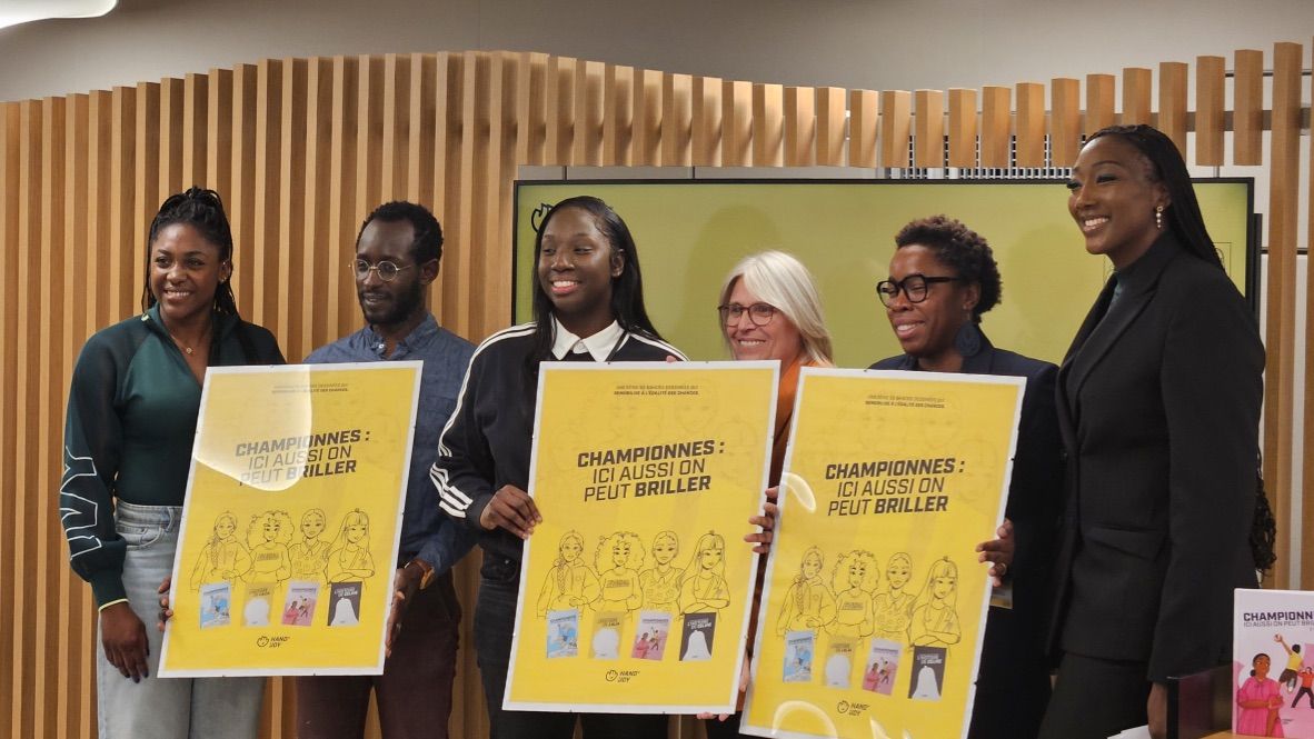
Grace Zaadi, Slimane Tirera (Paris 2024 legacy), Amina, Béatrice, Zaïnaba and Salimata ©EmelineOdi
Role models for the younger generation
Even though they are young, the fourteen champions become models for young girls with this comic book project. They are aware that they will make young girls who look like them want to do the same. “We try to send messages and tell young girls that they are not alone and that their voices can also be heard. We want to be like Amina (Tounkara) and it’s up to us to work and make our voice heard”believes Manon.
“Through this comic strip, we begin to become role models for little girls. I hope this comic will do great things and help the future generation”Nina smiles.
Émeline Odi