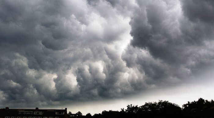

Lorraine is affected, this Saturday, June 29 from midday, by an orange vigilance for a risk of thunderstorms.
“Saturday afternoon, isolated thunderstorms are triggered towards Lorraine and Alsace. A more widespread stormy deterioration then rises from the south. It reaches the Burgundy-Franche-Comté region around 6 p.m. then the Grand-Est region around 8 p.m. before continuing its progression northwards.“. In its latest weather report published this Saturday, June 29, Météo-France placed the departments of Lorraine on orange alert.
The meteorological site informs of a highly stormy summer situation which requires particular vigilance given the geographical extent and intensity of the forecast phenomena. “In addition to intense electrical activity, these storms can cause violent gusts of wind, hail and heavy accumulations of rain in a short period of time.“.
According to Météo France, these storms are particularly virulent and are accompanied by violent gusts of wind (80 to 100 km/h, locally around 110 km/h possible), large hail and heavy accumulations of rain (40 mm in less than an hour and up to 80 mm over the entire episode). This marked storm zone is gradually evacuating through the north-east of Lorraine and Alsace after midnight.


