Update June 26, 2024 at 2:00 a.m.
A low pressure system will travel across Canada throughout the week and bring rain to several provinces, including Quebec.
Starting Wednesday, the west of the province will taste the first drops of the depression that awaits us at the end of the week. British Columbia to start, then the Prairies between Thursday and Friday, where the heaviest rain is expected. The Rockies could even get some snow at higher elevations. While late June snowflakes aren’t completely unusual, they’re not what you’d hope for around Canada Day.
The depression will continue its path eastward to reach Ontario and Quebec on Saturday. Between 10 and 30 millimeters could fall on La Belle Province this weekend. After midsummer festivities in the rain, the second long weekend of summer may not escape it either.
Finally, the depression will reach the Maritimes on Sunday and end its journey across the country in Newfoundland on Monday, Canada Day.
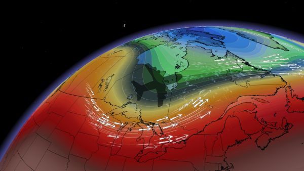
A particular context
These widespread rains are the result of a particular atmospheric context. The jet stream is positioned a little more in a straight line than usual and extends from west to east. Like a highway, this atmospheric corridor will open the way for depressions which will be able to rush in and move more easily throughout the country.
With the collaboration of Maxine Cloutier-Gervais, meteorologist.


