From Brivadois to the summit of Mézenc via the Loire and Allier and the crystalline highlands of the north, the department is of unsuspected landscape richness. A geological guide has just been published by Omniscience editions. This collective work written by the Haute-Loire Geological Group will be the companion of explorers of our exceptional territory through ten geological hiking circuits allowing us to reveal even more of our riches.
This is a new opportunity to discover our department, the diversity and richness of its landscapes with the Geological Guides. Knowing how to read a landscape, its relief, its rocks, its vegetation, knowing how to decipher the imprint of its history, these are the goals of this new guide which reveals grandiose sites, carefully chosen and described.
Ten hiking excursions were recognized, described and illustrated by members of the Haute-Loire Geological Group: Jean-Louis Ameurlain, Lydie Chany, Jean-Claude Fontvieille, Timothé Lhoste, Christian Nicollet, André Plazanet, André Reymond and Michel Wersinger with the collaboration of Dominique Decobecq. “These routes are spread across the entire department, making it possible to address the diversity of the local geology. This selection was made in such a way as to cover the important themes of Altiligrian geology and the key periods in the establishment of these terrains,” explain Marie-Thérèse and Charles Allemand of the Geological Society.
What will this walk of several kilometers along the Dolaizon look like?
“The nature of the subsoil has strongly left its mark on the landscapes: the transition from granite terrain to volcanic terrain is accompanied by a striking contrast called “landscape tilt” which gives rise to magnificent viewpoints making part of the department's tourist attraction. The excursions are exclusively on foot, except for a few approach or connection journeys by car. They cover a distance of between 5 and 15 km achievable during the day.
From Margeride to Devès
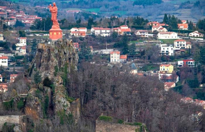
Viewpoints are offered for observing larger spaces: a sort of freeze frame to decipher the landscapes. “We hope that these readings will allow the curious to approach the origin of rocks, their main characteristics, the succession of events, to bring volcanoes, lakes and rivers to life,” continue the authors. Thus, we straddle the Hercynian chain at Saint-Ilpize with the Rodde mining museum. Between Margeride and Devès, a stop at Prades, where one of the most beautiful railway lines in France passes, is essential. On the granite heights of Chaspinhac, we will discover arkoses and horst. Vézézoux is famous for its coal basin.Geological history of Corneille Rock. Photo Vincent Jolfre
Receive our leisure newsletter by email and find ideas for outings and activities in your region.
In Emblavez, from Mézères to the Suc de Jalore, the Corboeuf ravine is an unmissable geological site, as is the Bourrianne boulder cascade with, not far away, the Chalencon castle and the Devil's Bridge. Saint-Pierre-Eynac is home to quarries with a diversity of materials. Around Chaudeyrolles, an obligatory passage on the Mézenc massif, its narces before returning to the Ponot basin via Polignac. Finally, Mount Bar is a model volcano for an inevitable geological excursion. More broadly, pages or boxes go beyond the scope of geology by addressing nature themes on fauna and flora, construction elements using local materials and gastronomic specialties linked to agricultural products.
Book. Geological guide – Haute-Loire, Omniscience editions, 24.90 euros
Jerome Bay


