

The inhabitants of the Devès plateau know that they have under their feet, at a certain depth, a unique water deposit. A real water tower which supplies the entire Ponote town up to Emblavez. In order to make it better known, an educational trail was created in the town of Saint-Christophe-sur-Dolaizon. Objective: to raise awareness of the presence of groundwater on the plateau, its vulnerability and to make the link between environment and health while favoring a fun approach. Monday April 29, it was time for its inauguration in the presence of elected officials.
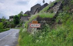
Starting from the central square of Saint-Christophe, the trail makes a 4.8 kilometer loop (a variation of the PR 547) and is intended to be fun and educational. The town of Saint-Christophe was chosen for its positioning in the center of the plateau. From a geological point of view, it is, in fact, ideal for seeing and understanding the superposition of basalt flows and permeable soils.
During the inauguration of the trail, the mayor of Saint-Christophe, Daniel Boyer, was delighted with this initiative which made it possible to address the entire water issue.
This trail, which is made up of five stations, presents the flow of water on the plateau, the geology of the Devès mountains, the operation of a piezometer, an instrument used to measure the level of an underground water table. , without forgetting the use of this beneficial resource. The school population being one of the preferred targets, very broad information is provided to educational establishments.
For more than five years, the concern of the Local Water Commissions has been the knowledge and preservation of the underground blue gold of Devès which extends over approximately 850 km², from north to south over nearly 80 km and from east to west for around ten kilometers. There’s nothing like an itinerary that allows you to set off on a Devès water adventure.
A poorly known deposit
But this blue gold is really poorly known. Under the will of the two Local Water Commissions of the Water Development and Management Schemes (Sage) Loire Amont and Haut-Allier, a study emerged to improve knowledge of the groundwater mass (see box ). Indeed the body of water, which is classified NAEP (Aquifer to be reserved for future drinking water supply), is made up of a multitude of aquifers. They make it possible to supply approximately half of the Haute-Loire department – more than 100,000 people, including mainly the Puy basin -, without forgetting other uses such as agriculture, geothermal energy and a significant contribution to participate in the good functioning of natural spaces, watercourses and wetlands.
“Although it is a very important resource for the territory, the stakeholders have little knowledge about it, despite issues related to health and the environment. Indeed, the health of the inhabitants of this territory depends on its quality and quantity,” explained the president of the local water commission of Sage Haut-Allier, Mireille Gardès Saint-Paul, during the inauguration of the trail. pedagogic.
The only measuring instrument is the Chaspuzac piezometer, installed in 2001 at approximately 22 meters depth. Since 2015, it has shown a clear downward trend in the water table level which could, in part, be explained by the drought episodes experienced in recent years. “In 2022 the lowest level was recorded since monitoring began. Recent rains have raised the piezometer level by four meters, i.e. that of 2020. This is good news, but we need to see the long-term trend. But the decline is continuous. In addition, a good water table should not depend too much on rainfall,” explained Philippe Cathonnet, president of the local water commission of Sage Loire upstream.
Four other piezometers were recently installed, notably in the perimeter of the Besson-Roulon sources. We will therefore have to wait several years to assess the variations.
We also know that water recharge occurs mainly in winter. A plateau resulting from intense volcanic activity, Devès has the particularity that the circulation time of water in the aquifers can range from a few days to several decades.
Drilling and nitrates: threats
In addition to the quantity of Devès water, there is also another concern: that of its quality. Increasing numbers of drilling operations can represent a threat: “A deep drilling can pierce several water tables and cause pollution,” underlines Philippe Cathonnet who wishes to go further: “We wish to acquire knowledge of the volumes taken from these water tables through the drilling declared or not with identification of the location”.
The current study highlights another threat: the increase in nitrate levels in the Devès area. The threshold not to be exceeded is 50 mg per liter. Beyond that, the water is no longer drinkable. However, this threshold was already reached at several measurement points carried out on certain sources on the plateau. The threat is very real.
Jerome Bay
The piezometer is essentialThe level of the Chaspuzac piezometer has been falling steadily since 2015.
On the groundwater body of Devès, there are very few monitoring points. The only sector monitored, that of the Chaspuzac piezometer, located at approximately 22 meters depth, has shown since 2015 a clear downward trend in the level of the water table, which could in part be explained by the episodes of drought experienced in recent years. last years. Here, Philippe Cathonnet, president of the local water commission, presents a piezometer on the trail, an essential instrument for knowing the resource.
The project was made possible thanks to several partners
At the start of the trail during the inauguration in the presence of local elected officials.
This project emerged from the will of the two local water commissions of the Loire upstream and Haut-Allier water development and management schemes (Sage), initiatives carried out by the Loire public establishment which extend respectively over the watershed of the Loire, from its sources at Mont Gerbier-de-Jonc to Bas-en-Basset, and on that of the Allier from its sources on Le Moure, from Gardille to Vieille-Brioude. Sage is a planning tool that implements the Water Framework Directive. This tool makes it possible to reconcile the different uses of water with the proper functioning of aquatic environments on a local and coherent scale (watershed). It therefore allows the implementation of balanced and sustainable management of the resource. This trail was made possible thanks to the Loire Public Establishment, which is responsible for the project, as well as the financial support and technical support of the Auvergne Rhône-Alpes Regional Health Agency (ARS), of the commune of Saint-Christophe-sur-Dolaizon, the Departmental Council and the European Union as part of the Leader program.

