

A powerful late-season winter storm has prompted the National Weather Service (NWS) to issue winter storm warnings across parts of Colorado, New Mexico and Montana, forecasting hazardous travel conditions, heavy snow accumulation and the potential for power outages.
According to the NWS bulletin, areas in all three states could see snowfall totals exceeding a foot in high-elevation zones, with localized amounts nearing two feet. Advisory-level impacts are also expected across five states—Alaska, Colorado, Utah, Montana and Wyoming—where winter weather advisories are now in effect.
Why It Matters
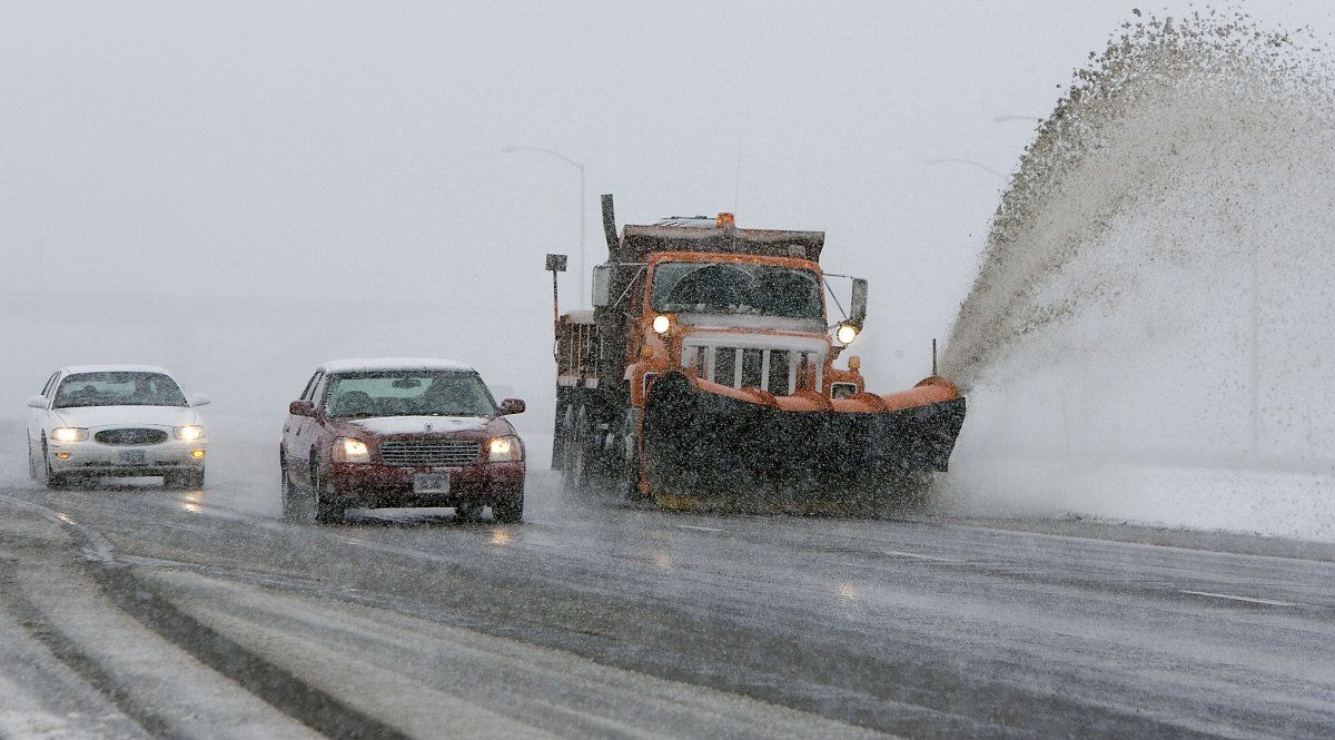
The timing and intensity of this May snowstorm present challenges for communities transitioning into spring. Roads over mountain passes are expected to be slick or impassable, with whiteout conditions likely during peak snowfall. Public safety officials warn against non-essential travel, citing increased risks of accidents.
Forecasters also stress the possibility of power disruptions as a result of the snow’s weight on trees already in leaf, particularly in the Sangre de Cristo mountain ranges.
What to Know
In Colorado, the winter storm warning is in effect from noon Monday through noon Wednesday for elevations above 10,000 feet, including Pikes Peak and the Northern and Southern Sangre de Cristo Mountains. Forecasts call for between 12 and 24 inches of snow with winds up to 35 mph, according to the NWS Pueblo office.
“Roads, including mountain passes, will likely become slick and hazardous. Travel could be very difficult to impossible,” the warning said.
New Mexico’s mountainous regions are under similar warnings. The Southern and Northern Sangre de Cristo Mountains may see snow totals of 8 to 24 inches depending on elevation, with the heaviest snowfall expected through Tuesday night. The warnings will remain in place until Wednesday morning.
“The heaviest snowfall is expected tonight through Tuesday. The weight of the snow on leafed out trees may cause them to break. Power outages are possible,” the warning, which was issued on Monday, said.
-On Sunday, parts of New Mexico also saw such heavy hail that snowplows were required to remove it from the roadways after six inches fell.
In Montana, the Absaroka and Beartooth Mountains—including the popular outdoor area around Cooke City—could receive 10 to 16 inches of snow above 7,000 feet, with strong winds complicating snow removal efforts. The NWS Billings office notes that northeast-facing slopes will be hardest hit.
“Recreation in the high country will be impacted by heavy accumulating snow,” NWS Billings said in the warning. “The heavy snow will also hamper snow removal operations on the Beartooth Highway.”
What People Are Saying
NWS meteorologist Clay Anderson, who works at the Albuquerque office, told Newsweek: “The amount of snow we’ve been getting over the peaks and northern mountains for the calendar date is abnormal, but it’s not far outside our climatology at all.”
Anderson added most people in New Mexico live below 9,000 feet in elevation, and the ongoing winter storm is affecting elevations at 9,000 feet and above. Some high mountain passes might close briefly, he said.
NWS Great Falls, Montana, in a post on X, formerly Twitter, on Sunday: “There will be widespread precipitation today through Monday with the greatest amounts tonight through Monday morning. Snow is expected in the mountains and along some mountain passes. Scattered thunderstorms are expected this afternoon in Southwestern Montana.”
NWS Pueblo, Colorado, in a post on X on Monday: “Heavy snow is forecast for mountain areas above 8500 ft through Wednesday morning. Advisories are in effect for the Continental Divide for 3-8 inches through Tues morning. Focus shifts east to the Ramparts/Sangre de Cristo/Wet Mts for Tues-Wed. 1 to 2+ ft of snow possible.”
What Happens Next
The storm is forecast to peak Tuesday into early Wednesday before tapering off. Travelers are urged to monitor 511 road updates in New Mexico and local Department of Transportation services in affected states. Residents in high-impact zones are encouraged to prepare emergency supplies and avoid unnecessary travel until conditions improve.


