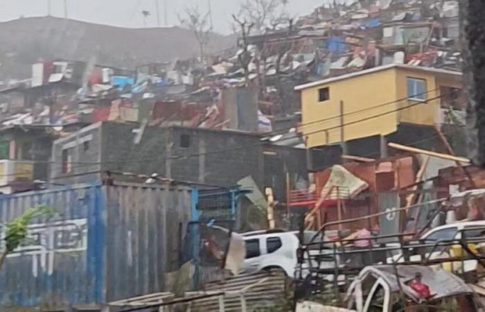
FOCUS – First classified as purple alert, the cyclone, which caused at least two deaths, exceeds the reference storm of 1984. We have to go back to 1934 to find such an “exceptional” phenomenon.
Scenes of devastation as far as the eye can see. A human toll which could prove heavy, warned the Minister of the Interior this Saturday evening, while two deaths have so far been recorded. A cyclone described as«historical»first classified as purple alert then downgraded to red alert so that emergency services can be deconfined. How could such a tragedy happen? Answer with meteorologist François Gourand, forecaster at Météo-France.
Cyclone Chido which hit Mayotte is “exceptional” because it directly hit the archipelago, while its power was boosted by particularly warm waters in the Indian Ocean linked to climate change, he explained this Saturday. Chido surpasses cyclone Kamisy of April 1984 which until then was considered a “reference” in the area, according to him. “We probably go back to the cyclone of February 18, 1934, so 90 years ago, to find such a violent impact on the department.” Authorities reported two deaths and damage on Saturday “huge” in Mayotte, while Météo-France noted gusts of 226 km/h at Pamandzi airport to the east of the “capital” Mamoudzou.
Also read
Cyclone in Mayotte: Bruno Retailleau fears that the human toll “will be heavy”
“For the eye of a cyclone to hit such a small area, there is still a probability which is extremely low, this is what makes it somewhat exceptional” of the event, according to François Gourand. Chido also benefited “an exceptional oceanic environment for several years and particularly this year, with water surface temperatures close to 30 degrees and very deep warm waters”revealed the specialist. This phenomenon, linked to climate change, creates “a large reservoir of energy available for cyclones”he demonstrated.
Another element that favored the development of Chido, “weak wind shear”which allowed the cyclone “to structure itself and persist”. If there is too much wind difference between the ground and altitude, “this can disrupt a cyclonic phenomenon and prevent it from developing. And there, unfortunately, that was not the case.said the meteorologist.
Such phenomena are not uncommon in the Indian Ocean, where the cyclone season begins “around November, with a general peak between December and March, or even April”he detailed. For the current season, Météo-France had announced cyclonic activity slightly above normal, which is 10 storms and cyclones, including five cyclones. The prediction was “between nine and 13 storms and cyclones, and four to seven tropical cyclones”underlined the forecaster.
France


