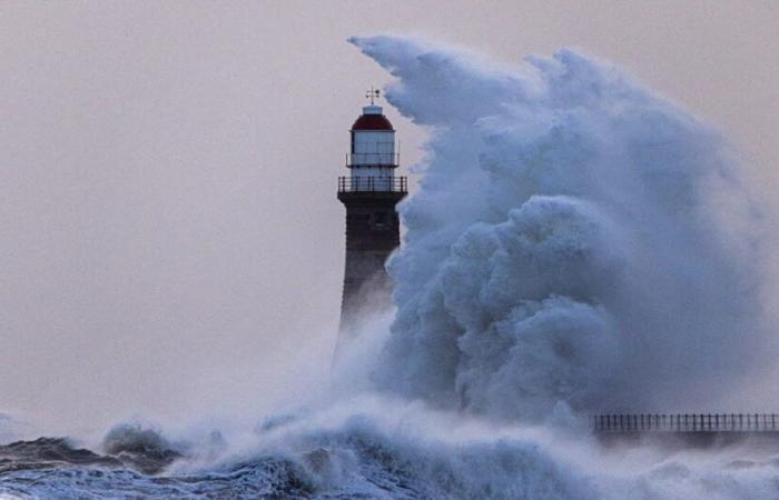
Wind gusts exceeding 130 km/h and locally reaching 150 km/h are expected on the British coasts. Storm Éowyn was expected to hit Ireland overnight and affect Scotland and England during the day on Friday.
Brittany, Normandy and Pas-de-Calais concerned
Storm Éowyn is caused by cyclogenesis, the rapid formation of a depression. This will lead to a violent storm which will hit the British Isles this Friday.
Storm Éowyn will continue its path towards the northwest of France. Winds could be around 80 to 90 km/h near the coasts of Brittany, Normandy and Pas-de-Calais between morning and midday this Friday.
This content is blocked because you have not accepted cookies and other trackers.
By clicking on “I accept”cookies and other trackers will be placed and you will be able to view the contents (more information).
By clicking on “I accept all cookies”you authorize the storage of cookies and other trackers for the storage of your data on our sites and applications for personalization and advertising targeting purposes.
-You can withdraw your consent at any time by consulting our data protection policy.
Manage my choices
I accept
I accept all cookies
Éowyn will remain active in these areas until Saturday morning and may also bring heavy rain. Brittany, Pays de la Loire and Normandy could experience showers of up to 40 to 50 mm locally.
“Weather bomb”
After 10 days under anticyclonic domination, these disturbances will confirm the mild weather in the northern half of the country. According to Météo-France, the pressure “ should go from 970 hPa Thursday at 12 p.m. UT to 940 hPa Friday at 6 a.m. UT.” A situation sufficient to speak of a “weather bomb” according to the institute.
France


