Monday morning, the lowest temperatures in the plains were observed in Franche-Comté in the sectors of Luxeuil (Haute-Saône) with -9.9°C and Val Suran (Jura) with -9°C but also much further south , in certain sheltered areas of Occitanie such as Blars (Lot) with -9.6°C and even Prades-le-Lez (Hérault) in the Languedoc hinterland with -8.8!
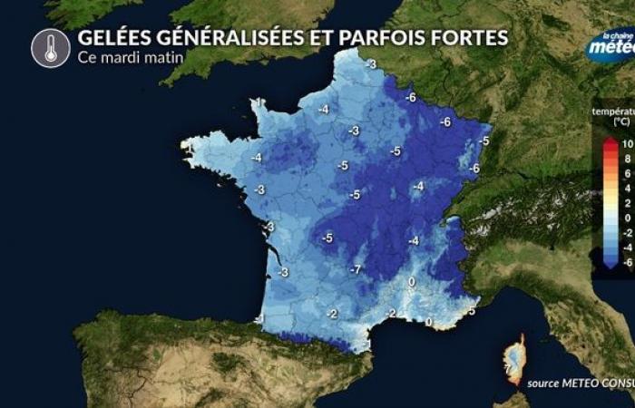
Severe frost Monday January 13 © The Weather Channel
Tuesday: Coldest morning of the week nationwide
This Tuesday promises to be a very sunny day in France with the presence of dry and cold continental air under high pressures spreading from northern France to central Europe. After a starry night with a full moon and a light wind over a large part of the country, temperatures are expected to be freezing at daybreak. It is in the sheltered plains and valleys of central and eastern France that the lowest temperatures are expected with -5 to -8°C and locally -10°C in the coldest areas.
Severe frost Tuesday morning in France © The Weather Channel
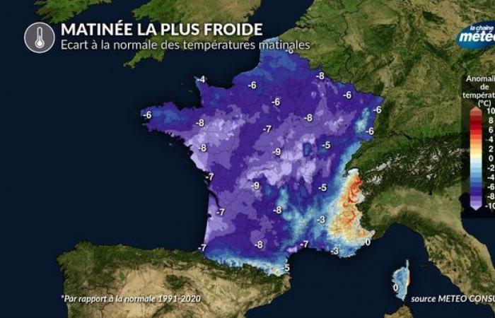
If we compare the temperatures expected at daybreak this Tuesday, January 14 to the seasonal norm, the temperature deficit will be between -4 and -8°C over 3/4 of the country. It is in the extreme south-east that temperatures will be closest to normal, between the French Riviera and Corsica.
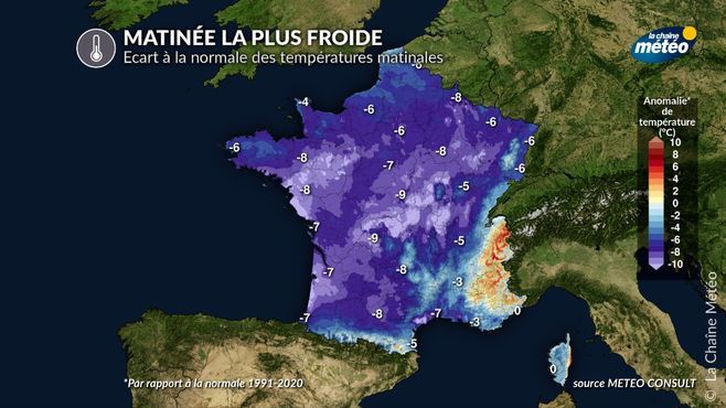
Difference from normal in morning temperatures on Tuesday © The Weather Channel
In the afternoon of this Tuesday, temperatures will rise significantly thanks to the sunshine. The feeling will be quite pleasant if you are exposed to the sun, in the absence of wind. The feeling will be much less favorable in the area of the mistral and the tramontane since the wind will reinforce the feeling of cold.
Why can't we talk about a cold snap?
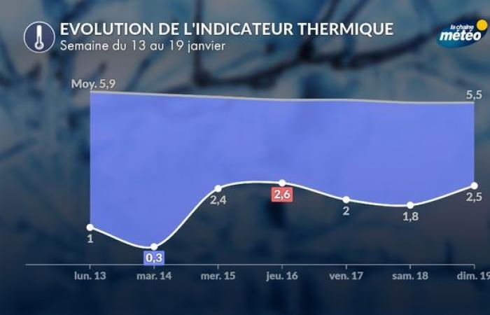
We cannot speak of a cold spell, because this period of cold is not intense and lasting enough. For there to be a cold wave, the national thermal indicator must be below 0.9°C for at least 3 consecutive days with at least one day below -2°C. If we look at the forecast of the national heat indicator this week. Only the day of Tuesday January 14 fell below the bar of +0.9°C instead of 3. On the other hand, the thermal indicator does not drop below -2°C.
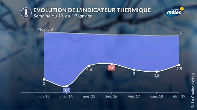
Evolution of the national thermal indicator this week © The Weather Channel
Return of low clouds from the north from Wednesday with an increase in minimum temperatures
From Wednesday, more humid air will infiltrate the lower layers of the atmosphere, over the northern half of the country. Low clouds and fogs will be there again. The impression will therefore be significantly less pleasant, even if morning temperatures will no longer be as low as at the start of the week, with cloud cover limiting nighttime cooling.

