Northern Virginia students are set to return from winter break Monday morning, but nature may have other plans.
If you somehow haven’t heard, there’s a potential snowstorm in the forecast Sunday night into Monday, with the National Weather Service saying “probabilities for a plowable snow” are increasing among weather forecast models.
But first, we’ll have gusty winds blowing in freezing temperatures starting Friday, which also brings the chance for a first round of wintry precipitation to the D.C. area.
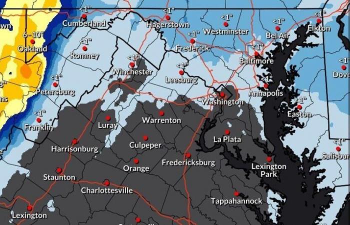
Thursday’s afternoon’s NWS forecaster discussion calls for the potential for a clipper-type storm system to move over the area Friday afternoon through Friday evening, with the “highest wintry impacts … to remain along and west of the Allegheny Front.”
But the potential is there for light snow shower activity during the Friday afternoon and evening commutes in the closer-in suburbs.
“Any snow amounts look to be fairly light in these aforementioned areas with most guidance coming in under 1 [inch],” the weather service said.
Temperatures will starting dropping Friday, as well, with forecast highs of 46 degrees dipping to 25 overnight and remaining close to or below freezing through most of next week.
Sunday will start out dry but a low pressure system will move in from the west, bringing the potential main snow event of the weekend. Precipitation onset could be anywhere from Sunday afternoon until late Sunday night, the weather service said.
“There are questions about precipitation type, as the track and strength of the low will determine how much warm air can be drawn northward into the system,” the forecaster discussion said.
Stay tuned!


