Storm Enol is causing continued unstable weather conditions, accompanied by violent gusts of wind in the Mediterranean. A descent of polar air causes snowfall in the mountains at low altitude, even down to the plains. Find our latest forecasts in this article.
Storm Enol has caused sometimes dire weather conditions in recent hours, with violent gusts of wind and heavy snowfall in the mountains. Conditions are not expected to improve significantly this Monday, with continued snowfall at very low altitude, or even temporarily down to the plains near the reliefs. Violent gusts of wind are also still expected in Mediterranean regions.
Météo-France's orange vigilance remains in force for several Alpine departments, where snowfall has been heavy and the risk of avalanches is now very high. The risk of snow slides is also very present in the Massif Central. During this holiday period, with many tourists in winter sports resorts, It is crucial to exercise caution and avoid off-piste skiing.
How will the weather forecast change over the next few hours? Can we expect rapid improvement as Christmas Eve approaches? Find our latest forecasts in this article.
Snow alert
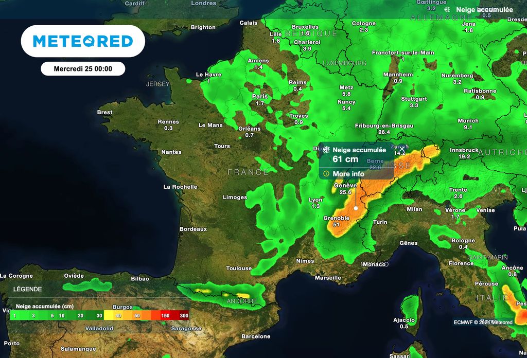
A remarkable snow episode is currently affecting the reliefs in the mid-mountains. Started yesterday, it will continue until this evening. In a rapid northwesterly flow, snowfall will continue over the next few hours on the mountain ranges. The arrival of a maritime polar air mass in the country explains a particularly low rain-snow limit, with snow sometimes appearing at an altitude of 300 metres, or even reaching the plains.

Several departments have been placed on orange alert for snow and ice: Ain, Isère, Savoie and Haute-Savoie. This snowy weather will continue today in the Vosges, the Jura, the Morvan, the Alps, the Massif Central and the Pyrenees. The snow is falling from 400 to 600 meters above sea level this morning, sometimes even reaching the plains.
The risk of avalanches is high this Monday in the Alps and the Massif Central, with feared significant snow slides.
Finally, particular vigilance concerns Ariège, where the quantities of snow are significant and where the rain-snow limit could be around 700 meters.
Wind alert in the Mediterranean!
The weather conditions are also particularly turbulent towards the Mediterranean regions!

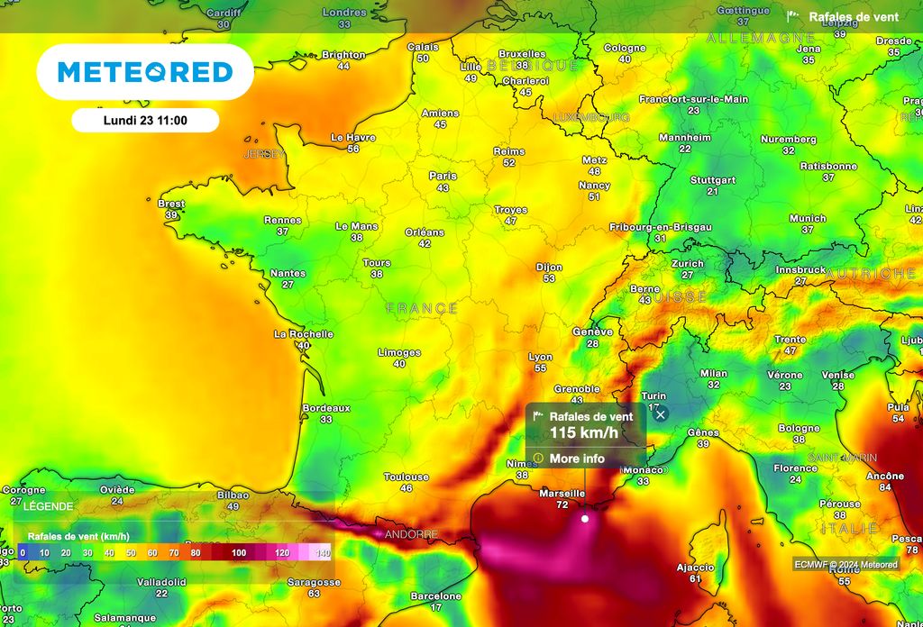
Despite a generous sun, the wind will blow like a storm this Monday around the Mediterranean regions. Gusts of mistral and tramontane, sometimes close to 100 to 110 km/h on the coast, are expected all day. As a reminder, a wind gust of 201 km/ha was recorded at Cap Corse in recent hours!
Cold!
In addition to wind and snow, temperatures are expected to be cold this Monday! The wind will also tend to accentuate this feeling of cold.
It is scheduled for this afternoon 3°C in Aurillac, 4°C in Besançon, 5°C in Grenoble, 6°C in Metz, 7°C in Lille and Lyon, 8°C in Paris, 9°C in Toulouse, 10°C in Nantes and Montauban, 11°C in La Rochelle, 12°C in Bordeaux, 13°C in Toulon and Brest, 14°C in Bastia and Biarritz and 16°C in Nice.
Calmer weather is expected in France from tomorrow and for the rest of the week, thanks to the return of the Azores anticyclone. However, fog and low clouds are expected to be numerous over the next few days and could have great difficulty dissipating during the day. In certain regions, the sun could therefore be absent for several days! To be continued.


