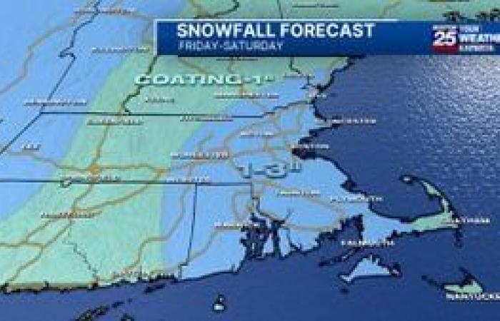
Enjoy the seasonable weather while you can because we’re in for snow in the Boston area on Friday followed by a deep freeze this weekend.
Thursday will be dry and partly sunny, but Friday will bring the chance for snow as colder air moves in and clouds build.
A winter blast of arctic air will grip the region this weekend when temperatures drop significantly.
Latest snowfall timeline
A few sprinkles and flurries are possible during the day, although impacts will be low with no more than a patchy coating, Boston 25 Morning News meteorologist Shiri Spear said in her latest forecast.
Come Friday evening, Spear said a “distant ocean storm will swing in additional moisture,” bringing steadier rain and snow to southeastern and eastern Massachusetts.
As temperatures drop overnight into early Saturday, Spear said it will become “more and more likely the local roads turn slippery and snowy.”
Snow showers may linger into Saturday morning.
Expected snow totals
Spear said 1-2 inches is likely for most towns east of Interstate 495, but some spots could make it up to 3 inches.
Cape Cod and the Islands might not be cool enough for much accumulation.
A slushy coating up to 1 inch of snow is likely in those communities.
Arctic air arrives
A high near 30 degrees is expected on Saturday, while Sunday will see highs only in the 20s.
For the latest on the forecast, click here.
Download the FREE Boston 25 News app for breaking news alerts.
Follow Boston 25 News on Facebook and Twitter. | Watch Boston 25 News NOW
Morocco

