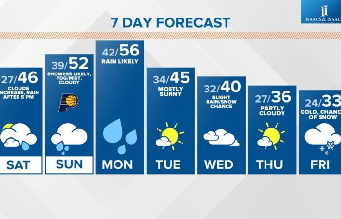
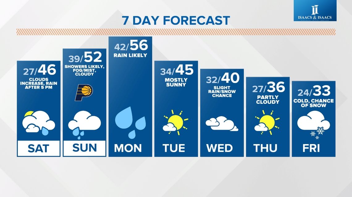
The transition from above-average to below-average temperatures will be wet, foggy and may end with some snow late next week.
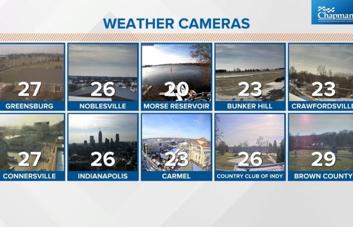
INDIANAPOLIS — The remainder of today will be a mix of sun and clouds. Thanks to the clouds being more mid to high level, there should be decent “filtered” sunshine. Though it won’t be nearly as cold as the past 24 hours, it will be seasonably chilly with midday windchills ranging from the single digits to lower teens.
But it will be a dry afternoon. With that said, you should be mindful that some roads in north-central Indiana remain slick, and you should certainly check road conditions before traveling in that part of the state today.
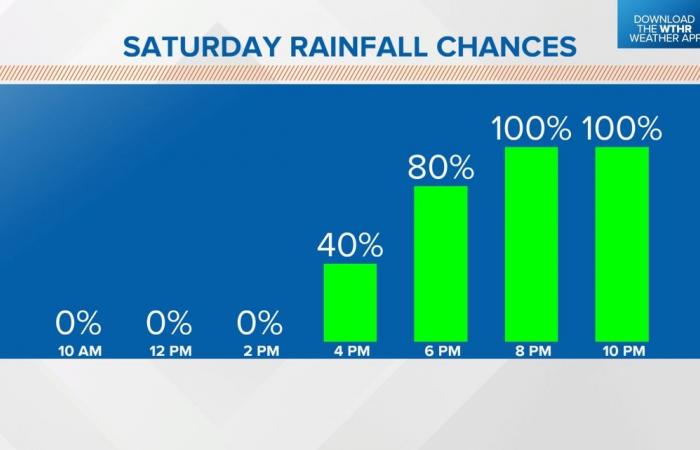
When does the rain arrive Saturday?
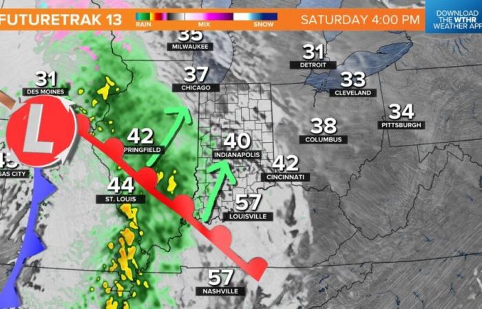
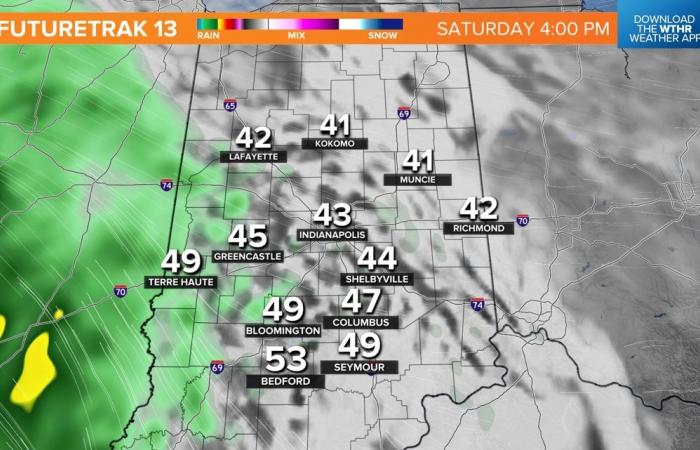
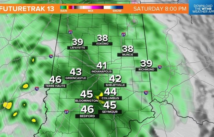
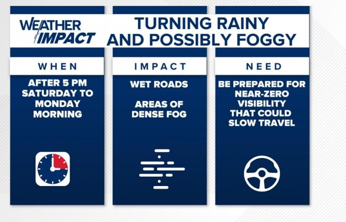
Despite the fact there will eventually be a “100% chance of rain,” you will have many dry hours to get things done tomorrow, with the continued expectation that the eastern periphery of an incoming rain axis not reaching I-65 until near/after sunset (5:21 p.m. EST).

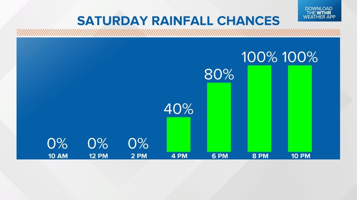

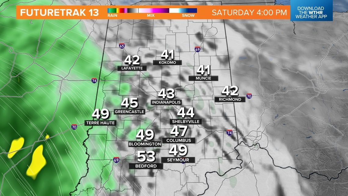

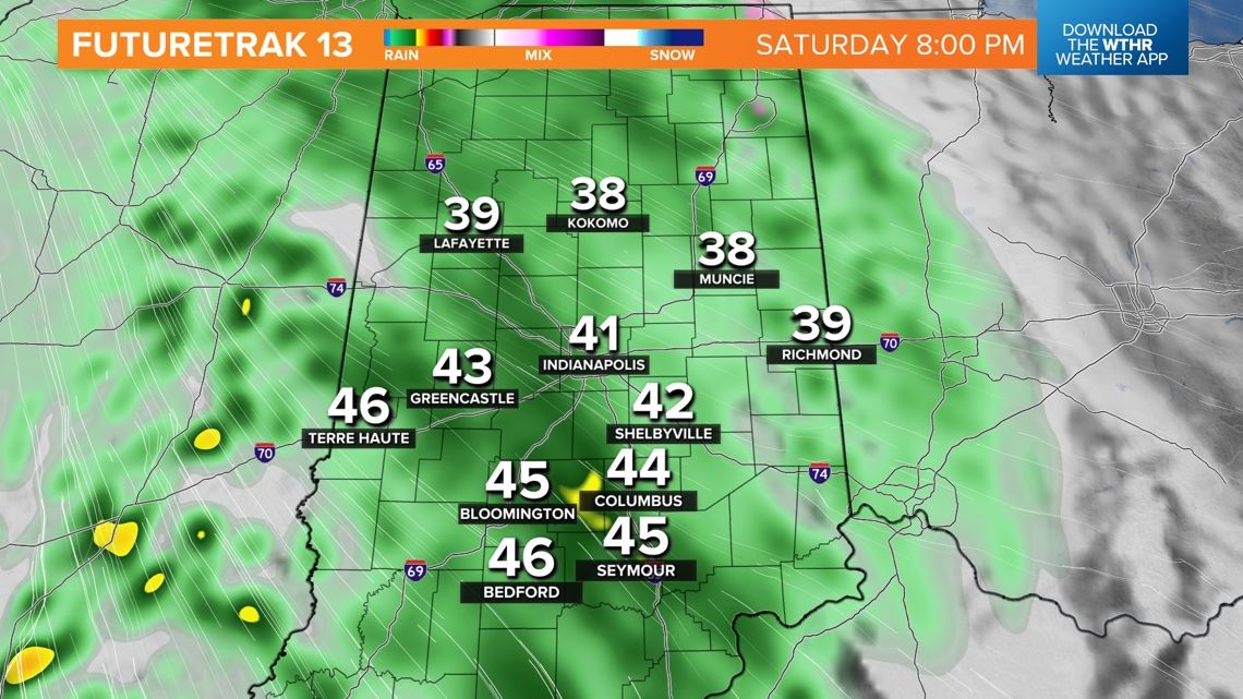
So if you’re wanting to hang up Christmas lights or get some shopping done, you’ll have plenty of time to do it dry. But if you’re planning to head out for holiday parties and/or visit the many holiday light shows, then you’ll be upping the ante of driving in rain as the axis of wetness overspreads the state between 4 p.m. and 8 p.m.
Will Sunday be a washout?
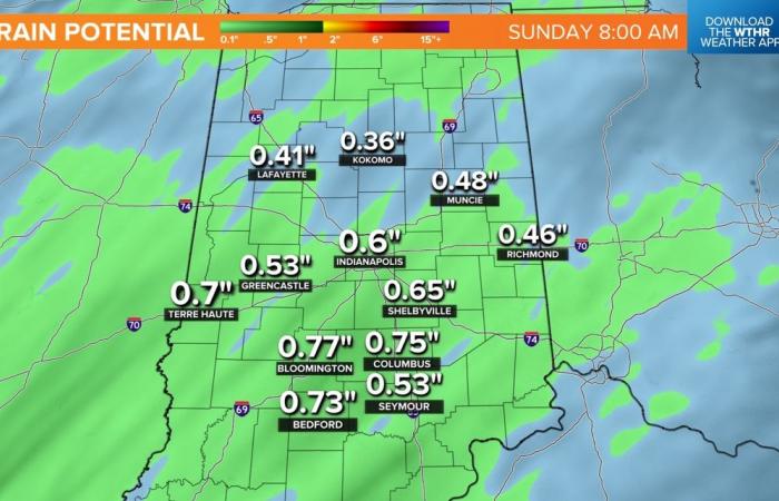
A solid .25″ to .75″ rainfall occurs between 4 p.m. Saturday and mid-morning Sunday, with additional lighter precipitation occurring much of the day Sunday in the form of showers, drizzle and/or dense pockets of fog/mist.


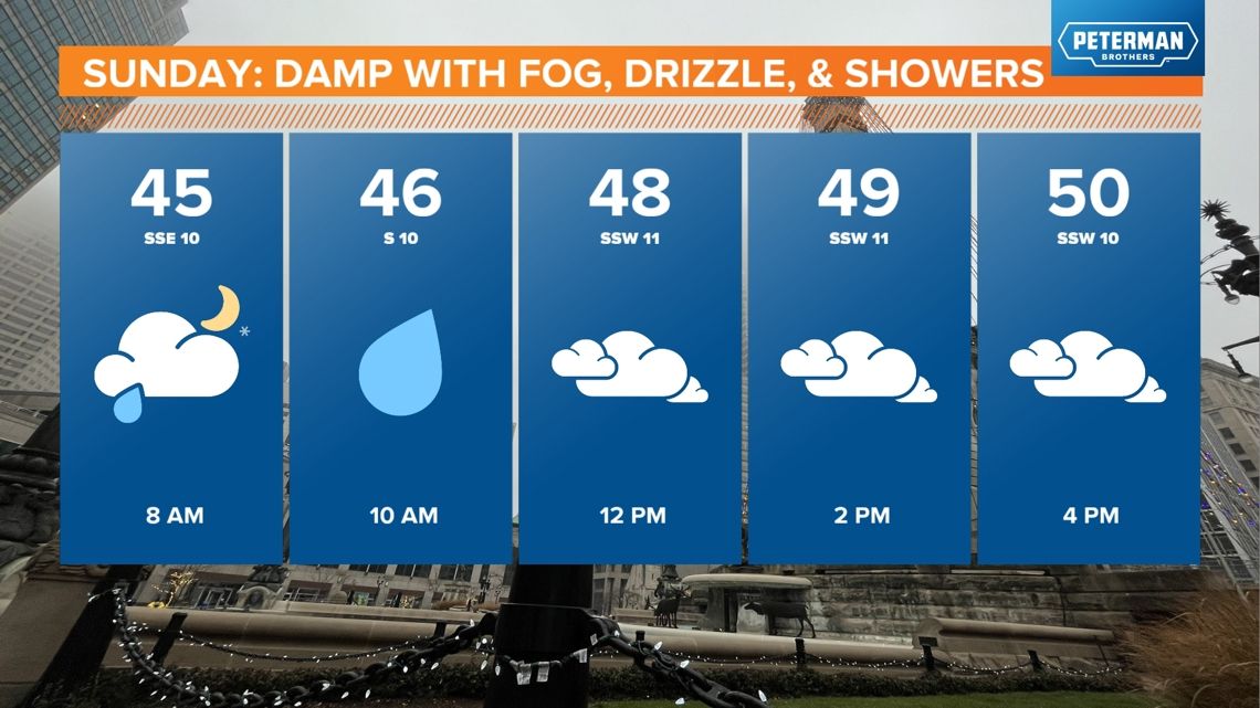

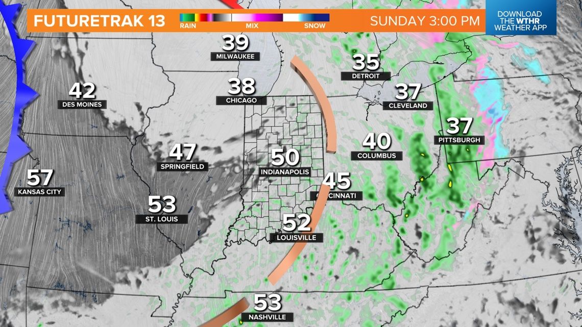
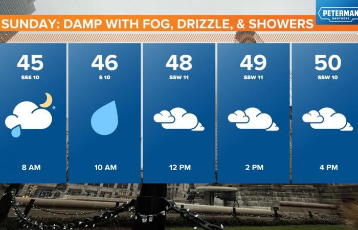
So though the rain won’t be terribly heavy on Sunday, it may be rather “damp” and steady, and we’ll need to monitor carefully the potential of near-zero visibility that could accompany the saturated air that lowers cloud bases to near the surface and makes more damp conditions Sunday.

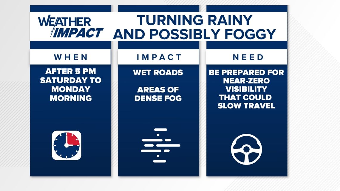
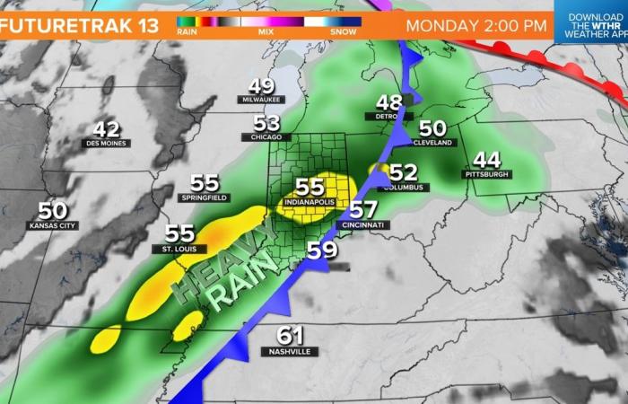
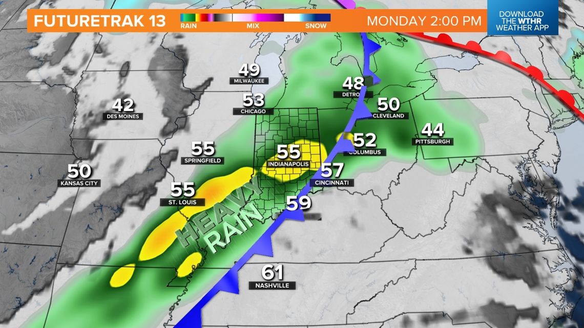
Heavier rain ahead Monday
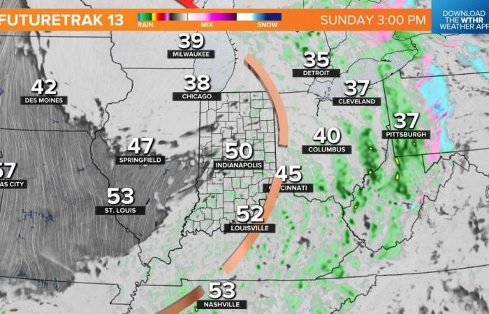
A stronger surge of moisture, combined with a frontal boundary, delivers heavier rainfall Monday with the early call of widespread .75″-1.50″ totals with that system.

After Monday, temperatures trend colder, and the next shot of Artic air looks likely in the 12/20-12/22 timeframe and could be accompanied with some snowfall.
Check back for updates and potential impacts the highly anticipated IU-Notre Dame playoff football game in South Bend next Friday, Dec. 20.

Swiss

