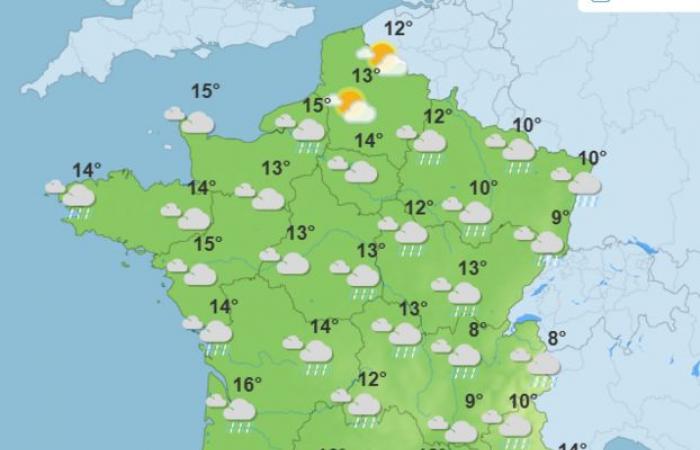
What weather can we expect at the start of December? Meteorological winter has been established since Sunday December 1st and the disturbances circulating from the British Isles to Italy will become more numerous. The disrupted weather is notably linked to the fact that the anticyclone which protected France until now “will shift towards Ukraine” by “allowing the ocean current to recover”, notes Météo Villes.
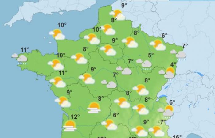
Monday: a first disruption
A large part of the country will be crossed by a disturbance, arriving the day before from Brittany, indicates La Chaine Météo, which predicts “fairly light rain from the South-West to the North-East”. This disturbance will spare the South-East where the sun will shine in Nice and Corsica.
Temperatures will cool down temporarily in the North-East where there are no more frosts on the plains in the morning. In Paris, it will be 12°C morning and afternoon.
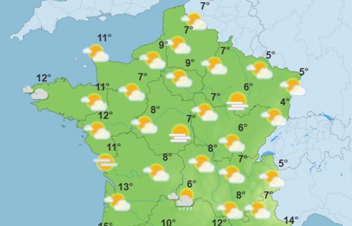
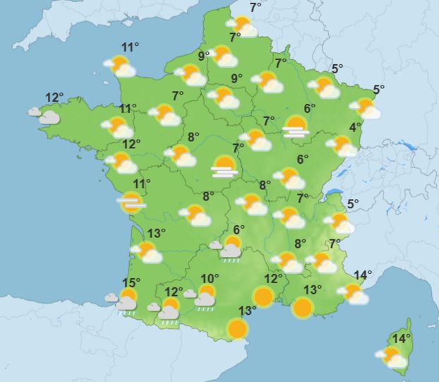
Tuesday: a lull
The weather will temporarily become calmer again on Tuesday, despite numerous clouds which will not allow much of the sun to shine through. In the South-East, the Mediterranean regions will benefit from good weather despite the mistral and tramontana. Temperatures will drop slightly in Île-de-France, with 8°C in the morning and 9°C in the afternoon.
Wednesday: cloud and wind
Very cloudy weather is expected to dominate the day on Wednesday with patches of fog in the west and central regions. The showers should remain scattered and weak, even if the reliability remains to be clarified for this day. The wind should blow strongly, from the south of Brittany to the Aquitaine coast. Temperatures are expected to drop further and be slightly below seasonal norms. “A burst of snow sweeps the west of the Pyrenees from 1,300 m,” warns La Chaîne Météo.
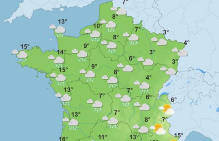
Thursday: the return of morning frosts
The drop in temperatures will bring frosts back at daybreak in the east, where cold and dry weather will set in. Near the Atlantic, a new rain wave will set in and invade “very quickly the west and north of the territory”. In Paris, the weather will be very cloudy in the morning, with 6°C displayed. It will rain in the afternoon, like over a large part of the country.
“The deadline is still far away, but the scenarios are increasingly converging towards the establishment of a polar air shift from Thursday-Friday,” underlines meteorologist Guillaume Séchet on At the end of next year, conditions could be wintry with cold air and a risk of snow to watch out for! »
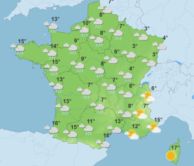
Friday: mixed weather
A new disturbance is expected to cross most of the country, potentially bringing rain and showers over a large part of the country. Only a part of the Mediterranean rim could be spared. In Paris, the sky will be overcast from morning until evening, with 12°C in the morning and 14°C in the afternoon. Snow could also fall in the mountains above 1,800 to 2,200 m.
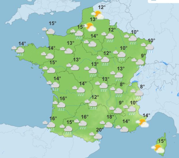
Weekend: cold and snow
With strong winds, rain and falling temperatures, the weather for the weekend of December 7 and 8 promises to be rough. A disturbance coming down from the British Isles is expected over three quarters of the country on Saturday, with temperatures still mild. On Sunday, the thermometer will drop a notch. It could even snow at lower altitudes. Forecasts which will have to be refined during the week.

