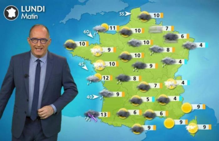
Highlights of the day
– rainy passage from southwest to northeast
– warm in the east and end of frosts in the morning in the east
– refreshment in Aquitaine with 4 to 8°C lower than Sunday for afternoon temperatures
This morning
From Aquitaine to the Paris basin in the Grand Est, you have a little rain. Behind the disturbance, you find clearings in the northwest, from Pays de la Loire to Brittany despite some coastal showers. From the Pyrenees to Rhône-Alpes to the Jura, the sky is cloudy. Near the Mediterranean, low clouds tend to break up over the hours.
It is 3°C in Colmar, 4°C in Lyon to 9 to 13°C from Perpignan to Brest to Biarritz.
This afternoon
The disturbance stretches from the Pyrenees to the north of Rhône-Alpes to the Grand Est and the Jura, giving rise to rain which tends to intensify. From Roussillon to the south of Rhône-Alpes to the Côte d'Azur, the sky becomes more and more cloudy as the hours pass. Everywhere else, the sky is variable with coastal showers along the Channel which progress a little inland.
You have 8°C in Metz in the rain, 10°C in Paris and Lille, 13°C in La Rochelle and 17°C in Perpignan.
Soirée
It rains from the Pyrenees to Rhône-Alpes in the Grand Est. Mists and fogs form over many lowland areas. Near the Mediterranean, the mistral and tramontane rise and blow at 60 km/h in gusts.
Rain totals for Monday © the weather channel
Things to remember over the next few days
In a northwesterly flow channeled between the Azores anticyclone which rises towards the Bay of Biscay and disturbances descending from the British Isles to the Mediterranean, the week is temporarily disrupted with the passage of several small-scale rainy fronts interspersed with temporary calms in a cool atmosphere in the east and gentle recovery in the west.


