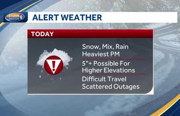
Good morning and Happy Thanksgiving, *** messy storm moving in over the next several hours with rain wintry mix and snow. The heaviest of which will fall no time today. And through this evening, there is the chance for several inches of snowfall, especially across higher elevations, very difficult travel developing later on today. And that heavy wet snow in some parts of the state, there is the chance for some scattered power outages. The best time to travel locally across the state will be through about mid-morning. After that, the rain and snow really picks up an intensity by this afternoon. High travel impacts due to weather for many because of the rain and snow really starting to come down at *** good clip. Here’s *** look at our latest snowfall forecast some very minor changes as of early this morning and that’s mainly just for far southern New Hampshire. We trimmed back totals just *** little bit in places like Concord, Manchester and Nashua. We may pick up *** slushy coating to an inch in the Merrimack Valley after most of this storm winds up being rained. But by this evening, there may be *** brief flip over to snow. The same is true for the Greater Dover and Rochester area. But once you get to the north and west of Concord and go up in elevation, that’s where snow totals quickly pile up from the bead knock region up toward Lake Sunapee and Plymouth. There’s the chance of 5 to 9 inches of snow. That is also the case for parts of the Mount Washington Valley points north up through Pinkham Notch and into the route 16 Corridor of Coos County. Somewhat lower. Snowfall totals out by keen as well as right along the banks of the Connecticut River, about three or four inches in the valleys there. And locally as much as five, especially on hilltops. Here’s the storm this morning, lots of heavy rain and snow breaking out over New York and Pennsylvania and all of that is shifting in our direction over the next several hours by 78 o’clock this morning, it’s some light rain and snow breaking out over central and southern New Hampshire. But even at this point, road conditions are still ok. The precipitation will pick up an intensity slowly but surely through late morning into the midday hours. And by noon time, that’s when the travel conditions really start to deteriorate, especially areas north and west of the state capital. It is mostly rain from Ra Manchester to Nashua and points East. So I think travel through the afternoon hours over much of Rockingham County is completely fine with that said over higher elevations of the mead knock region up through Lebanon in the Lakes region. *** good thump of moderate to heavy snow is expected this afternoon. And by early this evening, the rain may actually briefly flip back over to snow in places like Rochester, Manchester and Nashua. That’s where we could get *** slushy coating to an inch of snow. Looks like the worst of the travel conditions start to wrap up around 89 o’clock this evening and the storm will pull away shortly thereafter. By early tomorrow morning. I think we’re looking at much better weather, partial sunshine though there still may be some slick spots, especially anything that is wet and untreated overnight could once again ice up for Concord. I think we see basically no snow through early this afternoon. There may be *** coating on grassy surfaces around three o’clock today, perhaps an inch or two possible after dark this evening. But in *** place like Wolfeboro, the snow breaks out later on this morning, an inch on the ground. By noon time, we could have *** few inches of heavy wet snow on the ground starting around three or four o’clock and you should wind up with about 5 to 6 inches of snow in Wolfeboro. By the time the storm wraps up tonight, overnight temperatures fall back below freezing. So again, anything that is wet and untreated is likely to freeze up, use caution especially on secondary and back roads through early on Friday, but Friday itself will feature better weather. There may be *** quick mountain snow shower or two tomorrow. Otherwise it’s partly sunny and breezy with temperatures in the lower forties. *** good day to get some Black Friday shopping done or even go crab your Christmas tree over the weekend. It’s cool. It’s breezy, partly sunny skies and *** cold stretch of weather building in with temperatures in the thirties through much of next week.
Video: Messy storm moves in with snow, rain, wintry mix
Matt Hoenig has a look at the travel impacts for Thanksgiving Day and when we’ll see the heaviest snowfall.
Updated: 5:34 AM EST Nov 28, 2024
A messy storm will impact New Hampshire on Thanksgiving Day with rain, wet snow, and difficult travel conditions. Slippery spots on the roads will linger into early Friday. Brighter skies for the rest of the holiday weekend, but temperatures stay chilly.A Winter Storm Warning is in effect through 4 a.m. Friday for parts of Sullivan, Grafton, Carroll, and Coos counties. These areas have the greatest risk for picking up 5+” of snowfall.Light snow and rain develop through late morning. The intensity of the snow and rain pick up by noontime with travel conditions worsening through the afternoon, particularly if you are north and west of Concord. Several inches of heavy, wet snow could fall across the higher terrain, creating the risk for some scattered power outages. Very little to no accumulation is expected in the Merrimack Valley and points south and east.The snow and rain tapers between 9 p.m. and 1 a.m. Any roads that are wet and untreated could freeze overnight with temperatures in the 20s.Quieter weather with some sunshine on Friday afternoon with highs in the 30s to low 40s.More sunshine but blustery and colder over the weekend. Highs will be in the 30s into next week.
A messy storm will impact New Hampshire on Thanksgiving Day with rain, wet snow, and difficult travel conditions. Slippery spots on the roads will linger into early Friday. Brighter skies for the rest of the holiday weekend, but temperatures stay chilly.
A Winter Storm Warning is in effect through 4 a.m. Friday for parts of Sullivan, Grafton, Carroll, and Coos counties. These areas have the greatest risk for picking up 5+” of snowfall.
Light snow and rain develop through late morning. The intensity of the snow and rain pick up by noontime with travel conditions worsening through the afternoon, particularly if you are north and west of Concord. Several inches of heavy, wet snow could fall across the higher terrain, creating the risk for some scattered power outages. Very little to no accumulation is expected in the Merrimack Valley and points south and east.
The snow and rain tapers between 9 p.m. and 1 a.m. Any roads that are wet and untreated could freeze overnight with temperatures in the 20s.
Quieter weather with some sunshine on Friday afternoon with highs in the 30s to low 40s.
More sunshine but blustery and colder over the weekend. Highs will be in the 30s into next week.


